LOS ANGELES — A strong storm system brought record rainfall to parts of Los Angeles County and a rare tornado in Pico Rivera, as more rain fell across the region Friday.
What You Need To Know
- Scattered showers moved into Southern California Tuesday and kicked off a series of late-winter storms expected to bring heavier rainfall lingering into Friday
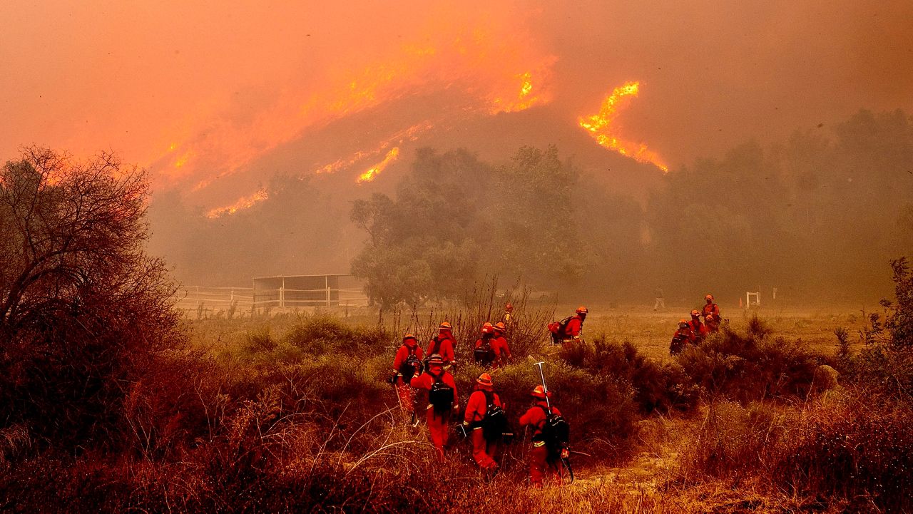
- Officials issued evacuation warnings and "address specific" evacuation orders in places vulnerable to mudslides, including recent burn areas
- A flood watch was expected from Wednesday at 6 p.m. to Thursday 6 p.m.
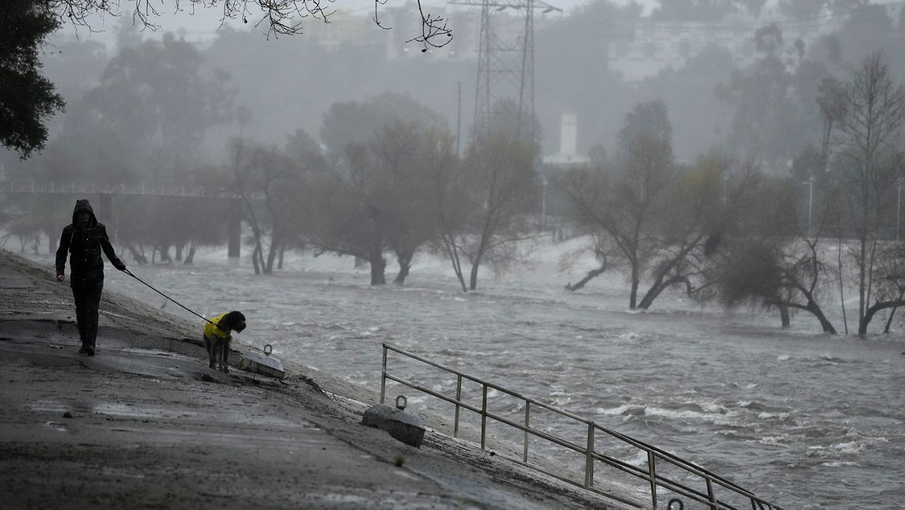
- A man hanging onto a tree at a creek in San Juan Capistrano was rescued Thursday morning by a firefighter who was lowered from a hovering helicopter, according to the Orange County Fire Authority. He was not injured
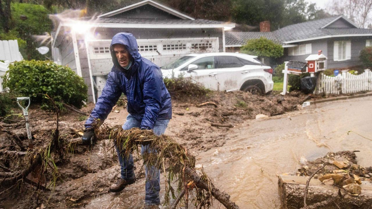
By Friday afternoon, the Los Angeles County Sheriff's Department said that recent mudslides in the Palisades burn scar area of Pacific Coast Highway caused a hard road closure effective immediately for PCH from Carbon Beach Terrace to Chautauqua Boulevard, Las Flores Canyon Road at Southbound Rambla Pacifico, and the 3400 block of Southbound Tuna Canyon.
Sheriff's officials stated that the road closures and reopening are subject to change as investigators continue to monitor roadway conditions.
"Please pre-plan your drive and use alternate routes," the department said in a statement. "Thank you for your understanding and cooperation as we ensure the public's safety."
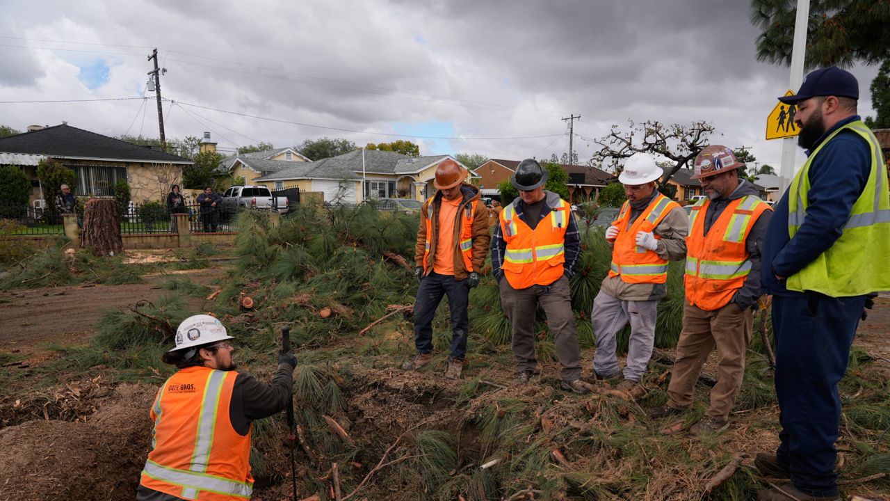
The storm moved through SoCal early Thursday amid evacuation warnings and fears of debris flows, bringing a heavy dose of rain over a short period of time and causing a rare tornado in Pico Rivera.
"CONFIRMED EF0 tornado occurred in Pico Rivera, CA (just W of the 605 fwy & Whittier Blvd) between 3am and 4am today," the National Weather Service announced at 8:39 a.m. "Preliminary details: wind speed 85 mph, length 1 mile, width 80 yards, duration 2 minutes. Exterior damage to homes and cars, multiple snapped trees."
The tornado caused some roof damage to a few homes in the area, along with uprooted trees and damaged cars, but no injuries were immediately reported.
Small, weaker tornadoes are rare but not unprecedented in Southern California. The last one occurred in Montebello in March 2023. The NWS also cited a 9-mile tornado in Lawndale in November 1966 that injured 10 people, and a deadly March 1983 tornado in downtown Los Angeles that killed nine people and injured 33.
"The main part of the storm has moved east of LA County after packing quite a punch overnight to the tune of at least one confirmed EF0 tornado, up to a foot of snow in the mountains, and rain rates that peaked close to an inch per hour," the NWS said at 11:01 a.m. "Today should be much quieter but can't rule out additional severe weather this afternoon (possibly including small weak tornados) with cold unstable air in the region."
Flooding was reported on Los Angeles-area freeways Thursday morning. Considerable flooding was reported by the California Highway Patrol on the connector road from the westbound Pomona (60) Freeway and the southbound Chino Hills (71) Freeway in Pomona, and the connector road from the southbound Harbor (110) Freeway to the eastbound Glen Anderson (105) Freeway.
In El Monte, flooding closed the fourth lane of the westbound San Bernardino (10) Freeway at Peck Road. Wet conditions caused a white Tesla to run off the road at the Lower Azusa Road exit of the southbound San Gabriel River (605) Freeway in Irwindale, and a black Toyota Tacoma spun out and crashed into a freeway divider on the westbound 105)Freeway at the Long Beach Boulevard exit in Lynwood.
Power outages were reported in areas near January's Eaton Fire in Altadena.
Orange County Public Works crews reported rocks, large tree sections and several inches of mud on Trabuco Canyon Road. Southbound Pacific Coast Highway, from Seapoint Street to Warner Avenue in Huntington Beach, was closed due to heavy rain, Caltrans reported.
A man hanging onto a tree at a creek in San Juan Capistrano was rescued Thursday morning by a firefighter who was lowered from a hovering helicopter, according to the Orange County Fire Authority. He was not injured.
With Los Angeles County expecting nearly an inch of rain per hour during the storm's peak, officials issued evacuation warnings and "address specific" evacuation orders in places vulnerable to mudslides, including recent burn areas, the Los Angeles Fire Department announced Tuesday.
The city of Sierra Madre also issued evacuation orders and warnings Wednesday for several areas in the foothills of the San Gabriel Mountains.
All evacuation orders and warnings were in effect from 7 a.m. Wednesday to 6 p.m. Thursday.
Officials said the following burn areas were "especially susceptible to heavy rain":
- Palisades Fire: Getty Villa area, Highlands near the burn areas, Bienveneda area near Temescal Canyon Park, Rivas Canyon/Will Rogers State Park area, Mandeville Canyon above Tanners Road, Old Ranch Road and Rustic Creek
- Sunset Fire: East and south of Runyon Canyon
- Hurst Fire: Olive Lane in the Oakridge Mobile Home Park
- Airport burn scar area in Orange County
Houses in the warning area with high risk were visited by the Los Angeles Police Department on Tuesday to receive specific evacuation orders. If residents were not home, the department was leaving a flyer with relevant information.
Mayor Karen Bass announced Wednesday morning that Los Angeles' Emergency Operations Center has been activated to a Level 2.
"While we prepare for another storm headed towards LA, I want to urge Angelenos to stay vigilant, especially in burn scar areas," Bass said. "My number one job is to keep Angelenos safe, so please heed all evacuation warnings, stay vigilant and stay informed."
Flood warnings expired Thursday morning in Los Angeles and Orange County, and Bass said that the worst of the storm had passed.
"Angelenos: The heaviest rain has moved out of the LA area," she posted on X at 8:43 a.m. "Please stay vigilant — especially in burn areas — as periods of heavy rain will continue throughout the day and a Flood Watch remains in effect until 6 p.m. tonight."
Caltrans closed a segment of Pacific Coast Highway to residents and businesses in burn scar areas at noon Wednesday due to safety concerns from the incoming storm. Only emergency vehicles and U.S. Army Corps of Engineers debris- hauling contractors were allowed through the closure, between Chautauqua Boulevard and Carbon Beach Terrace.
Residents with homes in the burn scar area should consider alternate routes in the afternoon hours or consider teleworking if possible, officials said.
LA Metro officials said bus Line 134 would be canceled until further notice.
Caltrans and other officials will reassess the situation Thursday to determine if the highway can reopen to residents and businesses with passes by Friday for morning commute, if not earlier. That decision is dependent on the extent of the storm and resulting impacts of any debris flows.
In Malibu, Webster Elementary School, Malibu Elementary School, Malibu Middle School and Malibu High School were closed Thursday due to road closures and safety concerns.
In anticipation of the storm, LA County Public Works crews prepared debris basins, stabilized slopes, and reinforced drainage systems to reduce flood risk, particularly in recent burn areas including Eaton, Palisades, Bridge, Hurst, Kenneth, Hughes, Sunset, Lidia and Franklin.
"While these efforts reduce flood risk, the storm could still bring moderate debris and mudflows to burn areas, potentially blocking streets and threatening structures depending on their location and the local terrain," the department said.
"To mitigate potential impacts, LA County Public Works has activated 24/7 storm patrols and remains fully mobilized," officials added.
LA County's Mudflow Advice Hotline can be reached at 800-933-0930, for questions about debris flows.
For storm preparedness tips, the county advised residents to visit READY.LACounty.gov.
Health officials also warned the public to avoid the water at all Los Angeles County beaches due to high levels of bacteria anticipated due to the rain. That warning will be in effect until at least 4 p.m. Friday.
In Orange County, officials issued evacuation warnings for areas in the Trabuco Canyon, Hot Springs Canyon, Bell Canyon, Long Canyon and Modjeska Canyon due to possible debris flows along or near the Airport Fire burn scar.
Long Beach prepared for potential flooding, particularly in low-lying areas including along the peninsula and Alamitos Bay. The city activated sandbag distribution sites for all residents through Thursday, with sand and sandbags available at all fire department neighborhood stations.
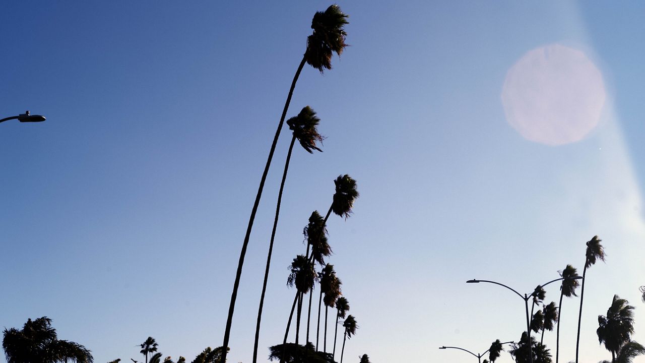
Stronger, gusty southwest to west winds will continue through Thursday night, the NWS said.