OHIO — A major blast of cold air is set to arrive by Friday morning setting the stage for a multi-day lake effect snow event
You'll want to plan ahead as we track impacts through early next week for areas in NE Ohio.
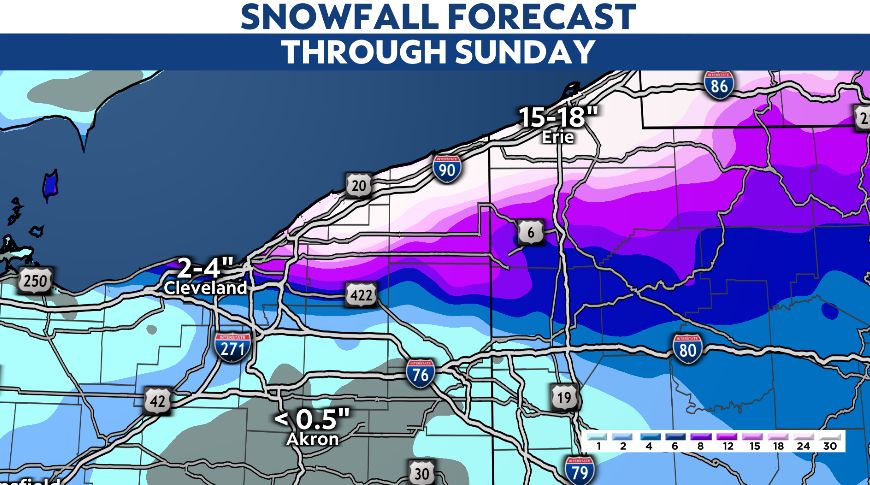
A major cold front sweeps across the state into Friday. Our winds will pick up and become quite gusty out of the west.
With this development, and falling temperatures, lake-effect snow begins into early Friday morning.
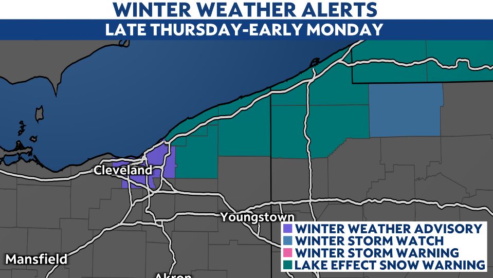
The initial focus will be along the I-90 corridor in northeast Ohio, mainly east of Cleveland. Snow will quickly accumulate on surfaces, including roads, beginning early Friday.
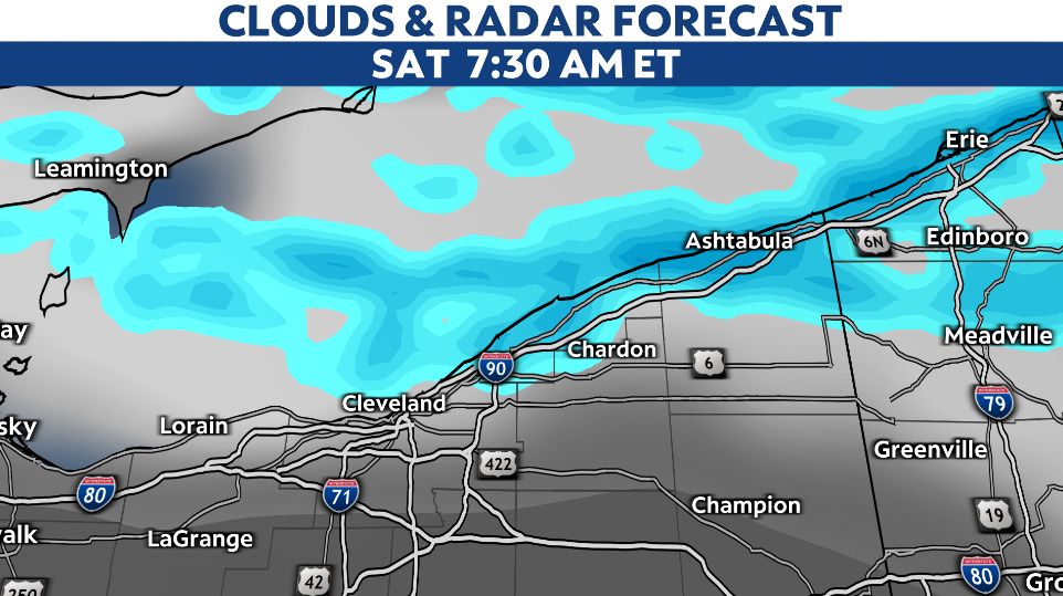
Lake-effect snow bands with rates of 1-2 inches per hour and low visibility will be possible Friday and the first half of Saturday. The greatest impacts will be in Lake, Geauga, Ashtabula and northeastern Cuyahoga counties.
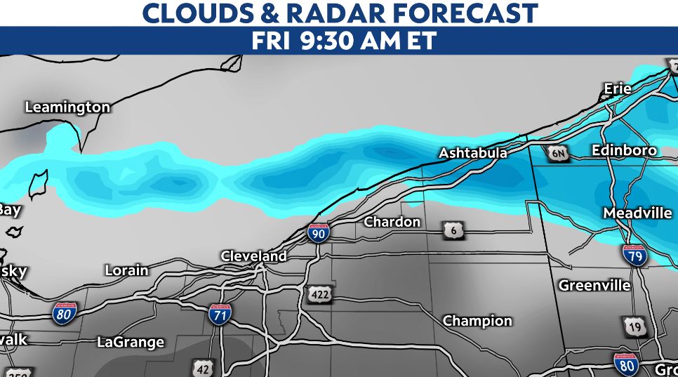
Gusty westerly winds will not only reduce visibility, but will also cause some blowing and drifting of the snow on Friday.
By midday Saturday, our winds turn more southwesterly which may pause the intense bands of snow briefly.
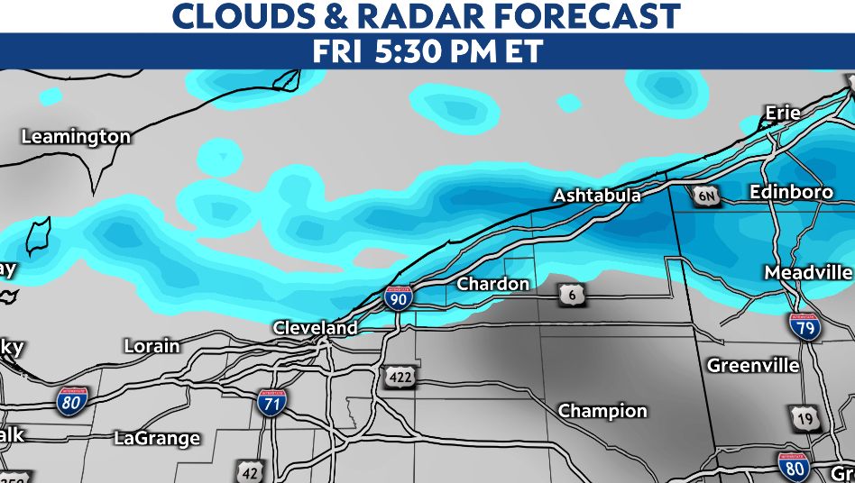
Some lulls in the snow are possible but some impacts will remain with more lake-effect snow redeveloping into Sunday.
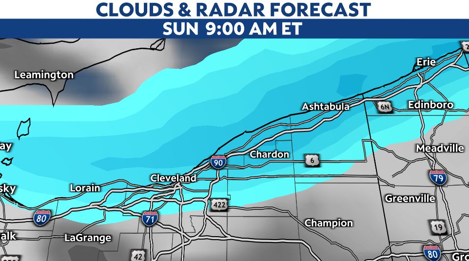
Winds will shift more westerly for the second half of our weekend, so heavier snow bands will push back onshore along the I-90 corridor. Once again, the primary Snowbelt east of Cleveland will experience more accumulating snow.
As we head into early next week, our wind direction will shift slightly so the bands of snow set up more northwest-to-southeasterly.
More areas inland and areas outside of the primary Snowbelt could pick up on bursts of snow early next week with this wind direction shift.
Bottom line: plan for several days of on-and-off again lake effect snow bands. There will be periods of heavier snow and reduced visibility.
Accumulating snow is likely around Cleveland and especially in the Snowbelt region east/northeast of the metro.
Significant snow accumulations are expected in the warned areas of Lake, Geauga, and Ashtabula counties. By Saturday evening, snowfall totals could be well over a foot.
Stay weather ready and plan for tricky travel conditions through the holiday weekend in those areas with winter alerts.
The lake-effect snow machine may not turn off until the middle part of next week.


