


As a warm front lifts north today, a threat for severe weather returns this afternoon.
What You Need To Know
- Moderate (Level 4/5) Risk for most of Ohio
- Threat most likely from 3 p.m. to 11 p.m.
- Damaging winds, hail and tornadoes are all possible
An unusually elevated severe weather threat is possible today across Ohio, with much of the state under a Moderate (Level 4/5) risk for severe weather.
At this level, particularly strong thunderstorms known as supercells are common.
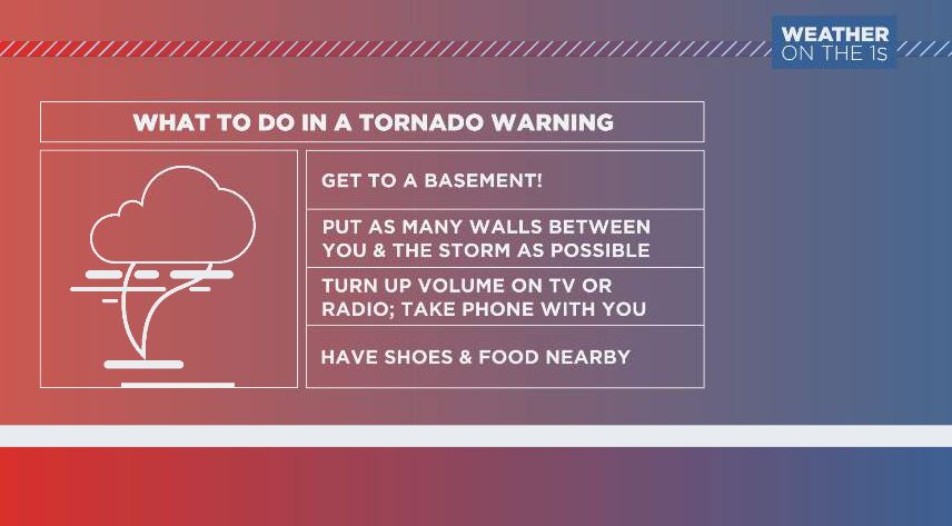
This is a particularly concerning level, with the threat for damaging winds and large hail, along with tornadoes. A few of these could be strong tornadoes, that remain on the ground for a long time.
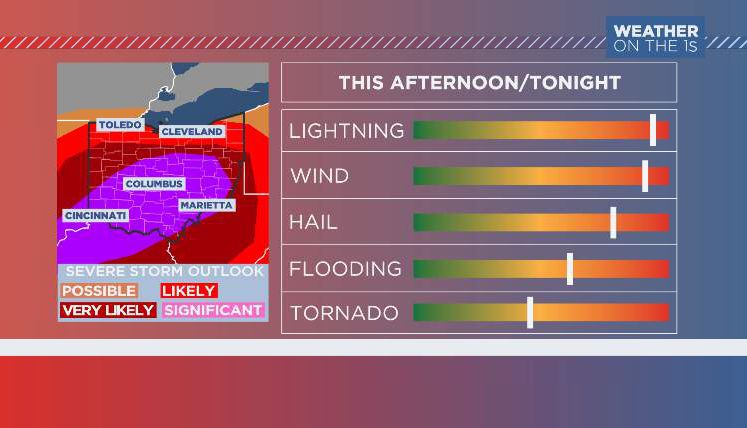
From about 3 p.m. to 11 p.m., the risk will be highest, although near the Ohio River, storms could fire a bit sooner. Prepare ahead of time by knowing where you'll be this afternoon and evening, and locating the safest place to be should a warning be issued for your area.
Flooding will be an additional concern, with some areas seeing between 1-4 inches of additional rain this afternoon/evening.