


A slow-moving cold front will drift into Ohio on Saturday, bringing with it an increased threat for storms. A few of those storms could become strong or even severe.
Most of the state is under a slight severe risk (level 2 of 5) on Saturday, with an increased threat for parts of Northeast Ohio under an enhanced risk (level 3 of 5).
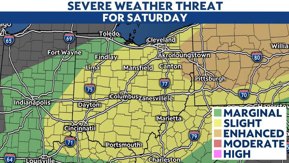
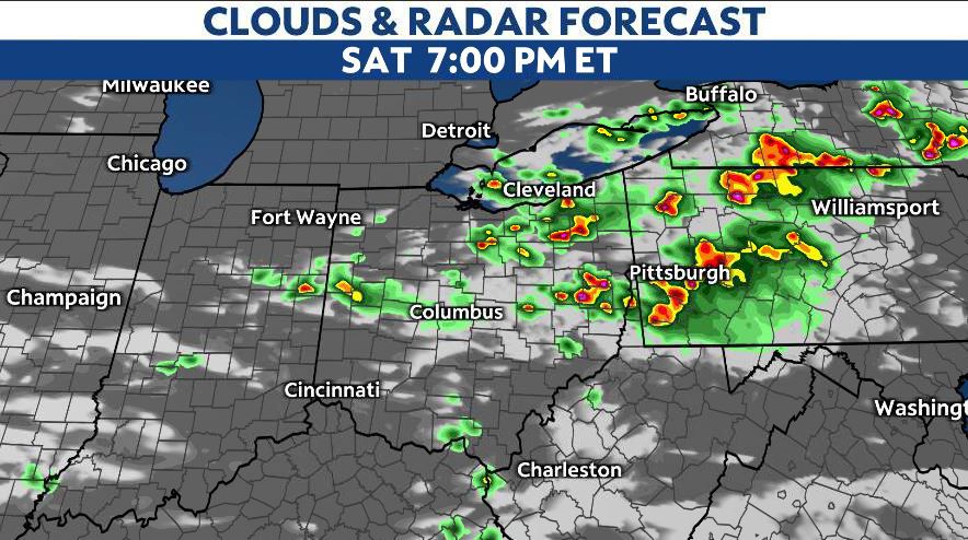
The overall focus for storms will impact areas along and north of I-70 through late Saturday, but a few storms will be possible farther south, especially during the evening.
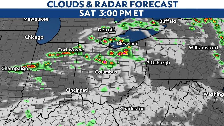
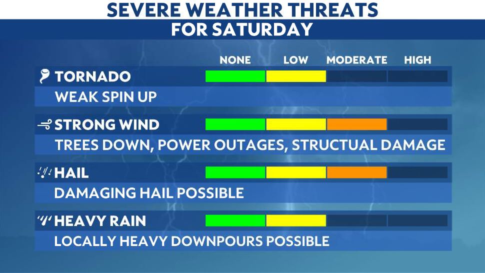
Some of these storms could be strong, with the brief potential for damaging wind gusts and even some large hail. We also can't rule out an isolated tornado.
By late Saturday evening, the storms are forecast to weaken as the front stalls and shifts back northward.
This will lead to a quiet and warm Sunday. However, the front is forecast to move back into Ohio on Monday, bringing with it a renewed threat for showers and the potential for more strong storms during the afternoon and evening.
Our team of meteorologists dives deep into the science of weather and breaks down timely weather data and information. To view more weather and climate stories, check out our weather blogs section.