


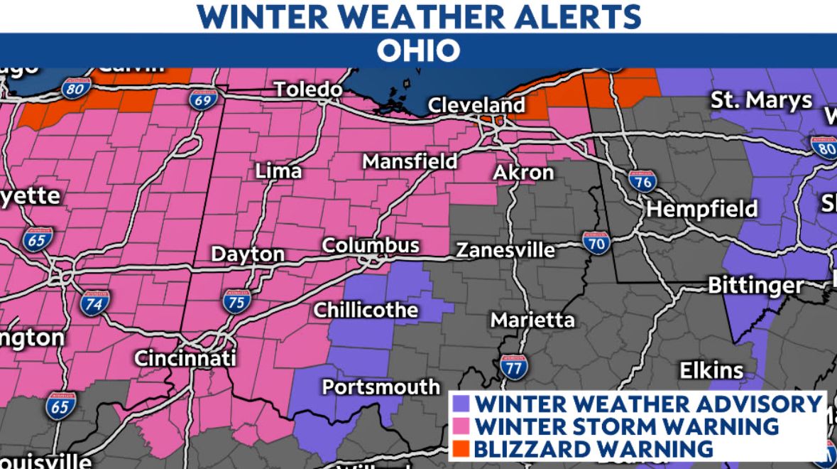
Cleveland and points east are in a Blizzard Warning through early Saturday morning, while other areas have a Winter Storm Warning, as a dangerous winter storm brings dangerous cold, strong winds and blowing snow to the Buckeye State.
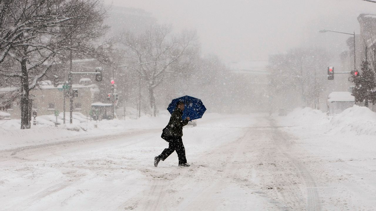
A brutal winter storm has dropped temperatures about 30 to 40 degrees since before the arrival of an overnight cold front. In addition to the temperature drop, strong winds are making for brutal wind chills across Ohio.
Winter Storm Warnings and Winter Weather Advisories are in effect through this evening. A Blizzard Warning runs along the eastern Lake Erie through early Saturday morning and includes the city of Cleveland. Heavy lake-effect snow will total over a foot along the shore east of the city, and strong winds will limit visibility and make travel dangerous.
Stiff winds will lead to spotty power outages and dangerously cold wind chills. Plan on wind chills Friday to be around -20 to as cold as -30.
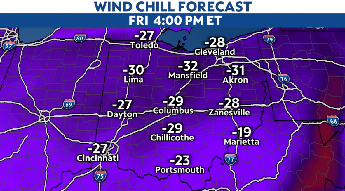
Temperatures themselves Friday will be down in the single digits, if not below zero.
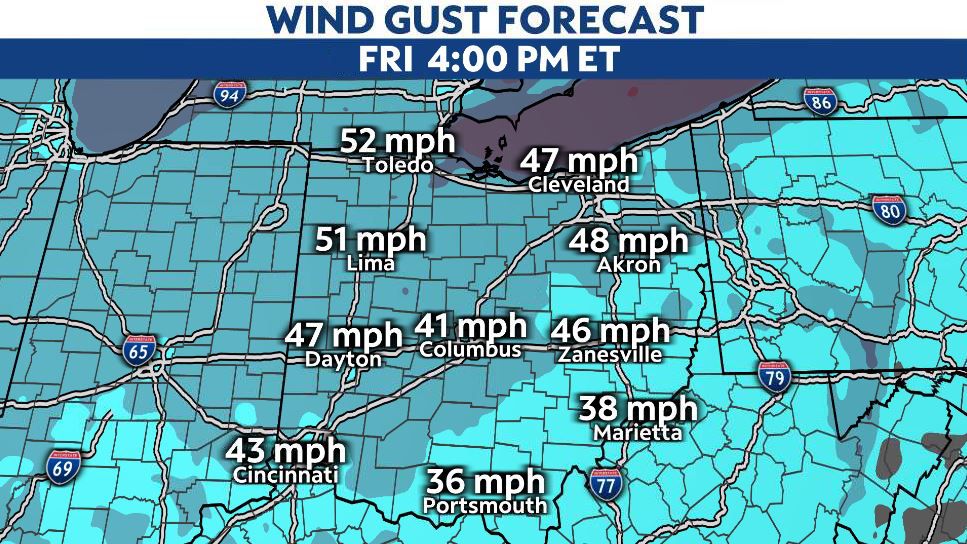
Wind gusts may approach 60 mph at times, especially in northern Ohio.
Strong winds, coupled with some heavy bursts of snow, could lead to near-blizzard conditions at times. The most likely area for that will be in far northeastern Ohio into the overnight hours.
The accumulating snow is largely over, except for the Snowbelt region in the northeast. Local totals over a foot are likely there.