


We're continuing to track a strong spring storm system that will bring impacts to Ohio throughout the weekend. It will bring rain, storms, wind and eventually much cooler temperatures after a very warm week for most of the state.
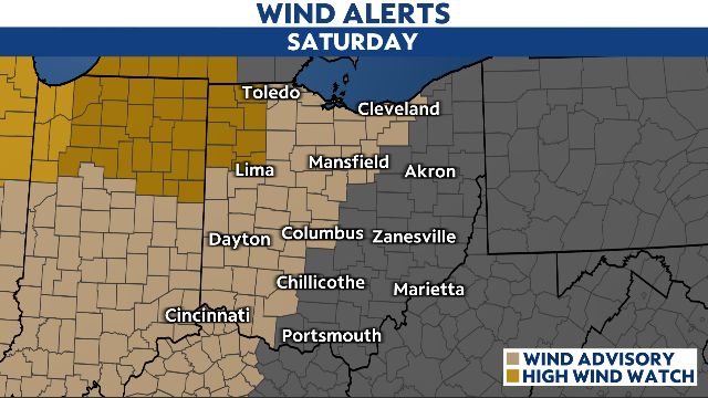
An unseasonably warm, dry and breezy Friday will give way to an active weekend. Winds will be elevated through the overnight and stay that way on Saturday. Gusts of 30-45 mph will occur pretty consistently for a large portion of the state, with potential for gusts of 50+ mph across northwestern Ohio.
These strong winds will be outside of any showers and thunderstorms. The potential exists for spotty power outages, tree damage and for loose objects to blow around outside.
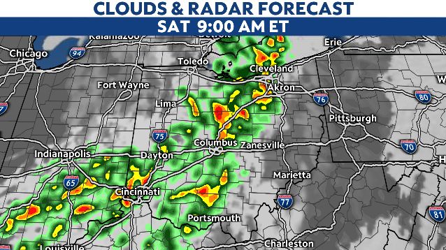
Rain and some thunderstorms will move into western Ohio early Saturday morning. This activity could include some heavy downpours for locations near the I-75 corridor. The severe risk will be very low.
Additional showers, downpours and thunderstorms will be possible throughout the day. The highest coverage of rain will probably be later Saturday through Saturday night and early Sunday.

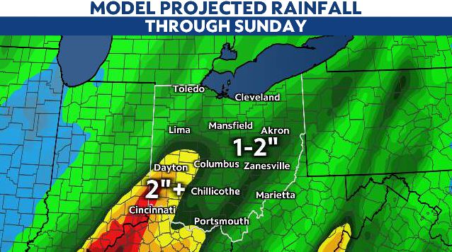
This is when the rainfall will likely be the most widespread overall for the state. This is also the window in which some flooding could occur. This will be especially true if heavier rainfall moves over the same areas over and over again.
Generally speaking, the state will see 1-2" of rain with this system; totals most locations should be able to handle. Some places may not quite reach one inch of rain while other places will exceed two inches of rain.
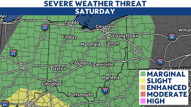
The risk of severe weather has decreased as some of the ingredients needed to produce tornadoes, damaging winds and hail look to remain limited. Still, there is a level 1-of-5 risk for severe in place for all of Ohio, so a couple of strong to severe storms can't be totally ruled out.
The chance of rain will decrease through the day Sunday as colder air pours in behind the cold front. This colder air mass will be around for St. Patrick's Day on Monday before we warm back into the 60s and 70s Tuesday and Wednesday.