


-1)
After a sunny Valentine's Day, multiple rounds of precipitation may alter some weekend plans.
Accumulating snowfall will move in overnight and many along and north of I-70 will wake up to fresh snow on the ground.
One to two inches inches of snow is possible with some higher amounts near Lake Erie.
)
Snowy roads early Saturday in the northern half of the state will likely lead to slowdowns.
)
Definitely plan to brush snow off of the car early Saturday if it's outside!
We may also see a brief window for some light freezing rain early Saturday, but it appears the ice accumulation threat is fairly low.
Temperatures will rise throughout the morning so we will change to rain as our primary precipitation through early Sunday.
)
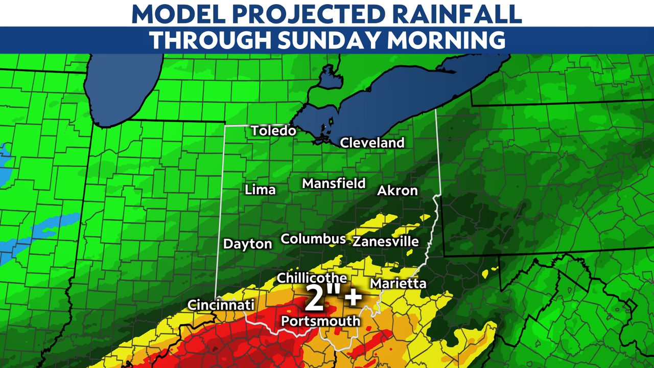
Flood watches are up for southern and parts of eastern Ohio where heavy downpours are possible Saturday night into early Sunday.
Two to three inches of rain are possible in our counties under a flood watch.
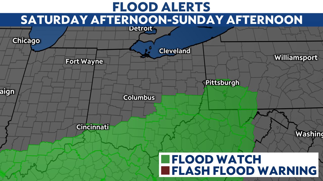
Be prepared to get to higher ground if a flash flood warning is issued and never drive through a flooded roadway.
Cold air will move in early Sunday so there will be a change back to snow showers.
Be aware of icy spots early Sunday on any surface that is wet or untreated.
Refreeze and snowy roads may be an issue for travel throughout Sunday as temperatures continue to fall.
Arctic high pressure settles in for Monday with mainly dry skies and very cold air for most of next week!