OHIO — Our first significant winter storm of the year is setting up for the Ohio Valley by Sunday. We will have nearly statewide impacts from late weekend through Monday to watch.
There's a Winter Storm Watch in effect for western and mid Ohio including cities Dayton, Columbus and Cincinnati as we track the highest impacts of heavy snow to ice potential. These areas specifically will need to be prepared for the winter storm and the impacts.
Let's breakdown the details of the approaching winter storm.
Starting early weekend, an area of low pressure moves through the central plains and continues to strengthens. There's a lot of Gulf moisture feeding into the area of low pressure from the south so that allows for heavy rain/wintry prep to develop with these cold temperatures.
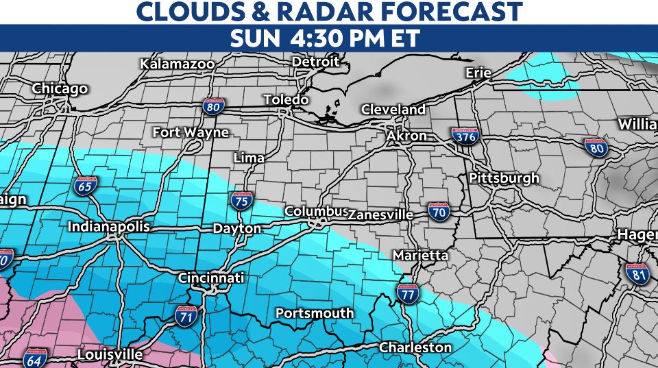
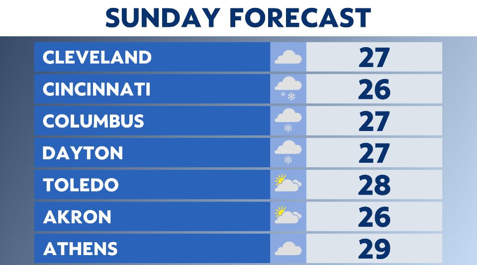
We'll first watch for snowfall by midday Sunday in Cincinnati/southern Ohio, quickly the snow band extends north toward I-70 (Dayton/Columbus) through the afternoon.

Heavy snowfall could quickly impact roads and stick to surfaces as it falls late Sunday.
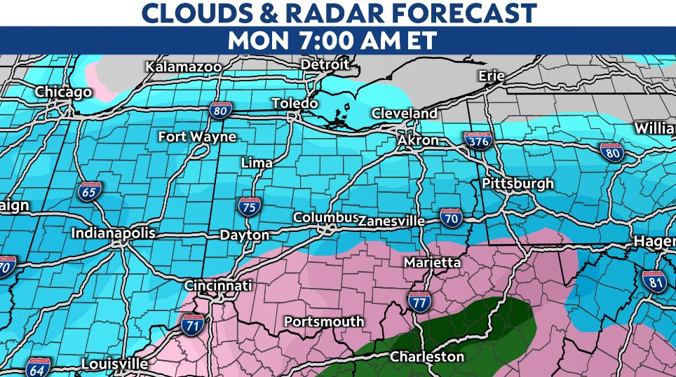
There won't be much snow for northern Ohio until Sunday night and into early Monday.

Depending on the storms track, this is key to the winter storm's forecast, there looks to be a change over from snow to ice/mix in parts of southern Ohio.
This window of ice times out into early Monday morning for areas along the Ohio River. It's a few hours of ice potential before changing back to all snow by late morning and the remainder of Monday's forecast.
Less ice potential and more heavy snowfall threat for mid-Ohio. A band of significant snow could quickly bring several inches of snow in a few hours.
Additional impacts on Monday, will be wind. Gusts could up to 20 to 30 mph and the threat of blowing snow brings poor visbility.

Again if the track of the storm edges further north or south, this will change the forecast easily. This is the tricky part of winter weather forecasting.
This is why it is a developing forecast, and you need to stay up to date with the latest forecast over the next few days and prepare for winter weather Sunday late through Monday.
Behind the snow Monday, temperatures turn even colder by mid/late next week. We could track sub-zero wind chills!


