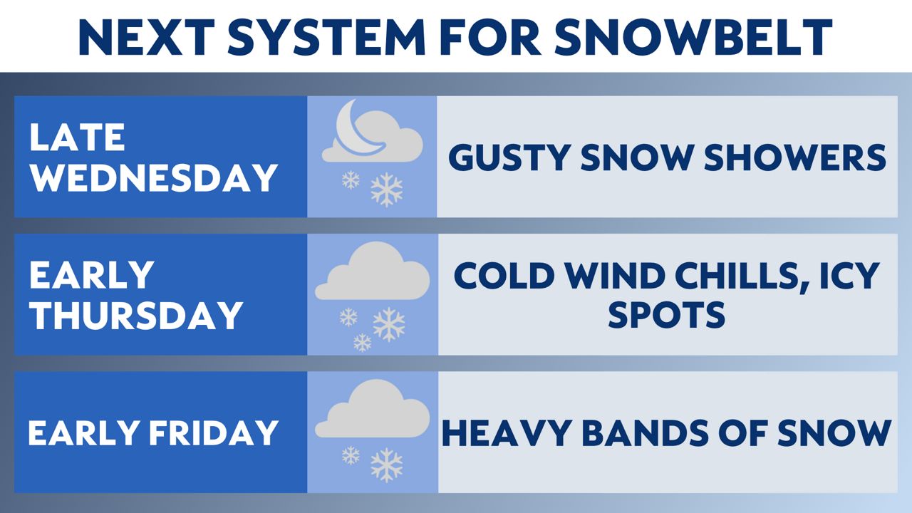
OHIO — The chance to catch a break and dig out from lake-effect snow will be very temporary in northeast Ohio.
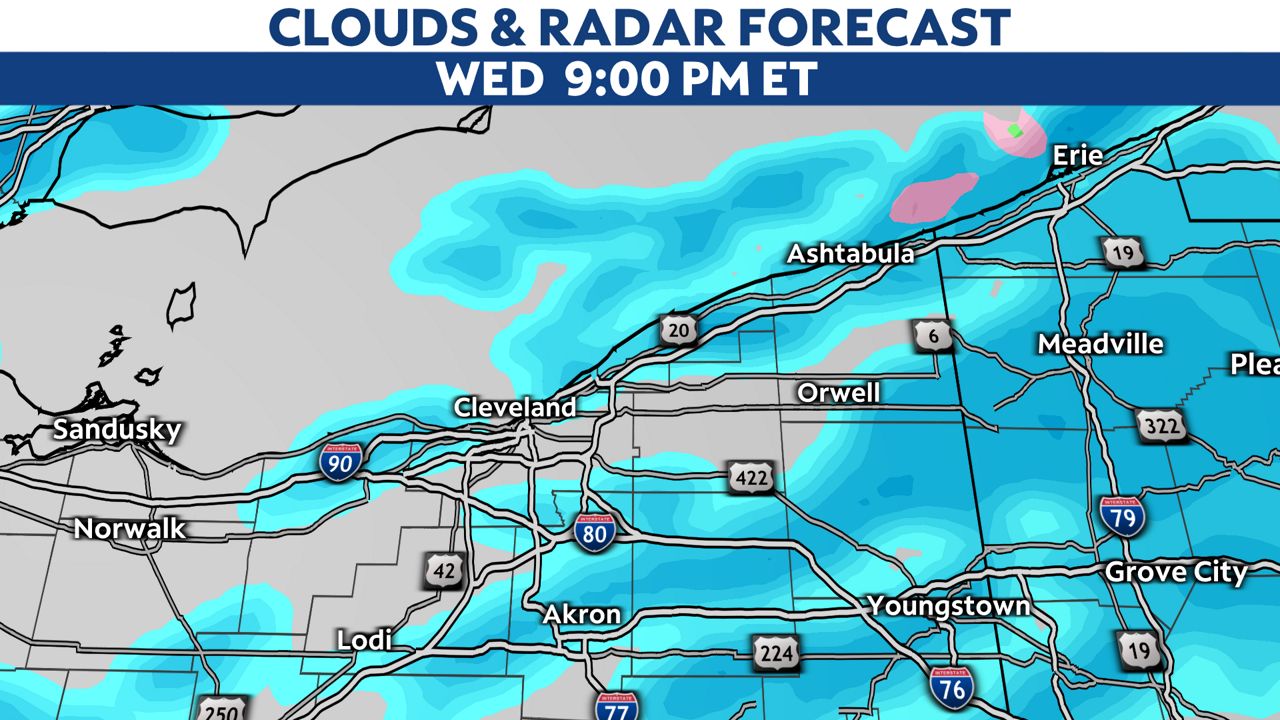
We will see a break from snow Tuesday evening through Wednesday afternoon, then the primary Snowbelt needs to be get prepared for a second, disruptive lake-effect snow event.
Wednesday’s highs will be warmer and we will see dry skies for most of the early daytime.
The quiet skies and warmer air won’t be around long.
A very strong, powerful cold front will approach from the northwest overnight into early Thursday.
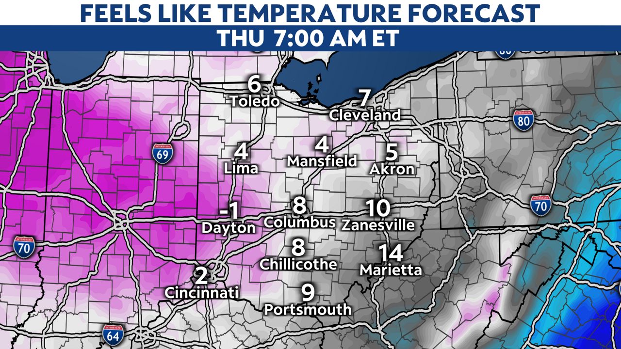
Wind chills could go to single digits or even sub-zero in some spots Thursday morning.
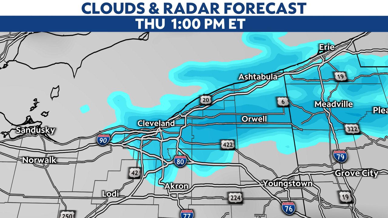
Scattered snow showers will probably slow down the Thursday morning commute statewide, but heavy bands of lake-effect snow and squalls will persist through late Thursday night in the snowbelt.
A winter storm watch is up for Cuyahoga, Geauga, Lake and Ashtabula counties Wednesday 4pm through 4am Friday.
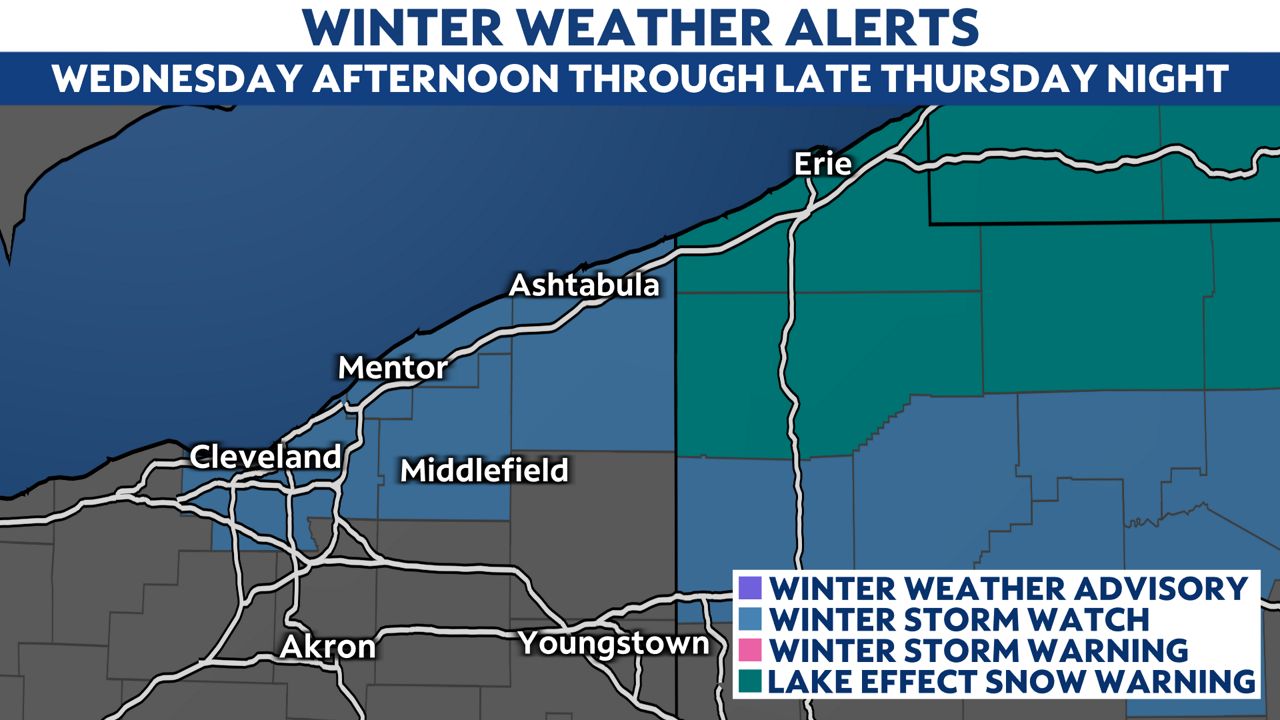
Another 6-12" of additional snow is possible in this area.
Snow amounts outside of the main Snowbelt will be fairly low around ½ inch up to 2".
Winds will remain elevated through Thursday, so blowing and drifting snow will be an issue for road crews and drivers.
This weekend looks mainly dry with warming temperatures.
Snow will melt with highs in the 40s and 50s on Sunday and Monday, so we will need to watch for flooding where we have seen heavy snow.


