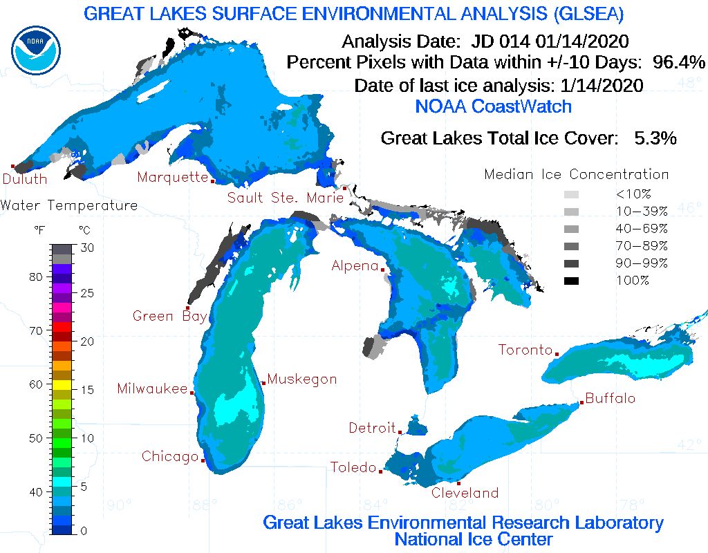
Lake Erie is currently 0% covered in ice. According to the Cleveland National Weather Service Office the average ice coverage for this time of year is 40%. Even taking all 5 Great Lakes into account, current concentration is only about 5%.
We saw a similar setup last year. A warm start to winter kept ice coverage to only around 1.6%. This can vary wildly depending on the year. In 2018, ice covered nearly 80% of the Lake in mid January.
The biggest impact to Ohio will be continued Lake Effect Snow events late into the season.
In order for Lake Effect Snow to develop, cold air must move over relatively warm water for a long distance. As the warm, moist air over the lake rises, it is picked up by these winds and carried tens of miles inland. Once that warm, moist air reaches the other side, that air rapidly cools and condenses, and can dump feet of snow in just a few hours.
As ice coverage increases, it decreases the distance that air can travel across the lake (known as fetch, which needs to be around 60 miles for a Lake Effect event).
In a typical year, these events wind down in February, but until we see consistently cold temperatures and ice coverage increases over the lake, the Snow Belt will see bands of heavy snow continue much later into the season.


