


Storms are likely across Ohio today into tonight, with severe weather possible.
What You Need To Know
- Two waves of possible severe weather
- Line of storms are expected in the early to mid afternoon
- Secondary severe weather threat tonight
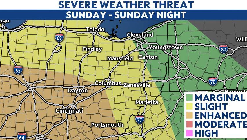
Storms are most likely today across southwest Ohio, but chances for severe weather will be present all across the state.
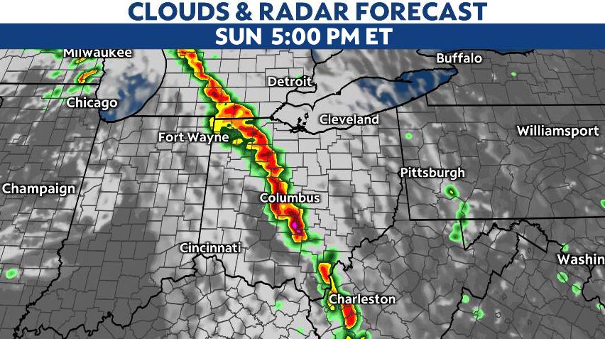
Starting around 1-2 p.m., a line of strong storms moves into southwest Ohio, then spreads northeast through the afternoon and evening.
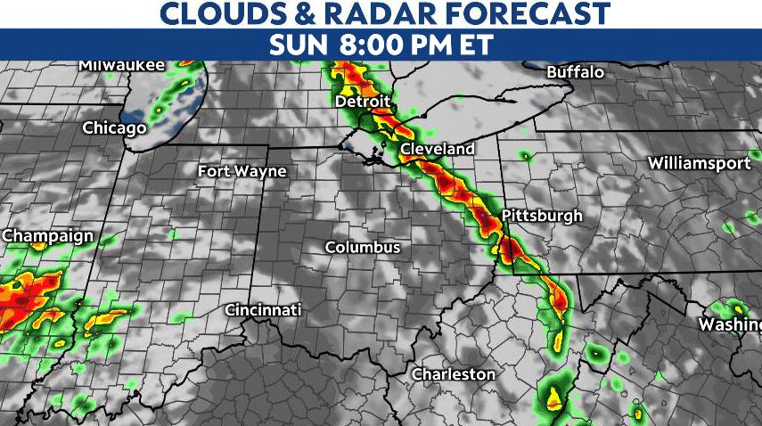
This first wave moves into Columbus closer to 5 p.m., then Cleveland around 8 p.m. Along this first wave, damaging straight line winds will be the biggest concern, followed by hail.
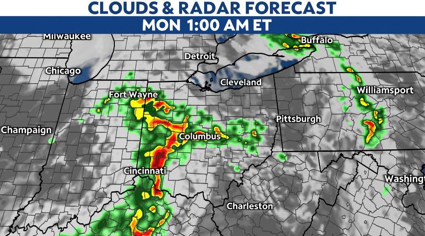
While an isolated tornado will be possible, that may be more likely late tonight with a second wave of storms. That arrives west around midnight, and exits overnight. The tornado risk may be slightly more elevated with this second wave.
Overall, the greatest threat from these storms will be wind damage, especially in the eastern half of Ohio. Additionally, large hail and tornadoes are possible, especially southwest, where we are under an Enhanced Risk (Level 3/5).