

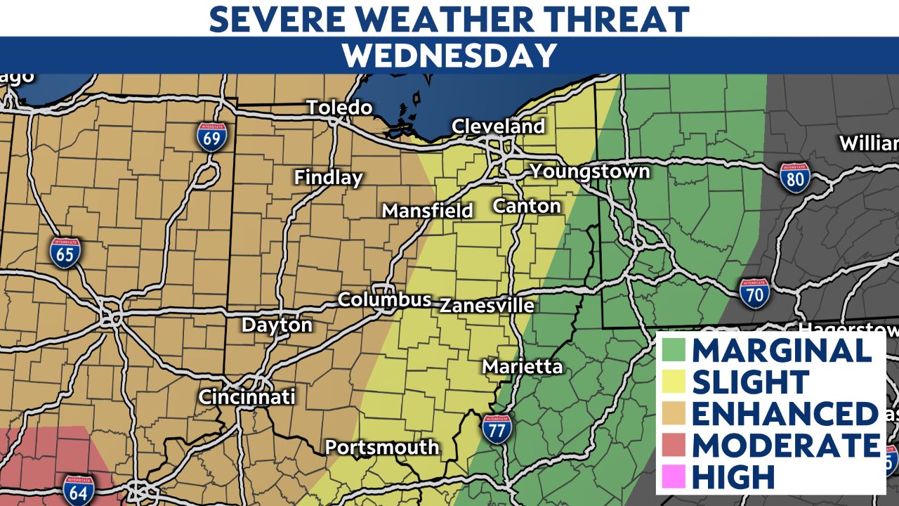
OHIO — Another round of severe weather looks likely Wednesday night into early Thursday morning.
After four confirmed tornadoes in Ohio Sunday night, another wave of severe weather returns late Wednesday, with damaging straight-line winds, hail, and additional tornadoes possible.
A quick chance of showers and storms will be possible late morning into midday, but with strong southerly winds, we will see afternoon temperatures surge into the 60s and 70s, fueling strong storms Wednesday night.
The higher risk for severe storms will be for the western half of Ohio Wednesday night.
Furthermore, showers and thunderstorms will redevelop on Thursday and bring the risk for more severe weather in central and southern Ohio.
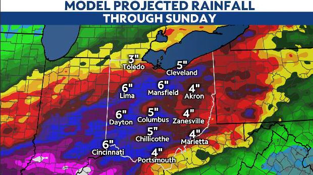
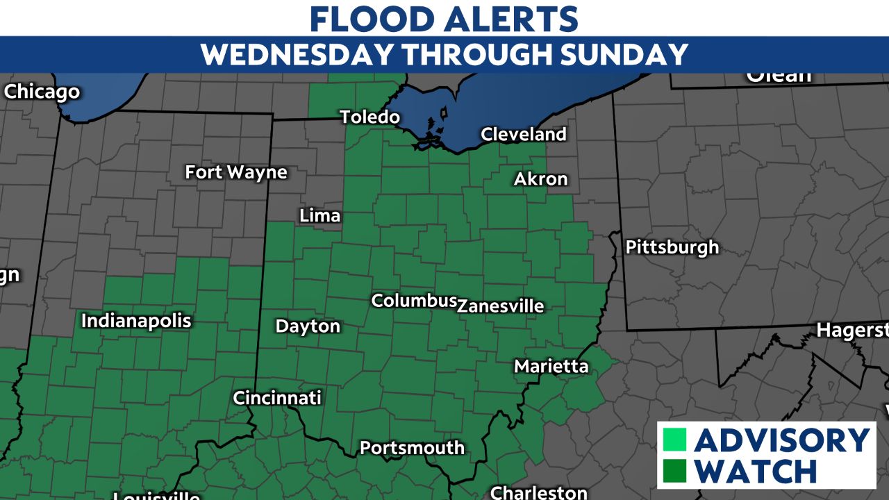
In addition to the severe weather threat, flooding will be of increased concern, especially late week into the weekend, with totals Wednesday through Sunday likely topping 4-5 inches for much of the state.