


OHIO — Most of us want to be outside this holiday weekend. We'll have chances to do that, but not all weekend as there will be active weather returning to be aware of.
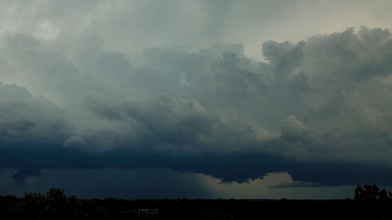
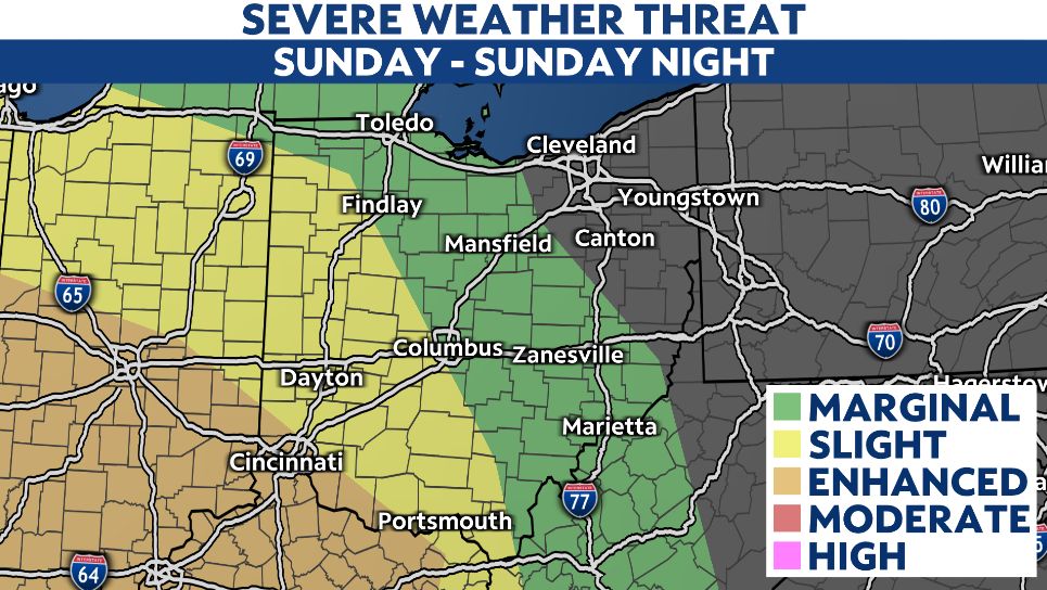
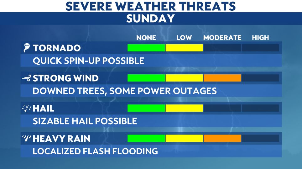
There will be a greater risk for storms on Sunday. Most of the state will have a risk for strong to severe storms with this complex developing later in the day.
The western half of the state will have the higher risk for severe weather, pretty much right along I-75 and westbound of the interstate.
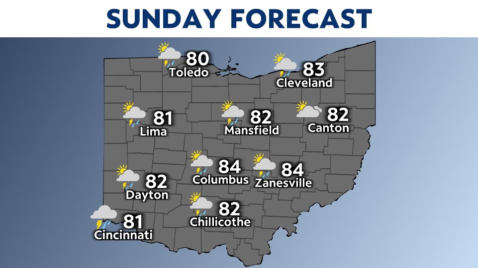
Highs on Sunday return back into the 80s, and our airmass is humid. So there will be ingredients in place for strong to severe storms.
Let's talk timing, the morning hours look mainly dry for most of the state. We start to notice pop ups possible as we warm by mid afternoon.
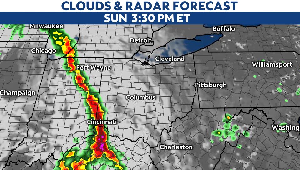
A cluster of heavy rain and storms pushes in from Indiana by late afternoon/evening timeframe. The leading edge of storms could be strong/severe as it races into western Ohio.
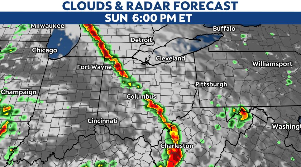
Central Ohio can expect the arrival of storms by the evening hours on Sunday, mainly around dinner and later.
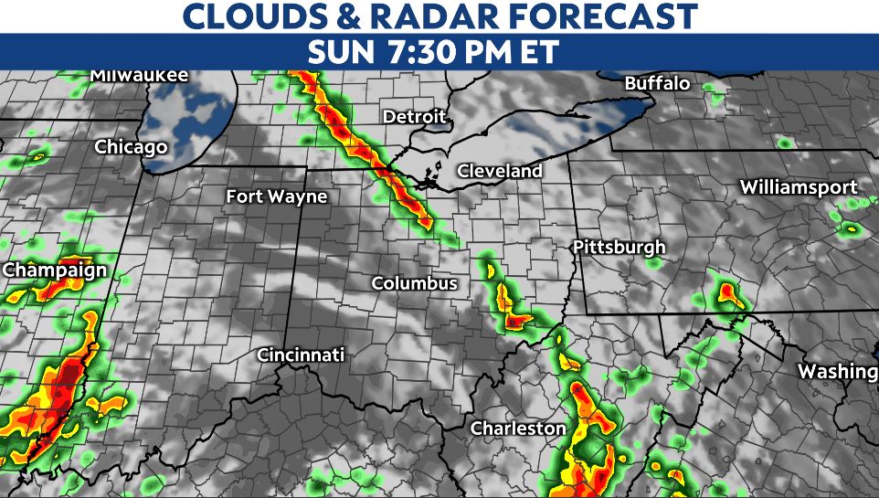
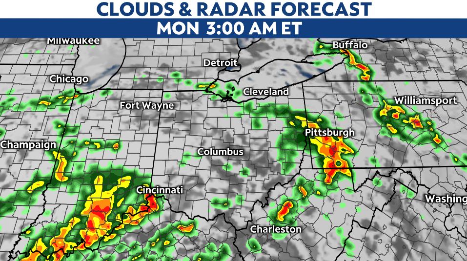
Storms could still be strong/severe after the sun sets into Sunday night, but generally we will expect them to weaken as they progress in Cleveland and further east Ohio. Sunday night. Heavy rain and damaging winds are still possible even overnight Sunday.
Please stay weather aware as storms are capable of producing damaging wind gusts up to 60 mph, heavy rain, lightning, and we can't rule out an isolated tornado.
On Memorial Day, Monday, the threat for severe weather decreases as temperatures cool off and showers continue through the day.