
A cold front is approaching New England from the west today, and will cross the region through this afternoon and evening. As the front passes, it will bring the potential for strong to severe storms.
There is a level 2/5 threat for severe weather stretching from central Maine through southern New England. A level 1/5 threat is issued for the rest of coastal Maine and interior New England.
Storms will be capable of producing damaging wind gusts and large hail.
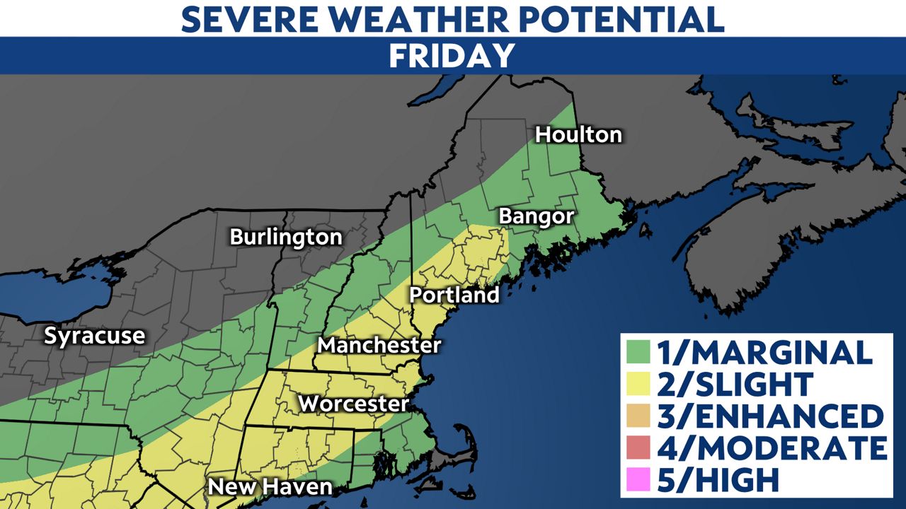
Some scattered showers Friday morning are possible, but the highest threat for severe storms will be during the afternoon and evening as the cold front passes.

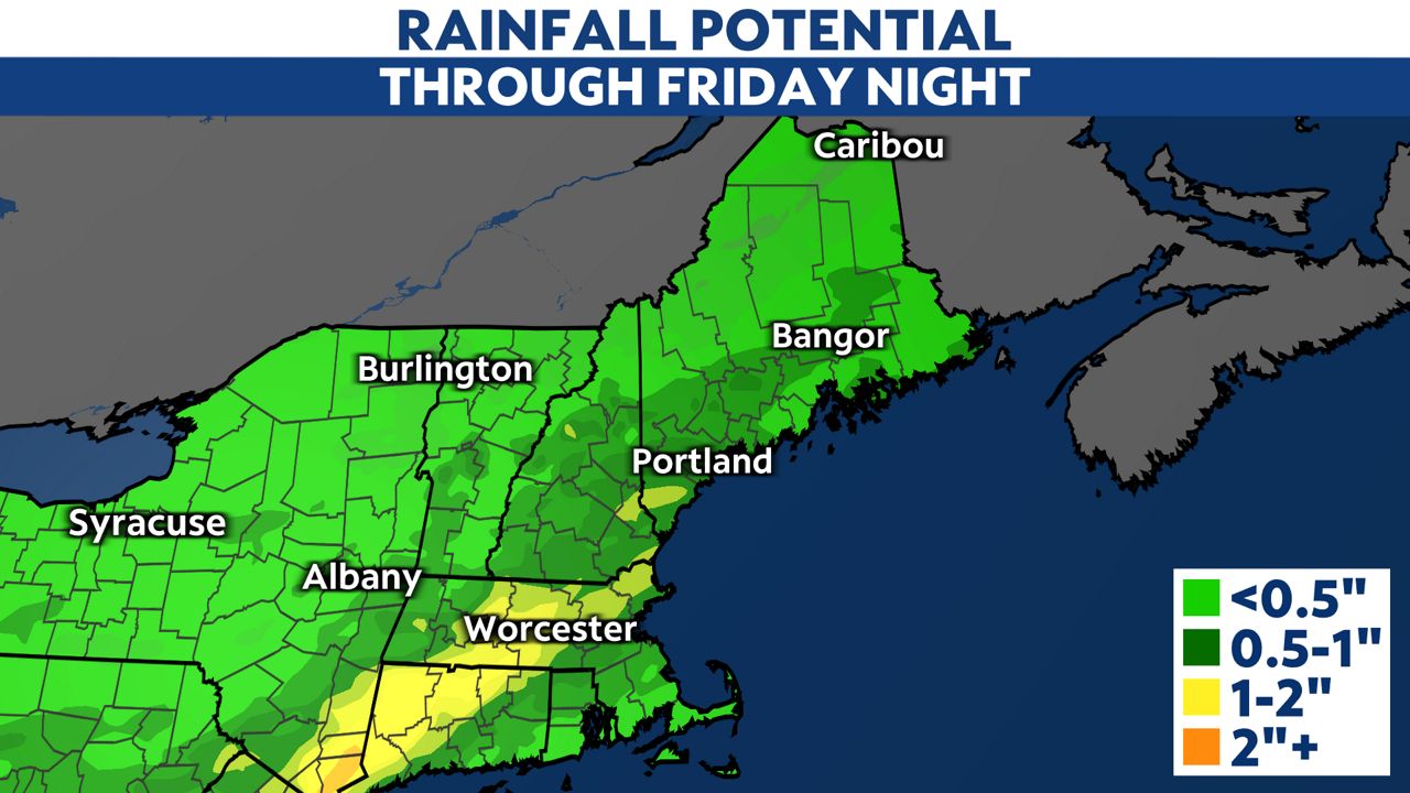
Some storms will also be able to produce locally heavy rainfall. Downpours could lead to rainfall totals up to 1 to 2 inches across parts of New England, with widespread totals around 0.5 to 1 inch.
You can get the latest watches and warnings sent to your phone by downloading the Spectrum News App and turning on notifications.
Our team of meteorologists dives deep into the science of weather and breaks down timely weather data and information. To view more weather and climate stories, check out our weather blogs section.