


"Was that a derecho?"
It's a popular term in meteorology for a storm event. But not every bad storm that passes through is a derecho. There are actually distinct characteristics that classify a weather event as a derecho.
The National Weather Service defines a derecho as a widespread, long-lived wind storm associated with a band of rapidly moving showers or thunderstorms.
The destruction is similar to tornadoes, but unlike a tornado, the damage is usually directed in one direction.
Two characteristics it must have include:
- The wind damage swath extends more than 240 miles
- Wind gusts have to reach at least 58 mph along most of its length
A derecho can bring hurricane-force winds and cause serious impacts. Impacts include damage to crops and property. Downed trees can damage cars and buildings, and downed power poles can lead to power outages.
In extreme cases, these winds can lead to the loss of life.
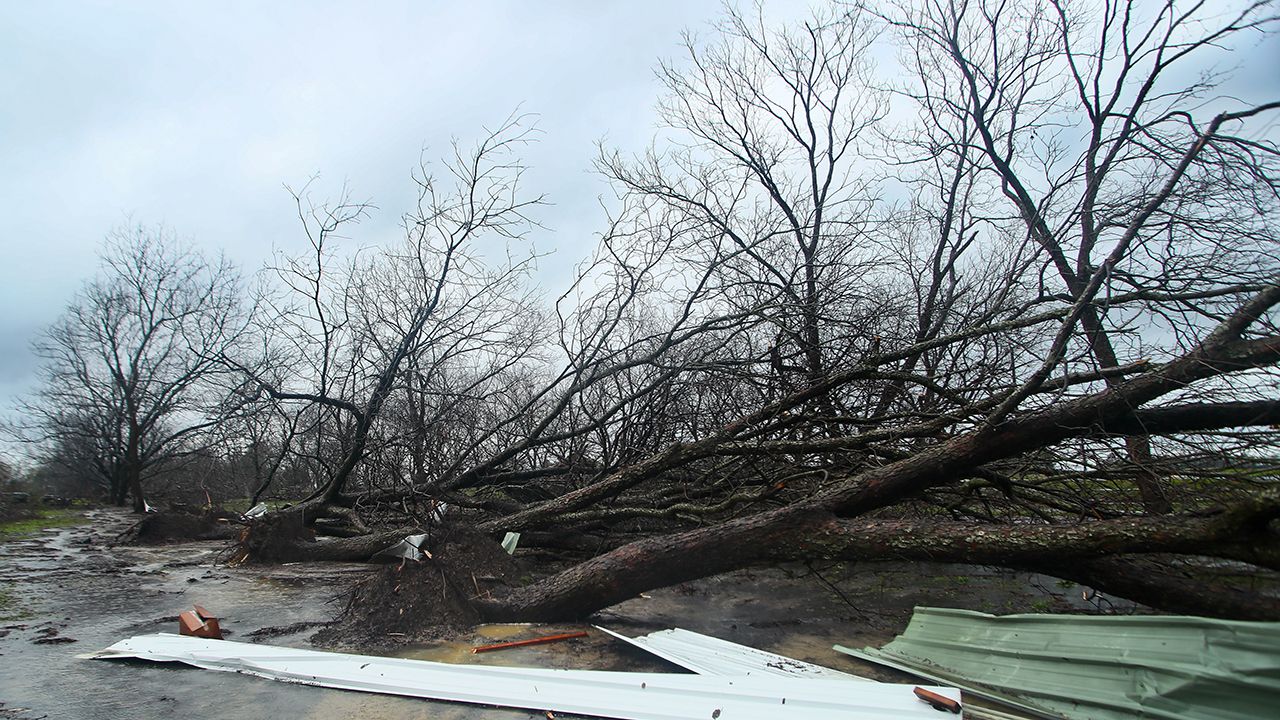
As rain cools in a thunderstorm, it sinks and can create a downdraft. That downdraft spreads horizontally once it reaches the surface and forces the warm, moist air around the storm up along the edge of the outflow.
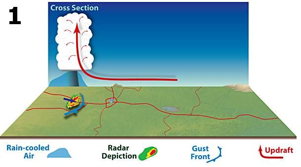
Once the warm, moist air travels upwards, new storms form. The rain from these storms helps strengthen the flow of air from the backside of the storm and encourages the stronger winds at the top of the storm to lower towards the Earth's surface.
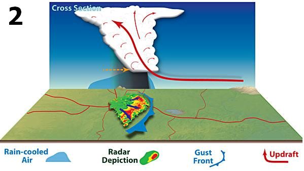
As the thunderstorms continue to grow, the step above repeats. The NWS states that the line of storms accelerates as one large bow or multiple smaller bows within an overall line and persistent wind damage occurs.
Predicting a derecho in advance is very difficult since the processes that lead to a derecho are small-scale.
It’s easier to identify a derecho when the storms are happening, which in the end, could only give a few hours’ notice.
It is much easier to predict where severe weather might be possible. If the National Weather Service forecasts severe weather for your area, it is best to prepare before the event. This way, you’ll be ready for whatever happens.
Our team of meteorologists dives deep into the science of weather and breaks down timely weather data and information. To view more weather and climate stories, check out our weather blogs section.