Record heat and humidity have had a firm grip across parts of the U.S. this week, and it won't let go this weekend. Along with the excessive heat, parts of the Upper Midwest and Northeast will deal with severe weather as south Texas dries out after Tropical Storm Alberto.
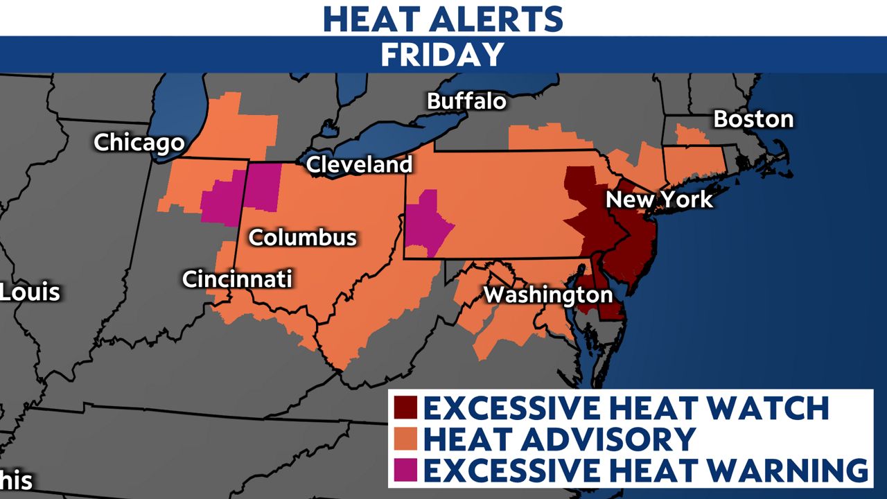
Heat Alerts have continued Friday across the Ohio Valley and parts of the Northeast with high temperatures in the mid-90s and heat index values climbing into the triple digits. A stubborn upper-level high system remains in place this weekend as a heat wave continues to bring record high temperatures.

The Ohio Valley, Mid-Atlantic and Northeast will feel the most intense heat this weekend, with temperatures climbing into the upper 90s and even triple digits in some places. More record high temperatures will be broken, especially in the Mid-Atlantic, with heat index values as high as 110 degrees in the forecast on Saturday.
Record warm overnight lows will also be set as temperatures struggle to drop below the mid-70s at night, providing little-to-no relief from the early arrival of summer.
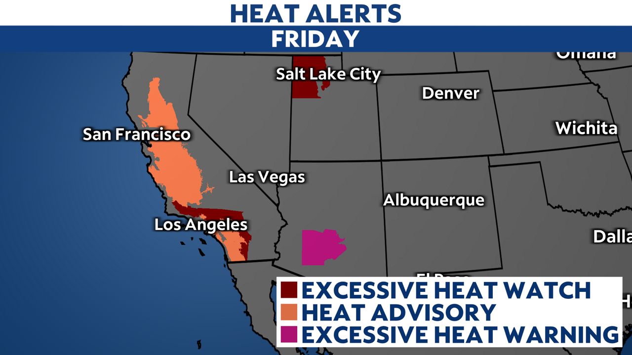
Out west, Heat Advisories and Excessive Heat Watches are in effect across inland Southern California this weekend. Highs will climb around 96 to 106 degrees for interior areas with gusty winds.

If you have outdoor plans this weekend, there will be an elevated threat for heat-related illnesses because of the oppressive heat and humidity. Protect you and your family from the heat this weekend.
- Stay hydrated and drink lots of water
- Wear light-colored and loose-fitting clothing
- Take frequent breaks outside and seek shade or A/C when needed
Here are more heat safety tips for you and your family.
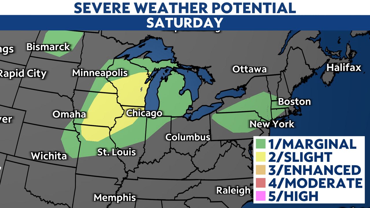
It's going to be an unsettled weekend for parts of the Upper Midwest, including Wisconsin, where strong to severe storm chances carry into the weekend. Storms on Saturday will be capable of producing heavy rain, damaging winds, hail and a few tornadoes.
A level 2/5 threat for severe storms is issued across parts of Wisconsin, Minnesota, Iowa, Illinois and Missouri.

The Northeast will see daily shower and storm chances this weekend. There is a low-end severe weather threat across the Northeast and New England all weekend long for strong storms capable of producing damaging winds and heavy rainfall.
Tropical Storm Alberto was the first named storm of the 2024 Atlantic hurricane season.
It made landfall in northeastern Mexico on Thursday, June 20. It brought heavy rainfall, winds and coastal flooding across northern Mexico and South Texas. Alberto weakened and dissipated on the same day that it made landfall.
Surfside Beach, Texas, was inundated with water as the storm surge moved inland before Alberto even made landfall on Wednesday, June 19.
Texas dries out this weekend. Even though Alberto has dissipated, we’re keeping our eyes on multiple other disturbances in the tropics with the potential to develop.
Our team of meteorologists dives deep into the science of weather and breaks down timely weather data and information. To view more weather and climate stories, check out our weather blogs section.


