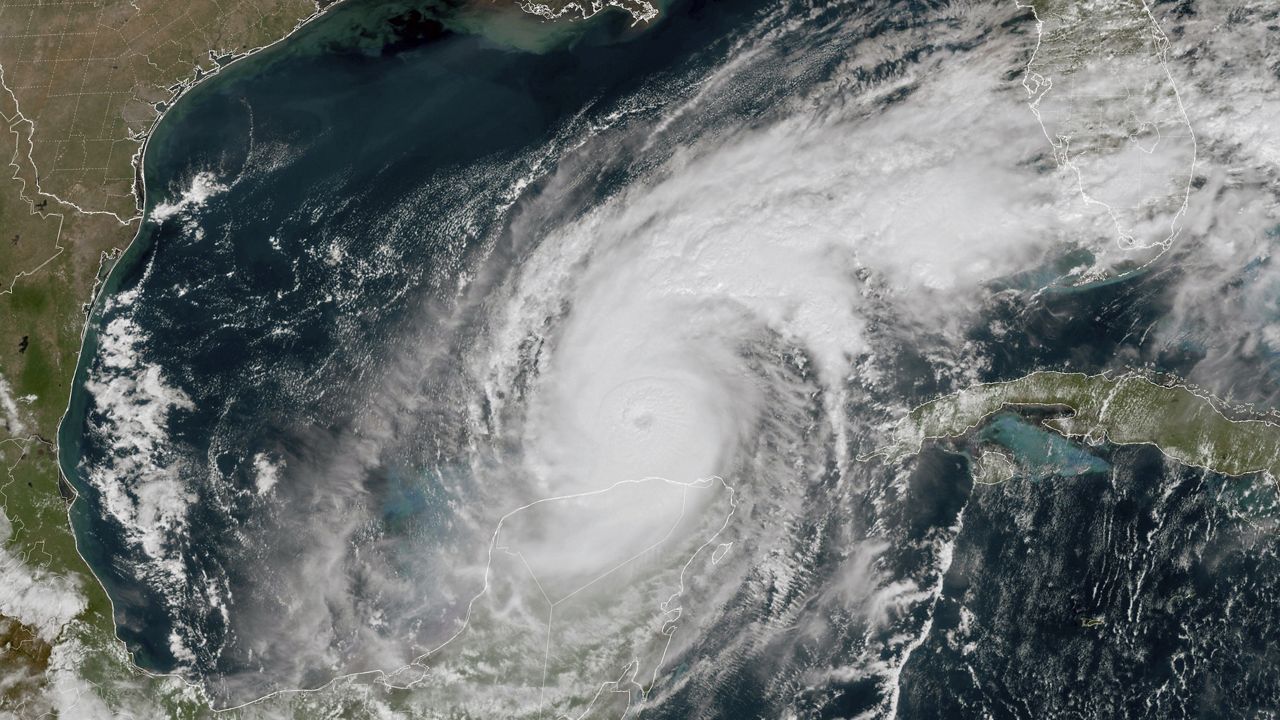


Tropical Storm Harold was a well-forecasted weather event.
Water vapor satellite imagery clearly showed the tropical wave that preceded the cyclone as it moved across the western Atlantic. Dynamic computer models showed it had potential about a week before it formed.
What You Need To Know
- Tropical Storm Harold was well-forecasted, developing just as expected
- Satellites, dynamic computer models and modern communications make such forecasts possible
- But even without those tools, seasoned weather observers could detect storms before they arrived
National Hurricane Center forecasts predicted formation accurately, and the storm developed just as expected in the western Gulf of Mexico, reaching tropical storm strength just before landfall on the lower Texas coast.
To put it bluntly: We nailed it.
But what if we did not have satellites, a network of observation sites and computer forecasts? How would anyone in Texas know what was coming in, for example, the 1890s? As Harold brewed over the Gulf, I tried to imagine that scenario.
It is important to note that the origins of modern meteorology are rooted in simple daily weather observations that go back to the start of agricultural societies.
When cultures began planting food crops in an organized way, early farmers made daily observations, eventually creating written weather records.
They would note what they saw each day; how the sky looked, the direction and speed of wind, the amount of moisture in the air, how frequently rain fell and in what amounts.
By the 18th century, weather observers would add new tools to their efforts: Mercury thermometers (temperature), wind vanes, anemometers (winds), barometers (pressure) and hygrometers (humidity). This gave them ways to accurately measure the daily weather patterns - methods still in use today.
When the telegraph came to Texas in the 1850s, it allowed weather watchers to share their daily observations, vastly improving the understanding of local weather patterns.
So, for our Texas weather watchers in the 1890s, what clues would they have about the approaching storm? By this time, most would know that tropical cyclones existed.
For coastal cities like Galveston, the first indications something was afoot might be reports from ships arriving to port. Sailors would have stories of wild, raging storms over the ocean waters they were lucky enough to escape.
Or perhaps no incoming ships arrived at all.
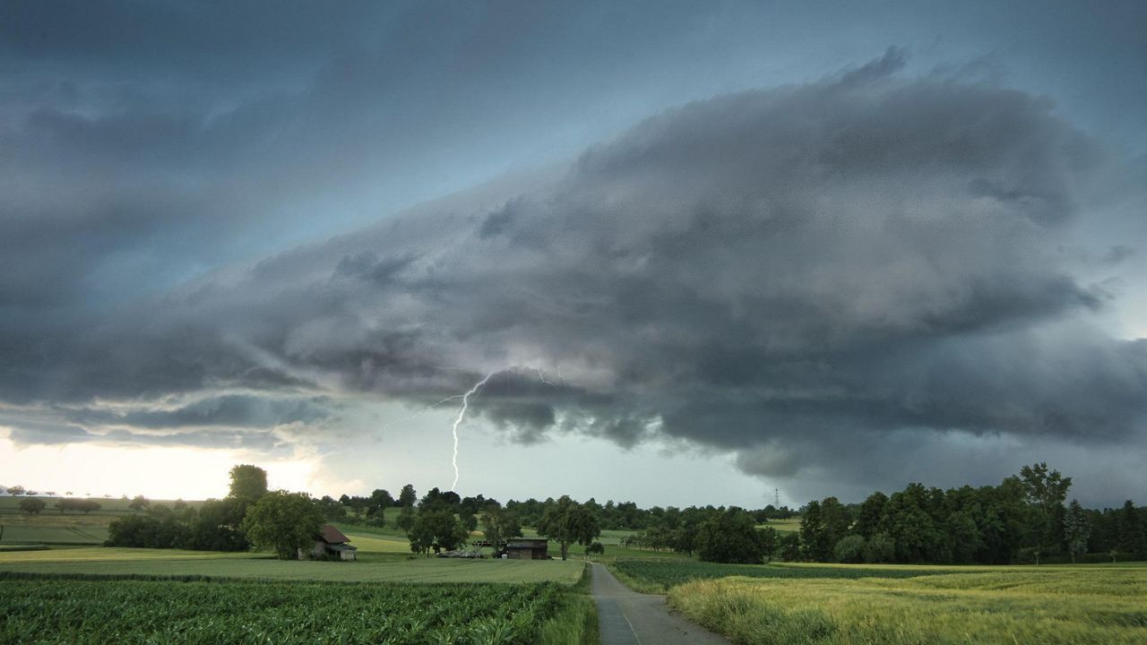
Next, observers might notice their barometers trending lower. It might be because of a nearby surface boundary. But if no front arrived, and the pressure kept falling, most observers would turn a wary eye to the sky.
The next evidence would be the wind direction. South winds prevail in Texas during the summer. But an increasing east wind would raise alarms for our weather watchers. It would mean that the outer wind field of a cyclone had reached the area.
As east winds increased, high overcast cloud cover would appear from the east. That would confirm an approaching storm. Our 1890s weather watchers would probably start telling anyone who would listen that a calamity was imminent.
Outer rain bands moving across in a northeast to southwest direction indicated that the storm was drawing near. Winds would increase, rain would become heavy, and in within a matter of hours, the full force of the hurricane and storm surge would arrive.
We can only imagine how our 1890s weather watchers would react as these events unfolded. Would people heed the warning or think it was just the ranting of an eccentric fool?
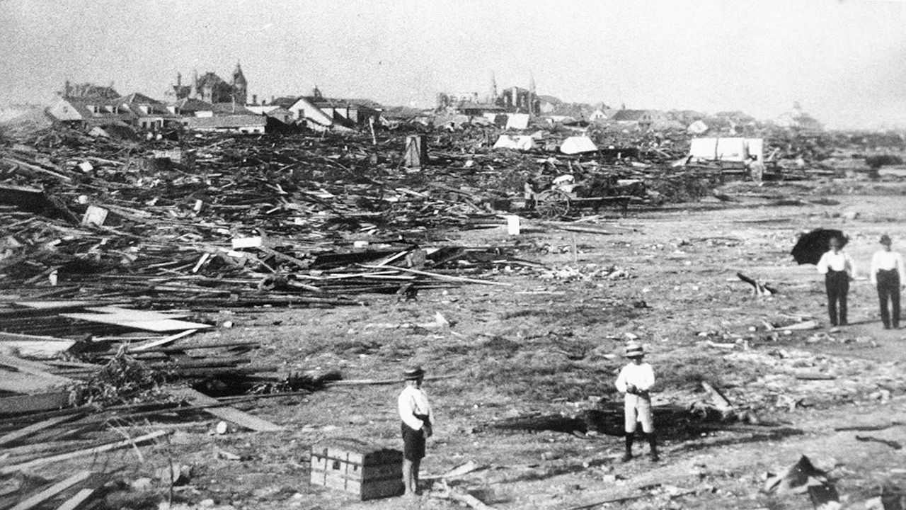
In 1900, about 8,000 people died on Galveston Island and several thousand more were casualties on the mainland when a ferocious hurricane and storm surge swept across the island and destroyed the city.
One Texas weather watcher saw it coming and tried to warn them. His name was Isaac Cline and according to the book “Isaac's Storm,” he traveled by horse to warn people of the storm's approach.
But most ignored him.
Our team of meteorologists dives deep into the science of weather and breaks down timely weather data and information. To view more weather and climate stories, check out our weather blogs section.