


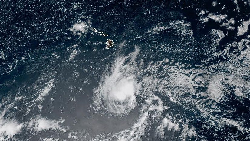
Tropical Storm Greg will head west, well south of Hawaii, but its impacts on us will be much less than Hurricane Dora’s.
Tropical Storm Greg will continue to pass south of the islands through Thursday night. It will be considerably weaker than Hurricane Dora was.
It still remains a tropical storm, with winds at 45 mph. Little change is expected, and bursts of shear could hinder any strengthening.
Through the end of the week and weekend, Greg will enter colder waters and encounter stronger shear, which will lead to gradual weakening.

The area of high pressure that was partially responsible for the intense, dry trade winds last week is farther north now. However, between that and Tropical Storm Greg, trade winds will be a little breezy until Thursday night.
Surf will come up midweek as the trades pick up, but it isn’t forecast to reach advisory levels at this time.
Shower activity will also be limited, mostly confined to windward slopes and coasts. Rain chances may increase early next week as the remnants of Fernanda, a tropical system in the eastern Pacific, approach the islands.
Our team of meteorologists dives deep into the science of weather and breaks down timely weather data and information. To view more weather and climate stories, check out our weather blogs section.