


Summer is still hanging on in Kentucky at the halfway mark of September, with temperatures persistently climbing well into the 80s on most days. Mother Nature looks to keep the Commonwealth in this pattern for about another week before our next season starts to show its face.
Once our latest system departs off to our east, high pressure aloft will build into the Ohio Valley for this weekend and early next workweek. This pattern will yield above-normal temperatures and relatively rain-free conditions as the “dome” of high pressure puts a cap on thunderstorm development. However, a rogue or isolated shower or storm can’t be ruled out during this stretch.
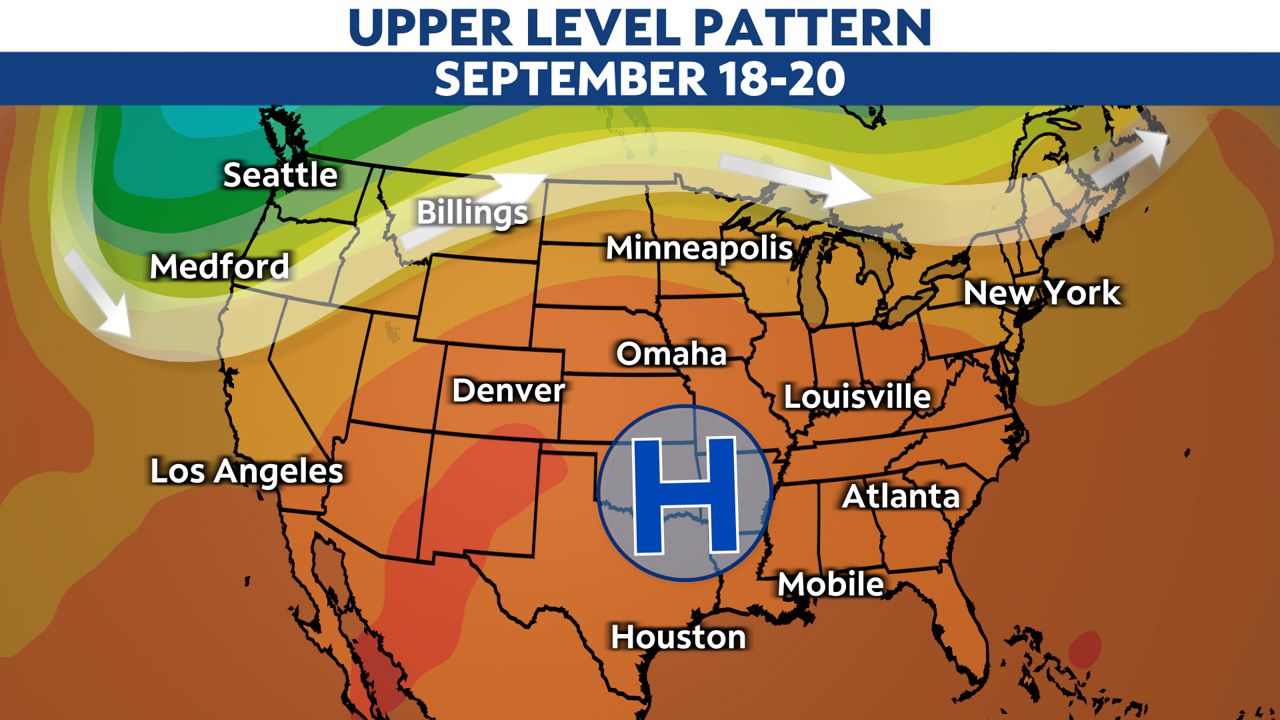
Highs from Saturday through next Tuesday could range between 5 and 10 degrees above average. This puts our highs in the lower to upper 80s. The humidity looks to stay high as well, further adding to that summer feel.
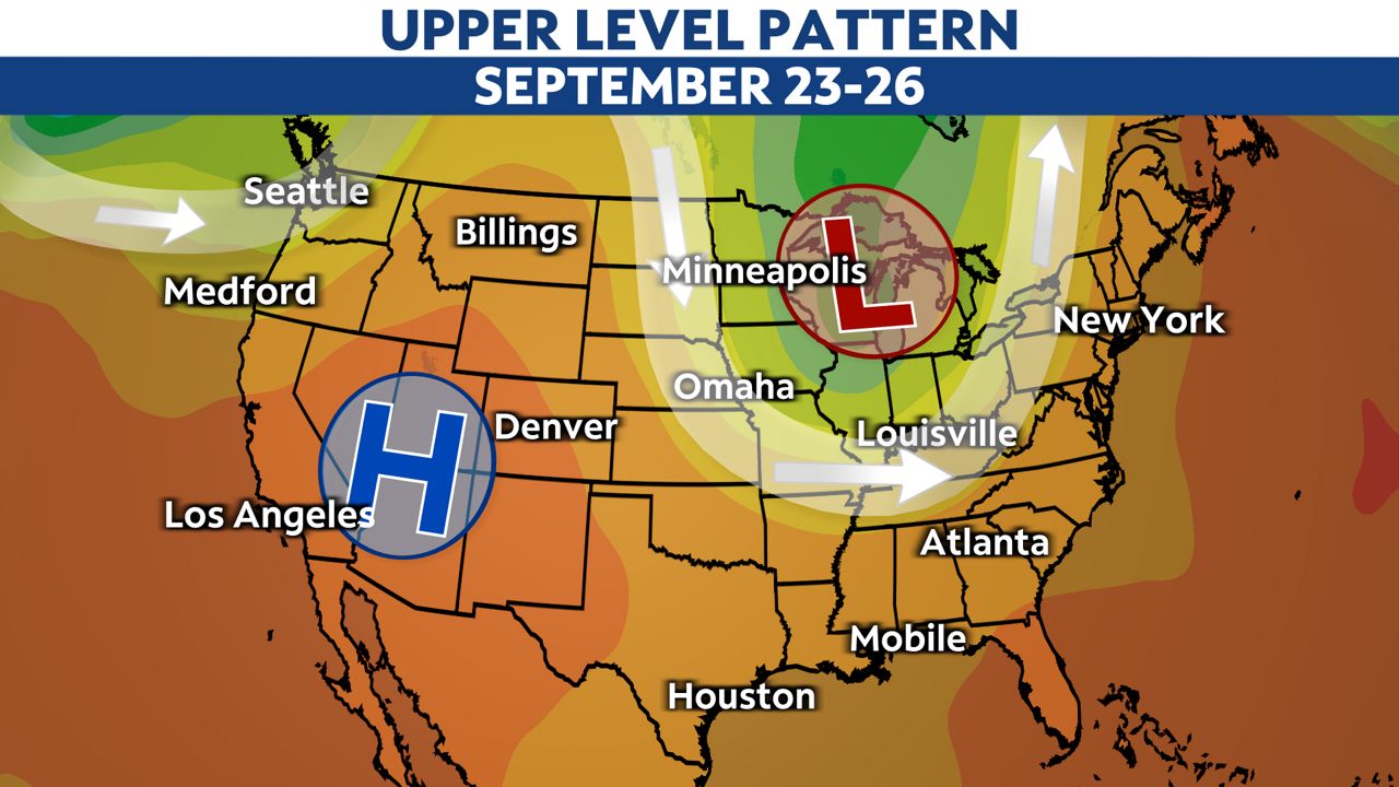
A trough will start pushing into the Pacific Northwest early next week. A trough is the opposite of an area of high pressure aloft and causes unsettled weather. This trough will gradually move into the Ohio Valley by mid-week, resulting in higher chances for rain as well as cooler temperatures.
To put it simply, summer-like conditions are sticking around through next Monday, Sept. 20. Unsettled weather looks likely from next Tuesday through next Thursday. Then, conditions more typical of early fall will arrive to close out the month. More precisely, this would mean days with highs in the 70s to lower 80s.