


After quiet and mild conditions dominated the weather picture last week, snow and cold are about to take over.
We sure hope you gobbled up the mild and generally nice weather last week, because that's not what's coming as the calendar flips from November to December.
Before we delve into forecast specifics, let's break down what's causing next week's big weather switch.
It starts with the jet stream, the narrow ribbon of strong winds at the upper levels of the atmosphere that dictate much of our weather. The jet stream looks to become curvier in nature (meteorological term: amplified) this week.
That 'curvy' appearance to the jet stream will help pull in much colder air from Canada and Alaska. This means much of the eastern half of the country will get in on the chilliest weather so far this winter season.
Meanwhile, an upper-level low spinning out of the southwestern U.S. will move into the southern Plains. That will tap into moisture from the Gulf of Mexico.
Mild weather ahead of the system coupled with very cold air behind it will help strengthen the storm system as it zips northeast.
If you couple the chill from the dip in the jet stream along with the moisture coming in from the south, you've got the recipe for a lot of active weather in the next couple of days.
No matter what the thermometer says of where you live, it'll probably feel much colder this week for most of the eastern U.S. That'll be the storm system's most widespread impact.
Temperatures across the Great Lakes will plunge into the teens and 20s for lows this week. Highs will have a hard time nudging above freezing from Buffalo, New York to Madison, Wisconsin.
Farther south, Texas and Florida will likely feel their coldest temperatures of the season, with highs struggling into the 50s and 60s across most of those states. Overnight lows drop into the 30s and 40s.
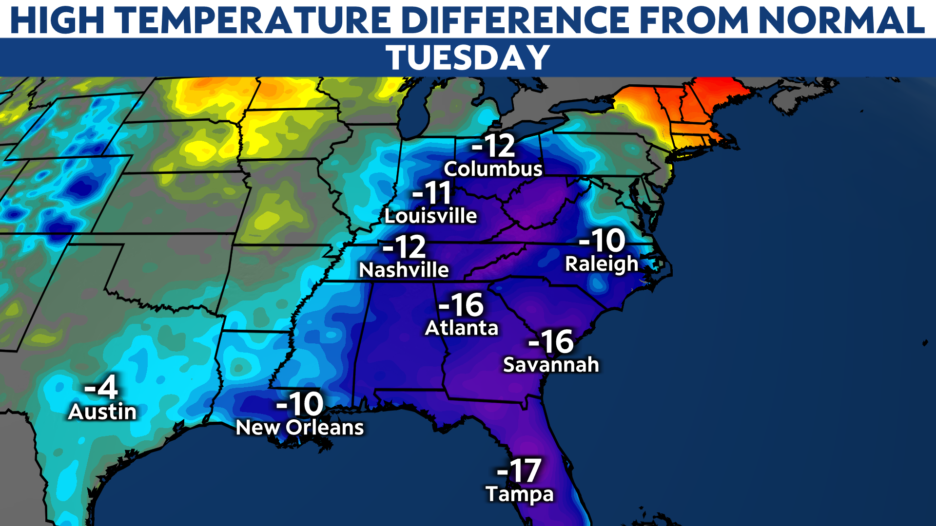
These temperatures will, generally speaking, run about 10-20 degrees below average across the eastern half of the country. It might feel even colder considering the relative warmth of the last few weeks, including Thanksgiving.
The cold spills southward starting on Sunday.
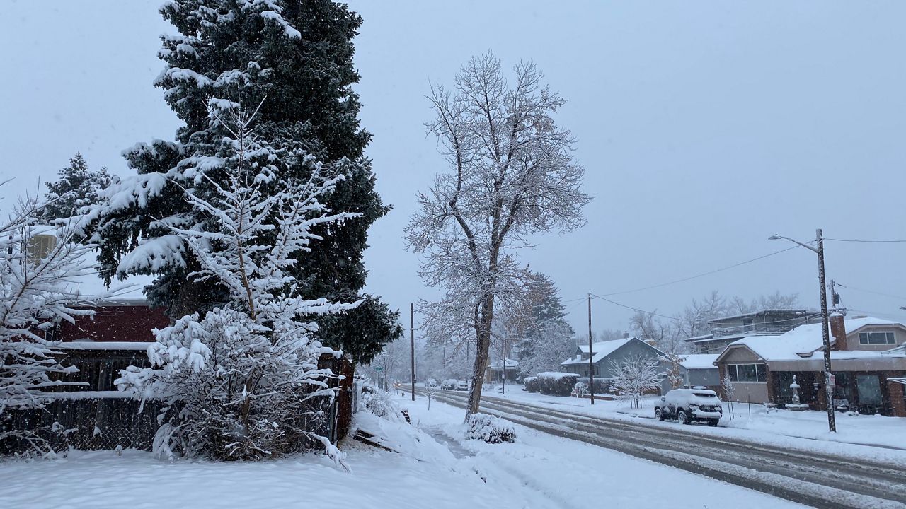
Ah yes, the four-letter s-word. Snow is on the horizon, and potentially a fair bit of it.
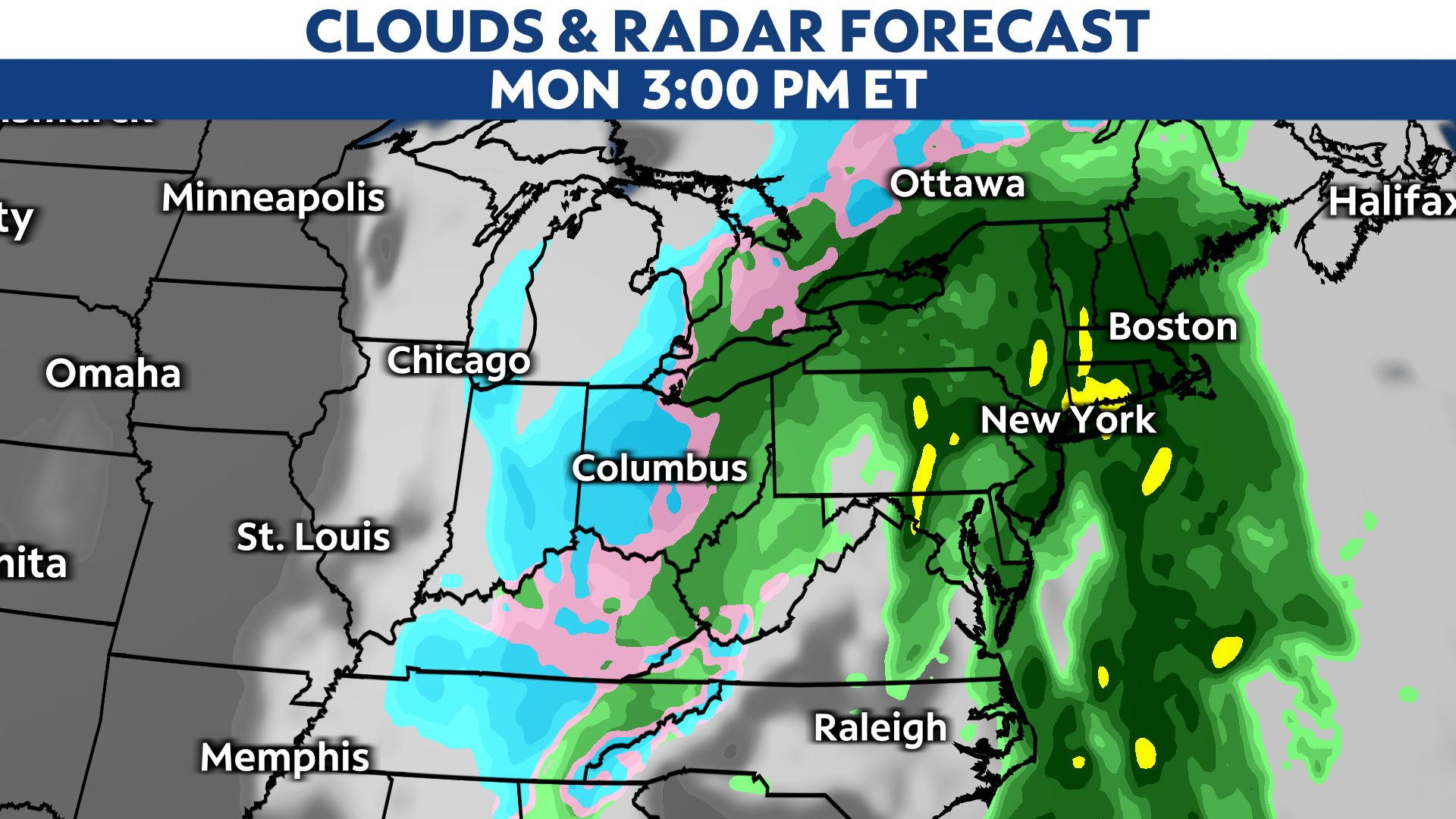
As the low pressure center spins northeast and continues to strengthen, there'll be enough cold air behind it that rain will change to snow.
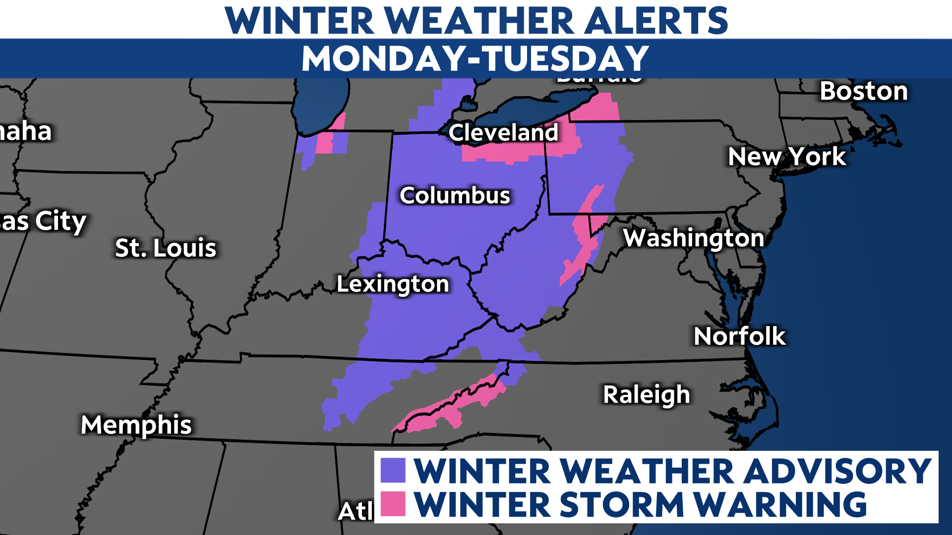
The low will take its sweet time spinning into Canada, meaning Ohio and Michigan could be in the corridor for some fairly healthy snowfall.

Over six inches of snow is in the cards for parts of the region, and near a foot is a distinct possibility near Lake Erie, including Cleveland, Ohio. A plow-able snowfall looks likely in the ski country of western Upstate New York, western Pennsylvania, eastern Michigan, and perhaps as far south as Kentucky and West Virginia.
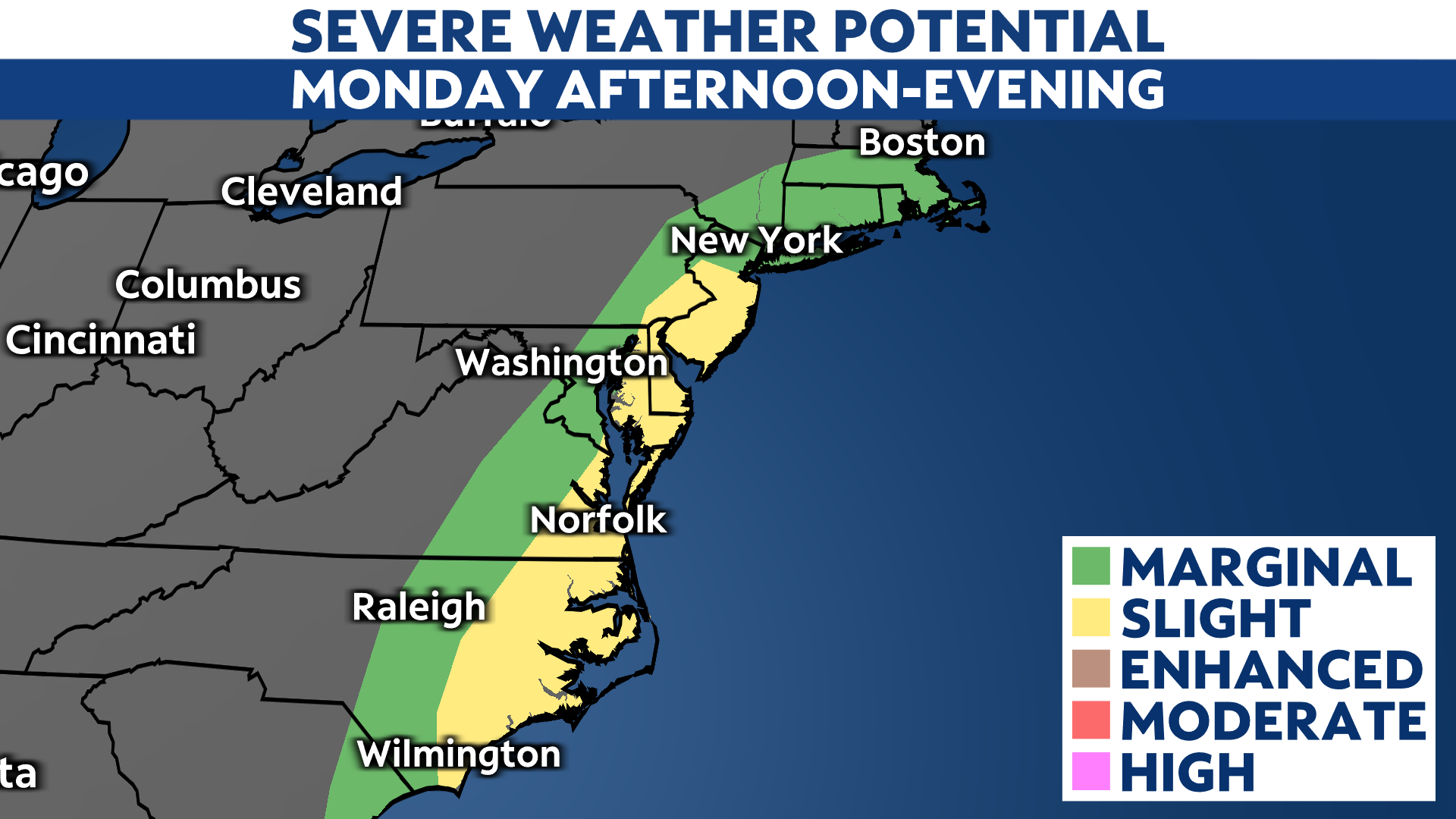
Finally, there's also the chance that we could see severe weather and heavy rainfall across in the East on the warm side of the system.
The heaviest rain is likely to fall from New England to the Mid-Atlantic, where rainfall totals well over an inch are likely. Some could top two inches. Now that we're entering the cold season, heavy rain tends to run off into streams and rivers more easily.
There's also a threat of severe weather as the cold front presses east, mainly near the coast. Gusty winds and perhaps a brief spin-up tornado are possible.
No matter how you stack it, some active weather is likely heading your way in the next couple of days.