


For many of us, it has felt like 2020 has lasted for multiple years. Sometimes, it feels like we never really got past March.
However, like it or not, December is right around the corner. In fact, you or likely some of your neighbors may have already begun decorating for Christmas.
During this time of a global pandemic, the distraction of holiday decorations can be positive.
One of the main questions we get often is what do we expect for the winter, and specifically: What about Christmas?
So our weather team has started taking a closer look at what the long range outlook is showing for the month of December. For those who like cold and snow weather, you may be somewhat out of luck, at least for the start of the month.
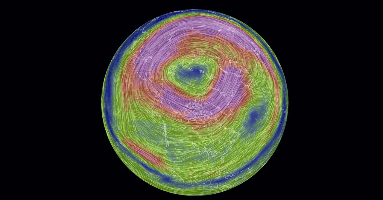
One of the main things we look at is the polar vortex and what we expect this to do over the coming days and weeks. First, let’s explain exactly what the polar vortex is.
The polar vortex is a large area of low pressure and cold air surrounding the Earth's North and South Poles. The term vortex refers to the counter-clockwise flow of air that helps keep the colder air close to the poles (left globe).
Often during winter in the northern hemisphere, the polar vortex will become less stable and expand, sending cold Arctic air southward over the United States with the jet stream (right globe).
The forecast for the polar vortex over the next few weeks is for it to remain extraordinarily strong and stable. This means the coldest air will be locked across the pole due to the strong, stable polar vortex.
If you were hoping for a cold outbreak with a bigger threat for snow, you would want the forecast for a weaker, wavier polar vortex.
The forecast for the polar vortex goes out through the first week of December. This should mean temperatures will average near or above normal at least through the next two to three weeks.
It is important to note that while the polar vortex may not send any extreme, long-lasting cold waves into the Ohio Valley and Great Lakes over the next two to three weeks, it does not mean we won’t get a few days of near or below average temperatures.
It also does not take into account days on which precipitation falls, which would also keep temperatures cooler.
The bigger question comes toward the second half of December. Typically, when we have a warmer than average November (around Thanksgiving), we typically get some sort of reversal in the weather pattern in about 30 days, which would put us around the Christmas holiday.
Obviously, it is too early to know if this tendency will work out this year, but if you are hoping for a white Christmas, then having a warm Thanksgiving is not necessarily bad news.
It is honestly too early to know, but if the pattern changes like years past during similar events, our winter may really get going right around or shortly after Christmas.
Stay tuned!