


A shower or t'storm is possible before 10pm, otherwise it will be mostly clear and rather muggy overnight with lows in the upper 60s to near 70.
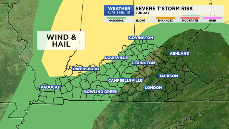
A cold front moves in Sunday bringing showers and t'storms into Western Kentucky in the morning. They will move east by the afternoon and evening. Any t'storm will be capable of producing gusty winds, hail and heavy rainfall. Thanks to the extra clouds and storms, it won't be as hot with highs in the low 80s.
The front will clear the region by Monday with sunshine returning and also less humidity and cooler temperatures. Highs will top out in the upper 70s in most spots to low 80s in far southeastern Kentucky where a few morning showers are also possible.
Tuesday looks dry with highs in the upper 70s.
The heat and humidity returns by Wednesday with scattered showers and t'storms. Highs will be back in the upper 80s and it stays hot with temperatures around 90 through Friday.
-Alan Auglis