


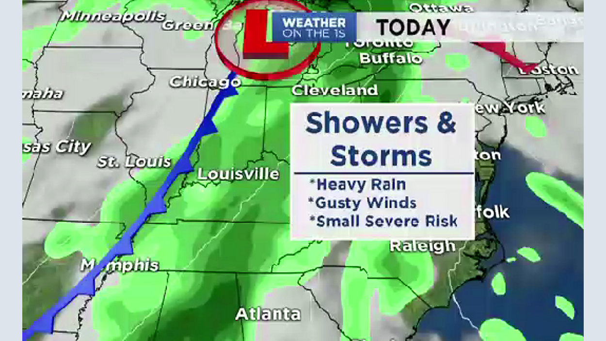
A cold front will move closer to the area today, and showers/storms can be expected to develop ahead of it. There will be a few light-moderate showers through the morning, but showers/storms become more likely this afternoon & evening. However, clouds have helped in keeping "storm fuel down"... so, the risk for severe storms has gone down since this morning. Now, there's a Marginal Risk (Level 1 out of 5)...damaging wind will be the primary threat. Yet, stay mindful of the weather throughout the day, and have multiple ways of getting severe weather alerts just in case. Best timing for storms will be from 2PM - 8PM, and some localized flooding will be possible if storms roll over the same areas. Highs will be a bit cooler than yesterday (upper 70s) due to clouds and rain cooled air.
The previously mentioned cold front will cross our area on Friday morning. There will be a few morning showers along the front, but the weather improves in its wake. Actually, afternoon sunshine is expected for Friday with highs hovering near 70°. The front will stall across the Gulf States late Friday, but some models are hinting at the front moving back north as a warm front sooner ahead of a developing low. So, we threw in a small chance for afternoon showers on Saturday...but the best chance for rain will be on Mother's Day (not the best news for those of you who have outdoor plans with mom). Soggy conditions can be expected as a low moves right over our state. It'll also be a little cool for Mother's Day with highs in the upper 60s.
The low moves out by the start of next week, but an upper level disturbance could keep clouds and a slim rain chance in the mix for Monday (stay tuned). Otherwise, improving weather by Midweek with clouds & sun and highs warming back up to near 80° by Wednesday.