


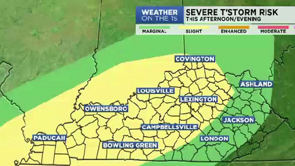
No changes in terms of it remaining unseasonably warm. Highs will reach the low-mid 80s today across most of the state (cooler for extreme W. KY where showers & storms are more likely throughout the day). Yet, the chance for storms will be higher today across the rest of the state as a very slow moving cold front gradually begins to journey east towards us. Conditions will be favorable for some storms that could reach severe limits...with damaging wind / hail being the primary threats. Yet, an isolated tornado is possible; so, have multiple ways of getting severe weather alerts. West of I-65, storms are possible before Noon. Along & East of I-65, the best timing for storms will be in the afternoon and early evening. So, unfortunately, Thurby has a rain-filled forecast. Don't forget the Ponchoes.
Friday, the slow moving cold front will finally start actually moving across the state. Ahead of it, more rain is expected. Along and West of I-65, the best chance for rain will before Noon (Including in Louisville). East of I-65, rain will remain possible through mid-afternoon (including for Lexington). Severe storms aren't expected, but rain is expected for the Kentucky Oaks. Again, Make sure to carry the rain-gear. The front will stall near the TN Border by Friday evening.
Derby Day, the stalled front will have an area of Low pressure develop and ride along it...spiking the rain chances back up to a likely chance. Severe weather isn't a big concern, but plan on soggy weather for the races on the big day. The rain-gear is needed. Highs for Derby Day will hover near 70°...definitely cooler than what we've experienced all week.
The entire system moves out by Sunday, and we'll get the sunshine back ( I wish we could reverse the forecast for Saturday and Sunday). It'll warm back into the 80s early next week ahead of our next storm system.