


August featured a little bit of everything in the Capital Region.
There weren't too many boring weather days in August - that's for sure. We came into the month riding a 33-day streak of 80+ degree weather.
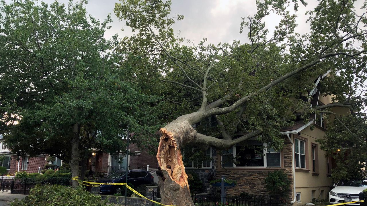
That came to end when Tropical Storm Isaias came to town on August 4th. Beyond breaking our streak, winds from Isaias produced downed trees and power outages around the region.
Under different circumstances, this may have brought some flooding issues, but since we were so dry, outside of some poor drainage flooding, no major flooding occurred.
Speaking of rainfall, we saw 6.07 inches in August, which is 2.61 inches above normal. If it weren't for Isaias we'd be below average for the month.

Temperature-wise we were pretty streaky. The end of the month ended cool and even had people remarking it felt fall-like, especially at night. The average monthly temperature at Albany was 68.8 degrees which is 1.3 degrees below average.
It is worth mentioning that the new temperature sensor at Albany International has had a cool bias the past month and a half and is currently being worked on.
Last, but certainly not least, we can't forget about the severe weather event that took place on August 29th. This was somewhat unexpected as the Storm Prediction Center Saturday morning only had the region in the marginal risk for isolated severe weather.
Alas, the region saw more sun than expected, which lead to higher instability. Two EF-1 tornadoes touched down producing highly localized damage.


The first week of September is a quiet one, with some nice weather expected for Labor Day weekend. Hopefully, we're treated to a few more days of summertime heat and humidity before fall officially begins on September 22nd.