


The National Oceanic and Atmospheric Administration has extended their El Niño advisory, forecasting greater than 95% odds that the conditions will continue through spring.
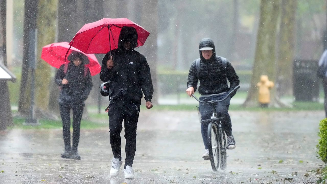
After a very active west coast winter this year, a strong El Niño could lead to even more rain and mountain snow this fall and in the winter and spring of 2024.
El Niño (and La Nina) is known as the El Niño-Southern Oscillation, or ENSO for short. This is a reoccurring weather pattern caused by temperature anomalies in the Equitorial Pacific Ocean and it has a very unique origin.
In an El Niño event, Pacific sea-surface temperatures are warmer than usual. Sometimes, the waters are much warmer than the seasonal norm, and that can affect the strength of an El Niño.
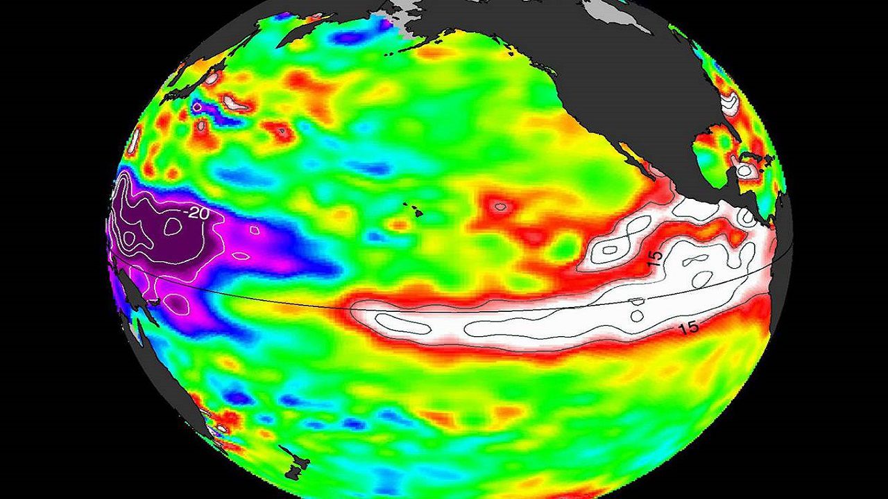
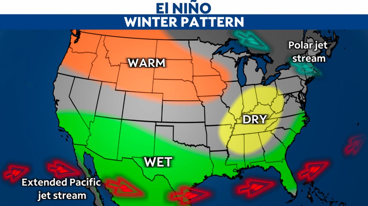
Sea-surface temperature anomalies, even the slightest change, have the ability to affect atmospheric circulation. Usually during an El Niño event, the jet stream track shifts farther south and is stronger during our rainy season months.
Hurricane Hilary made landfall in Southern California as a tropical storm back in August, and it packed a significant amount of tropical moisture that was fed by the warmer-than-average waters of the Pacific. Everything is connected, and some weather events are enhanced during the strong El Niño seasons.
A southerly and more amplified jet could help drive a higher amount of storms into the west coast, and another abnormally wet season could mean even more urban and rural flooding and a deep snow pack for our area mountains.
Not that the same situation will happen during our upcoming winter season, but the odds of it happening are higher based on the current ESNO pattern. El Niño events have been tracked for years, but each event plays out differently. The usual impacts, even during a strong ENSO season, is not guaranteed.
The usual impacts of more active season are not guaranteed as each year plays out differently.
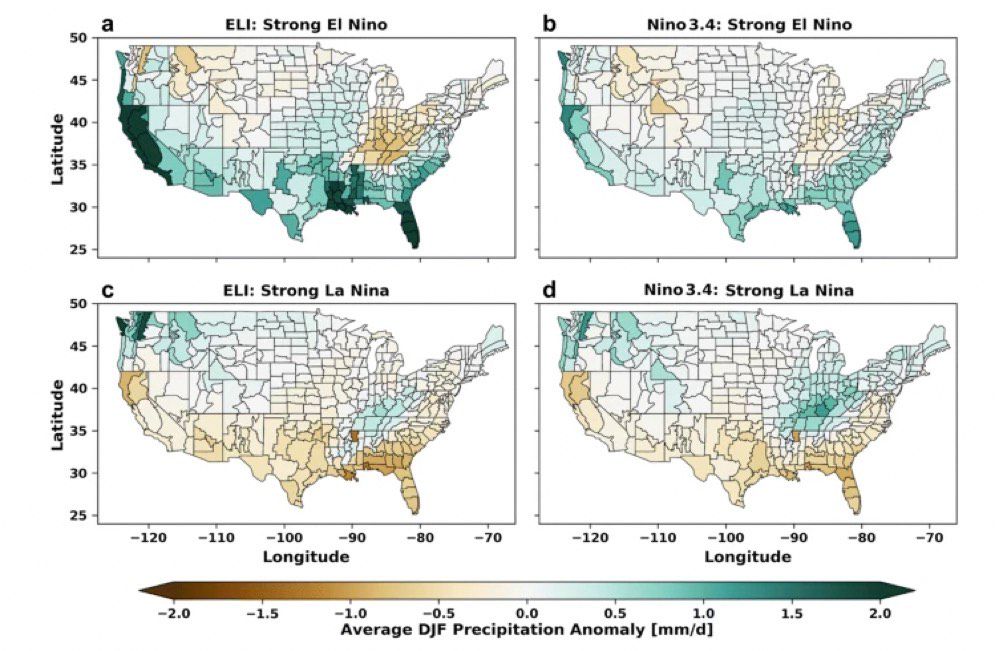
However, the ENSO Longitude Index, or ‘ELI’, for short, shows that the odds of very wet winters are increased during stronger and eastern-based El Niño events compared to strong La Nina events.
Our team of meteorologists dives deep into the science of weather and breaks down timely weather data and information. To view more weather and climate stories, check out our weather blogs section.