


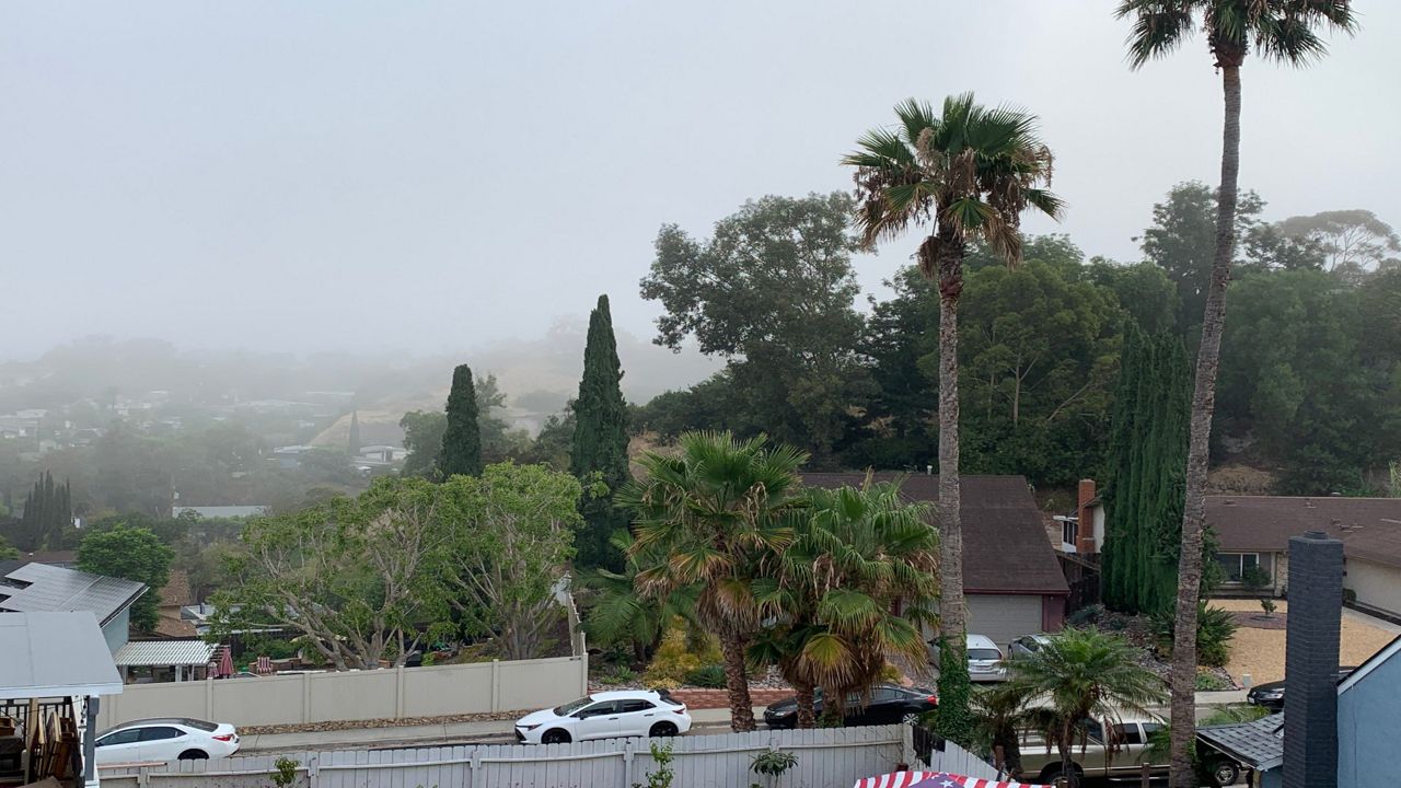
The extra sunshine this weekend has been a welcomed sight for many in SoCal who've been under the clouds for much of May.
If you thought we saw many more cloudy days than sunny ones, you're absolutely right.
Marine layer clouds were slow to clear or hardly cleared at all in May for many cities west of the mountains.
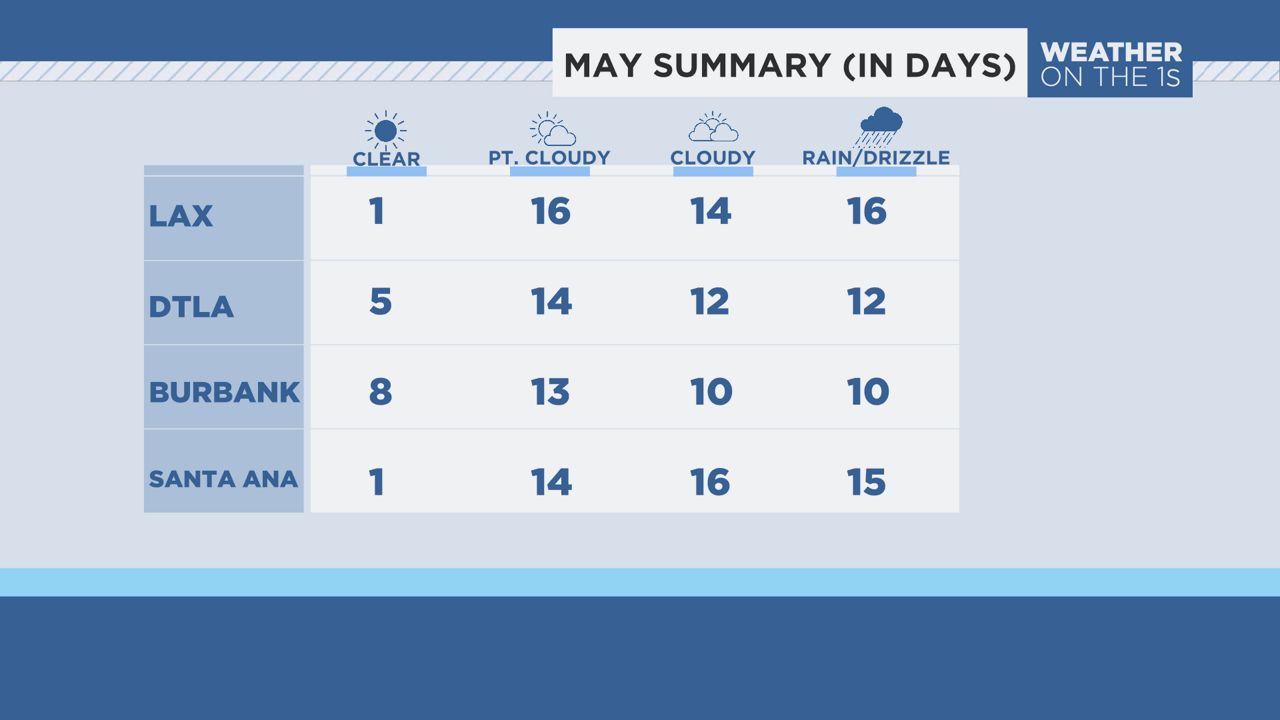
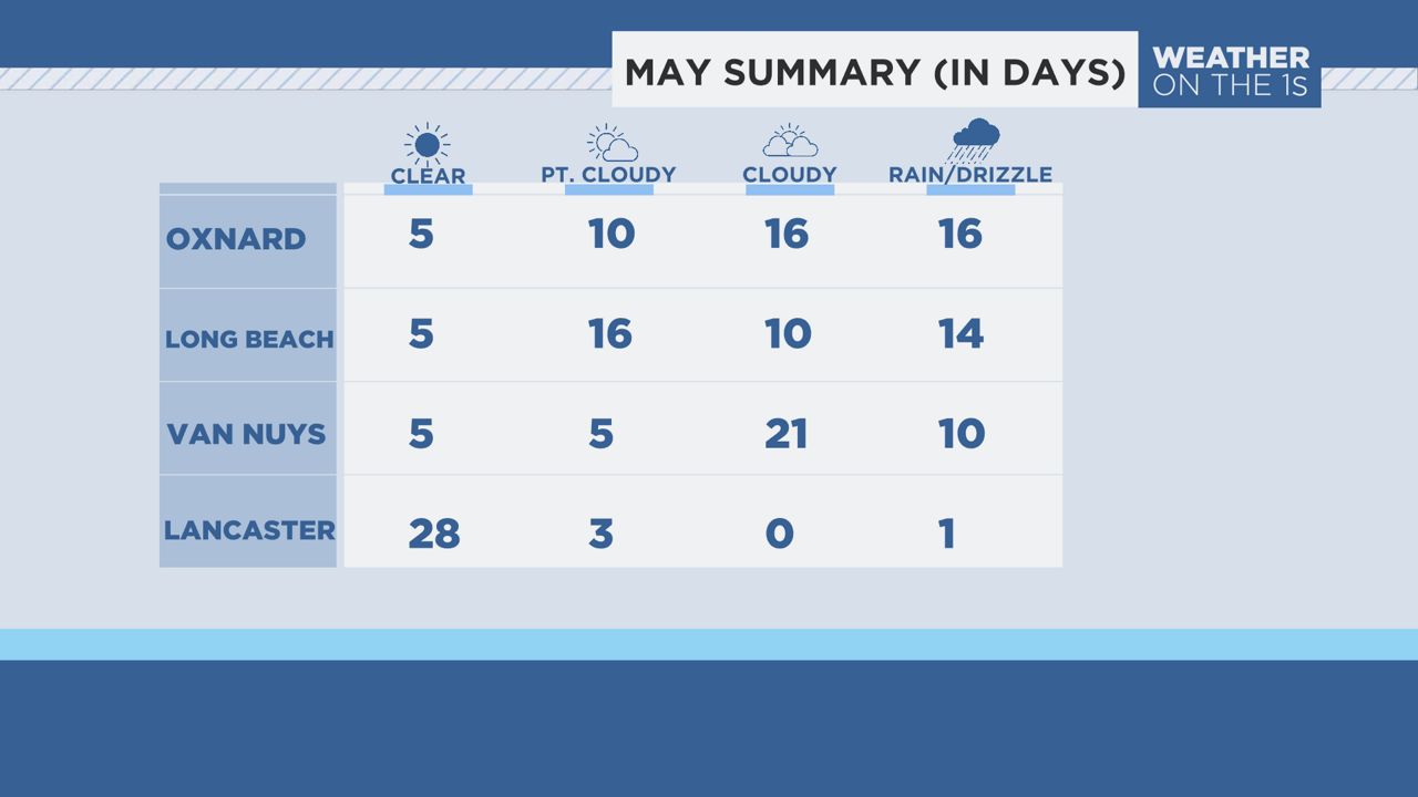
Below, I summarize how many sunny, partly cloudy and cloudy days we saw throughout SoCal.

This cloudy weather pattern commonly occurs in late spring and early summer, along the west coast of continents because of the cooler water that runs along their shores.
California is influenced by the cold California Current coming from the Gulf of Alaska.
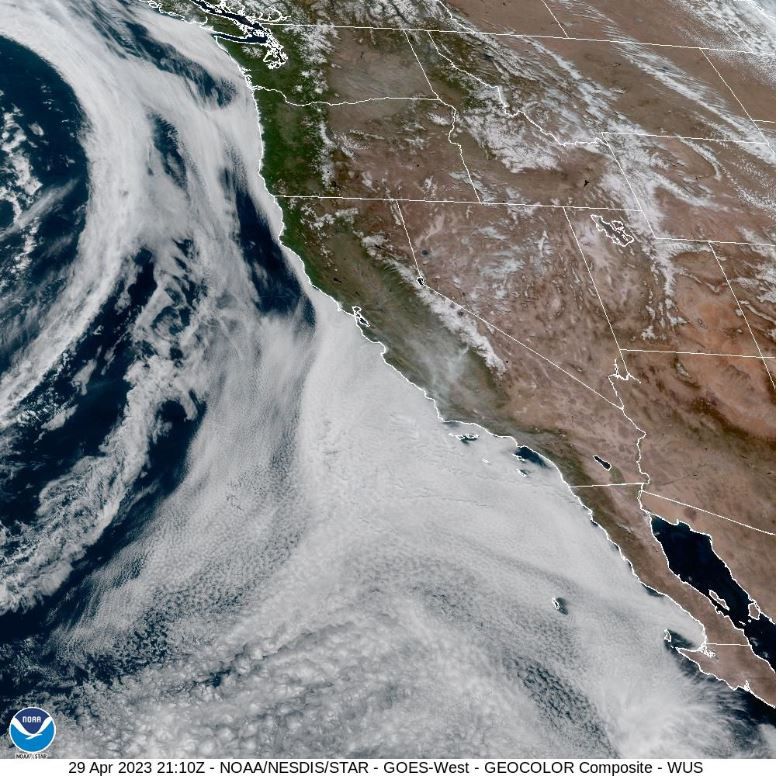
A shallow layer of air, also known as the marine layer, forms when warmer, moist air passes over a cold body of water and then cools and condenses into clouds that we see forming offshore each afternoon.
In the image below, you can see the marine layer cloud deck that extends from the coast of Baja California to the British Columbia coast.
In late spring and early summer, the land starts to heat up at a much quicker rate than the ocean.
The unequal heating rates of land and water creates the wind which carries those clouds over land, sometimes as far inland as 80 miles or more!
A deeper marine layer usually results in extensive cloud coverage extending well inland, often to the foothills of the mountains.
The depth of the marine layer and how long marine layer clouds stick around during the day and during the months of May and June depend upon the large-scale weather patterns that pass high overhead.
If low pressure systems are present as we saw in May, that creates the westerly flow that drives the clouds onshore and sometimes farther inland than just the coast.
Low pressure systems also thicken the clouds, leading to drizzle and sometimes light rain.
High pressure systems, on the other hand, bring sinking air over the region which can squash marine layer clouds down to the earth's surface.
If the strength of the sinking air is very strong, clouds can stay confined to the beaches while the sun shines over the basins and valleys.
Our team of meteorologists dives deep into the science of weather and breaks down timely weather data and information. To view more weather and climate stories, check out our weather blogs section.