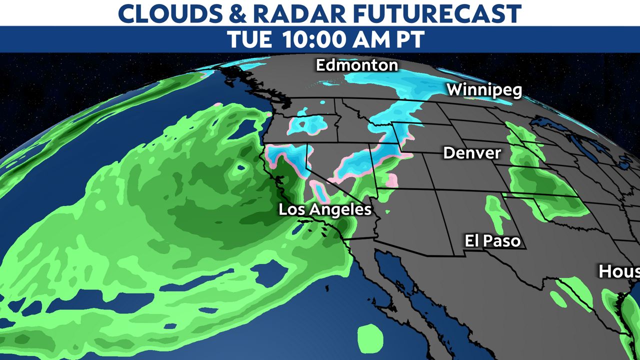
Southern California's first widespread rain event of the season has arrived. On Tuesday, the moderate to heavy rain bands will move from the northwest to the southeast throughout the day.
Unlike last week's storm that brought very little rain, this one will tap into deep Pacific moisture, which will bring widespread rain to all of Southern California. The exact timing and locations of the heaviest rain still have some variability, though.
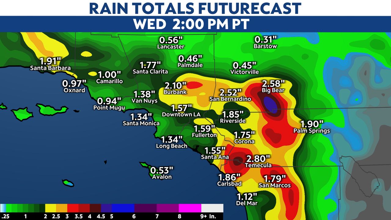
Rain totals on the west side of the mountains will range between 1 to 2 inches. The west and southwest facing mountain slopes are looking at 2 to 5 inches of liquid precipitation, with the deserts receiving anywhere between a half inch to an inch and a half.
Monday night into Tuesday morning is when the cold air will arrive behind the initial cold front. North/northwesterly winds will strengthen, ushering in much cooler air Tuesday night.
By Tuesday evening, snow levels will drop to near 4,000 feet. This means we will see a dusting of a couple of inches of snow along I-5 through the Grapevine. Snow levels could drop to 3,800 feet by early Wednesday morning, which means the I-15 through the Cajon Pass could also see a few flurries.
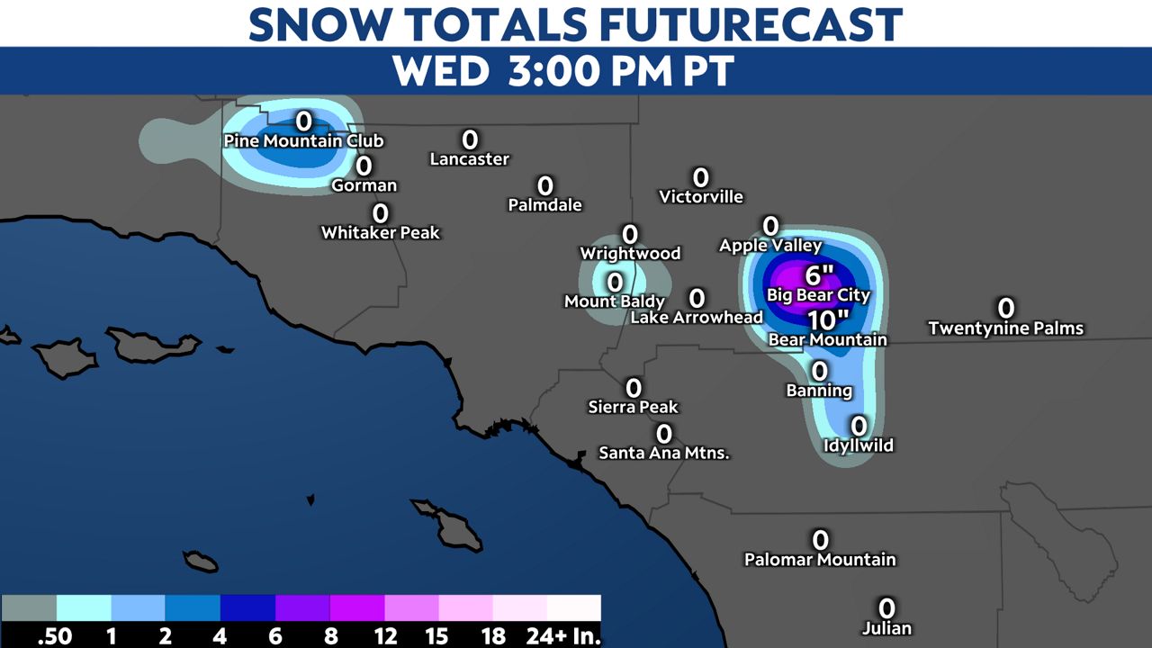
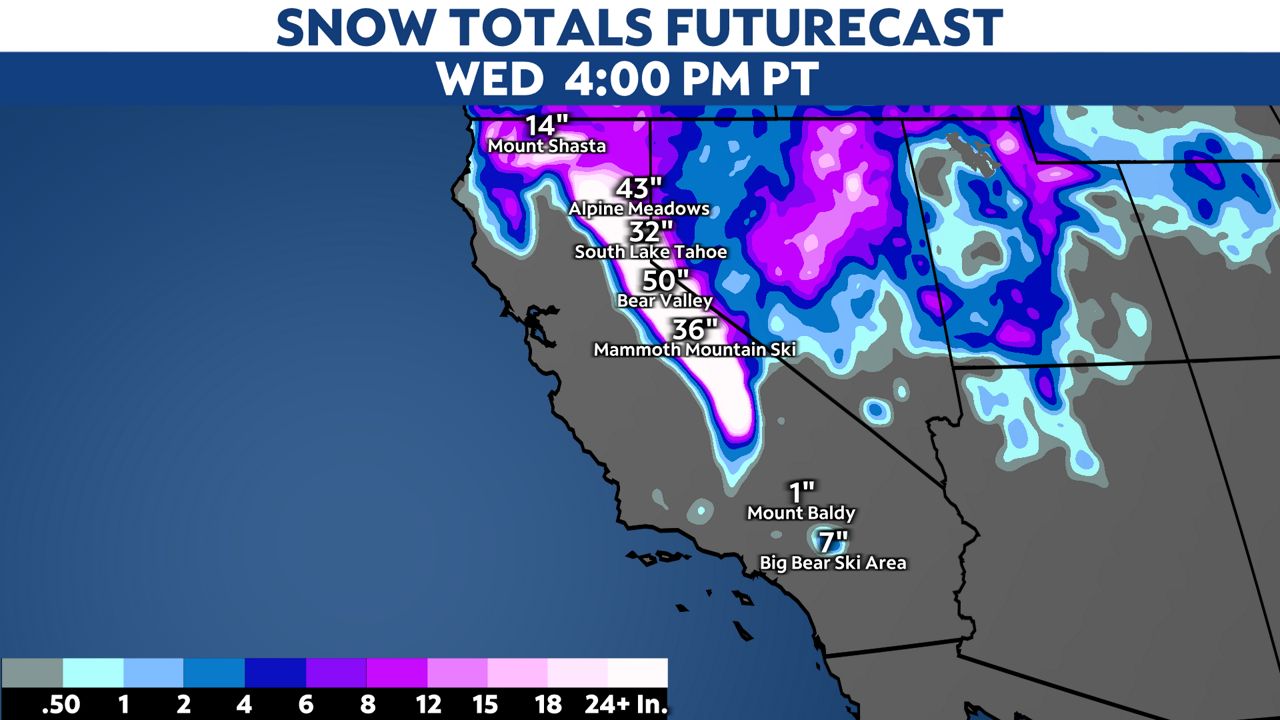
Snow totals around Big Bear Lake will be near 10 inches, with up to 20 inches at the higher elevations. This will also be a great snow maker for the central Sierra Nevada, where 3 to 5 feet of snow is possible from Mammoth to Lake Tahoe.
Besides the light to moderate steady rain, some convective showers and isolated thunderstorms are possible Tuesday evening through Wednesday.
Winds will pick up Tuesday afternoon and evening. Mountain and high desert locations will feel gusts between 50 and 60 mph during this time frame. Expect 30 to 40 mph gusts along the coast Tuesday afternoon. For the basins and valleys, gusts will be in the 20 to 30 mph range Tuesday afternoon and evening.
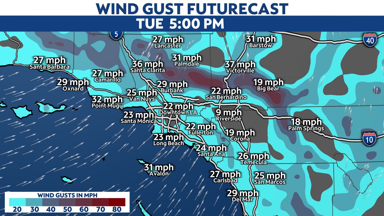
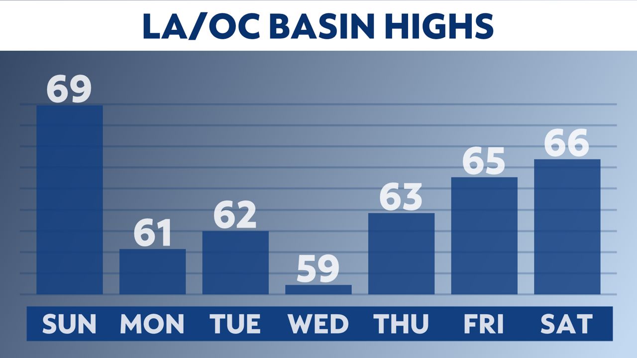
Winds will switch to north/northwesterly overnight Tuesday into Wednesday. On Tuesday, highs will be in the 50s for most of SoCal.
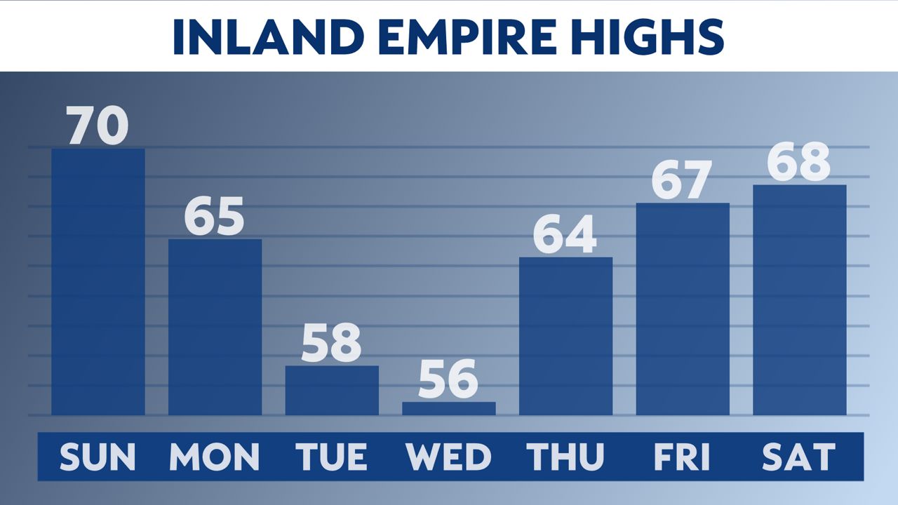
The storm will push east on Wednesday afternoon, and a ridge of high pressure will replace the trough. Temperatures will still be cool on Wednesday and Thursday, but it will be mostly sunny and dry. Highs in the 60s will continue into next weekend.