


Droughts, earthquakes and wildfires are natural disasters that occur in California. But the Golden State may have to prepare for another climatic event that hasn’t occurred since the 19th century.
A new study from “Science Advances” says climate change is increasing the chances of a California megaflood.
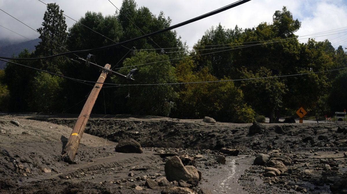
A megaflood is a catastrophic flooding event. It has the potential to inundate neighborhoods and cities with high waters for miles and miles.
It’s similar to the 1-in-1,000 rainfall events that happened in Kentucky and St. Louis, Mo. this year.
Climate scientists from the University of California Los Angeles used information from the U.S. Geological Survey's ARkStorm model to create a hypothetical forecast simulation.
The scientists designed ARkStorm to mimic a series of atmospheric rivers that pummeled California from Dec. 1861 to Jan. 1862, bringing a year’s worth of rain in a single month.
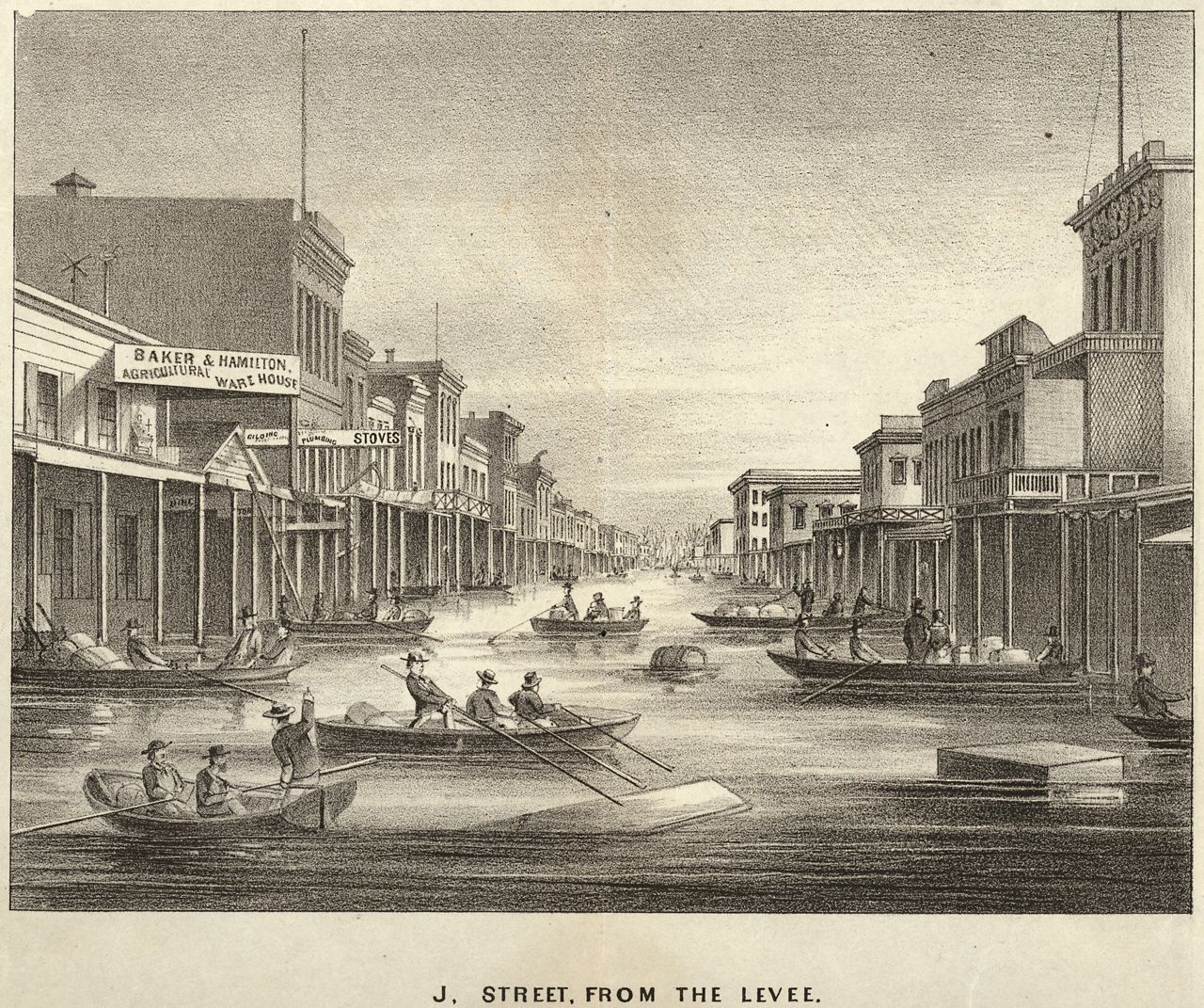
A direct quote from the study explains “weeks-long sequences of winter storms produced widespread catastrophic flooding across virtually all of California’s lowlands—transforming the interior Sacramento and San Joaquin Valleys into a temporary but vast inland sea nearly 300 miles.”
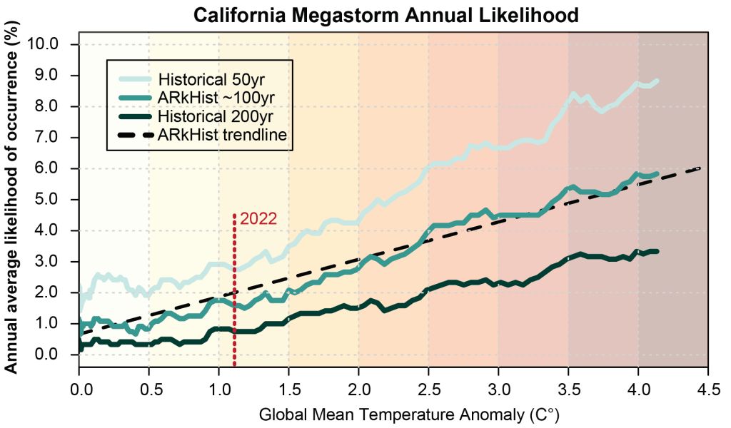
Researchers say climate change is doubling our chance for another event like this in the next 40 years.
Let’s talk about ARkStorm 2.0. This scenario forecasts more extreme rain events and when California could get hit with its next megaflood.
In ARkStorm 2.0, meteorologists account for climate change, which was not a factor in the first iteration.
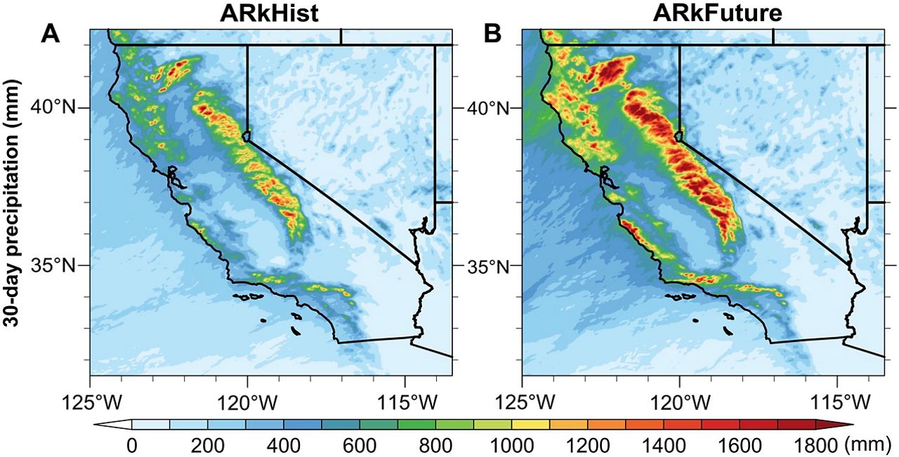
Climate scientist Dr. Daniel Swain and his co-author Xingying Huang developed two megastorm scenarios called ARkHist and ARkFuture. ARkHist is based on historical climate data while ARkFuture considers climate change.
Dr. Swain talked about the study in a Twitter Space on Aug. 15, 2022.
He says ARkStorm 2.0 shows the “plausible worst-case scenario extreme storm sequences might look like in the future.”
The storm they hypothesized could bring waves of atmospheric rivers for one month. That extreme weather event could bring 15 to 35 inches of rain to the state, especially up in the Sierra Nevada, which holds California’s snowpack.
The paper highlights “that runoff in the future extreme storm scenario is 200-to-400% greater than historical values in the Sierra Nevada because of increased precipitation rates and decreased snow fraction.”
This means increased runoff could lead to catastrophic flooding, landslides and debris flows, especially in California’s burn scars areas.
We have also talked to Spectrum News 1 meteorologist Autumn Robertson who’s based out of Los Angeles about this scenario.
Talking about climate, she says warmer oceans will lead to increased moisture in the atmosphere. Meaning higher rain rates will lead to an increase in mountain runoff, leading to dangerous mudslides and flooding in higher elevations and that water will rush down to the foothills.
“Even though we’re seeing drier and hotter days throughout the years, storms that do form throughout the year are capable of producing very heavy downpours and can create more hazardous/dangerous situations.
"We need the rain to recharge our parched grounds and dry reservoirs, but dry grounds can only take a certain amount of rain in a period of time, and this type of rain may be too intense for our topography to keep up with these heavily saturated atmospheric rivers.”
In a press release from UCLA about the study, if a megaflood happened today, parts of Sacramento, Stockton, Fresno and Los Angeles would become submerged under water.
The study also makes a correlation between the frequency of megastorms and a strong and moderate El Niño, which raises the risk of rain on snow events. We could a see a trend of these projected extreme rainfall events through 2100.
“Compounding the increase in extreme precipitation associated with AR (atmospheric rivers) events are warming temperatures themselves raise the mean elevation of snow accumulation in mountainous areas, increases the instantaneous runoff rates as the rain falls at the expense of snow.”
Robertson agrees.
"If you go back just a few decades, El Niño has brought more frequent than normal West Coast landfalling atmospheric rivers, whereas in a La Niña, SoCal tends to be drier, and we've seen less frequent atmoriver occurrences. But it only takes one big storm during any year to make a historical impact."
Plus, this megastorm forecast could also affect Oregon, Washington and western Nevada as well.
Dr. Swain wants to use his research to prepare California for the potential of megafloods.
“In all honesty…. this will be a disruptive, damaging and destructive event no matter what, but there is still a lot we can do to.”
The next phase of ARkStorm 2.0 is to get are more accurate picture of the impacts and how to mitigate them.
UCLA’s team will work with state and federal agencies like the USGS, the California Department of Water Resources and the Oak Ridge National Lab in Tennessee to forecast impacts of a megaflood at a hyperlocal level.
“We really do want to have a spatially explicit map of who gets flooded and how deeply and for how long it covers every square inch of California.”
The team is also collaborating with emergency management agencies like the California Office of Emergency and the Federal Emergency Management Agency to head off some of the very worst consequences.
Dr. Swain says megafloods could cost the state $1 trillion in losses. So that’s why it’s important to take action. For them, it’s all about identifying weaknesses in our disaster response and improving them in various situations.
Our team of meteorologists dives deep into the science of weather and breaks down timely weather data and information. To view more weather and climate stories, check out our weather blogs section.