


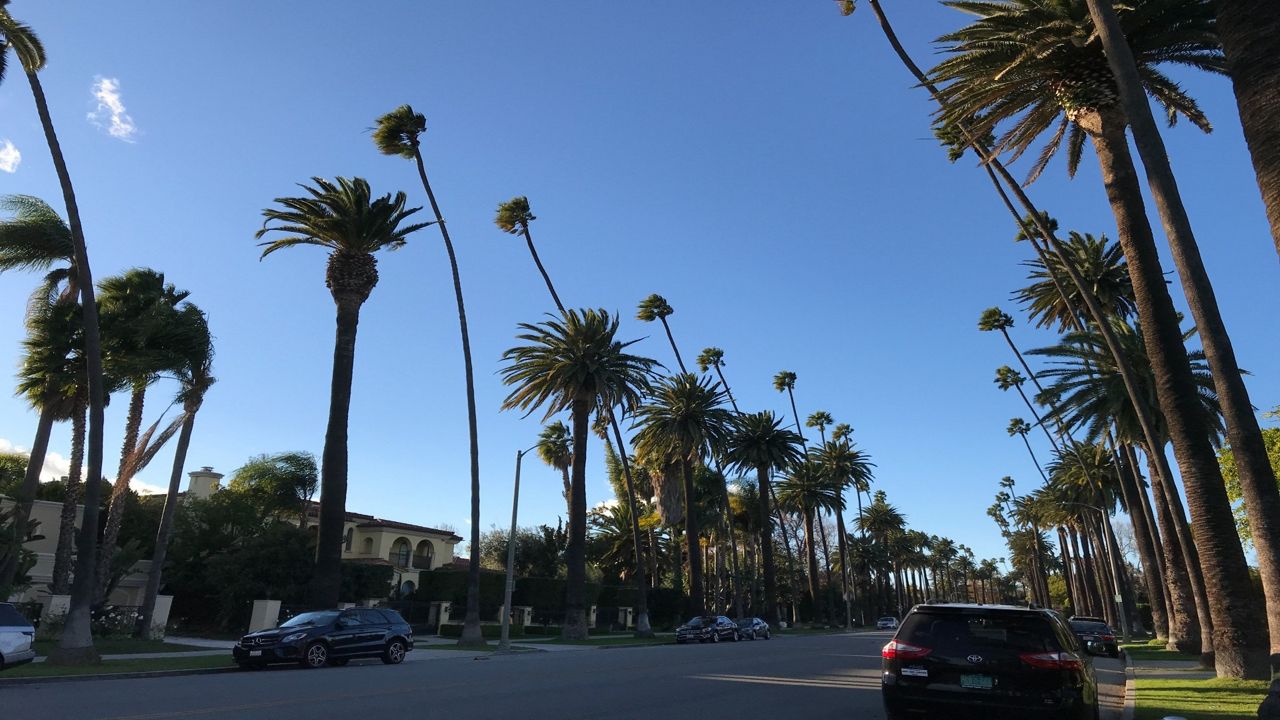
Santa Ana winds: We know them all too well here in Southern California, considering they're our major weather feature in this region.
During these wind events, the National Weather Service issues advisories, watches and warnings across the Southland.
Let’s revisit what each of these weather alerts mean.
Wind Advisory:
Wind Advisories are issued for sustained winds 31 to 39 mph lasting for more than one hour and/or wind gusts 46 to 57 mph for any duration. It means strong winds are occurring but are less serious and not strong enough to warrant a High Wind Warning. Outdoor objects should be secured and everyone should be cautious while driving.
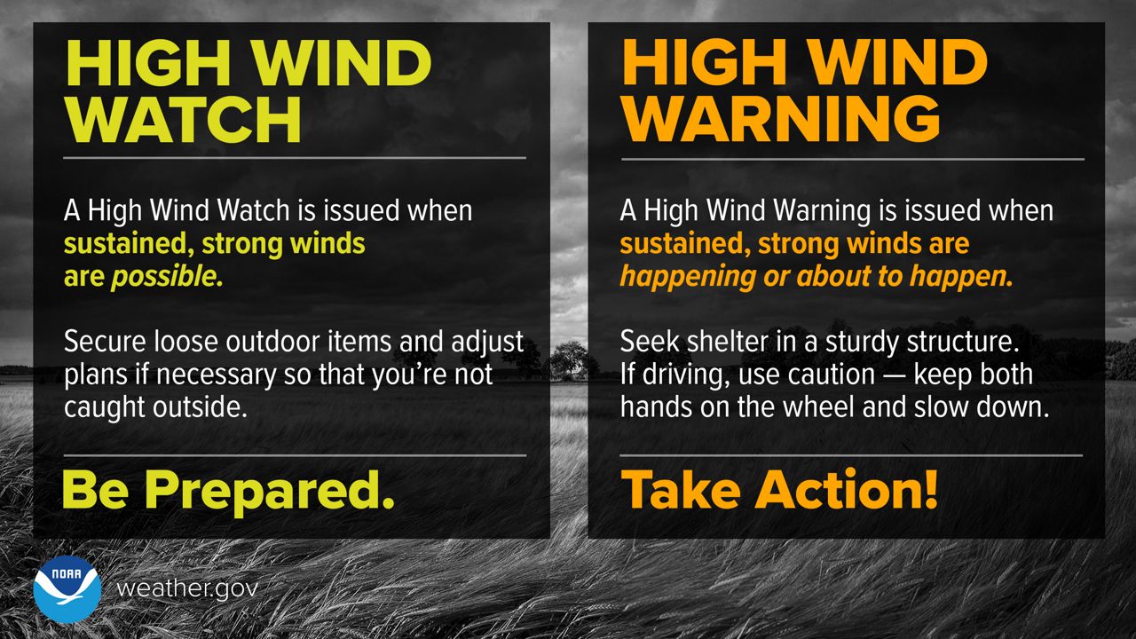
High Wind Watch:
High Wind Watches are issued if sustained, strong winds are possible within 24 to 48 hours. Usually, this is issued ahead of time to allow time for preparation. Secure loose outdoor items and adjust plans as necessary so you're not caught off guard outside.
High Wind Warning:
High Wind Watches turn into High Wind Warnings, which are issued for sustained winds 40 mph or greater lasting more than one hour and/or wind gusts 58 mph or greater for any duration. It means these winds are ongoing and very likely pose a threat to life or property. Stay indoors if possible, and if you are driving, keep both hands on the wheel and slow down.
Fire Weather Watch:
Fire Weather Watches are issued if rapid initiation and spread of wildfires are possible within 12 to 24 hours, along with sustained winds of at least 20 mph for at least two hours, minimum relative humidities of 30 percent or less and 10-hour fuel moistures of 10 percent or less for at least two days.
Red Flag Warning:
Fire Weather Watches turn into Red Flag Warnings, which are issued if rapid initiation and spread of wildfires are ongoing. Other criteria include sustained winds of at least at 20 mph for at least two hours, minimum relative humidities of 30 percent or less and 10-hour fuel moistures of 10-percent or less for at least two days.
Note that Fire Weather Watches and Red Flag Warnings have not been issued recently because of the significant rainfall in December, but conditions continue to dry out with each Santa Ana Wind event. Fuel moisture is becoming drier across the Southern California landscape, and we may start to see a bigger threat for wildfires soon if this dry and windy pattern persists.
Ahead of these strong wind events, it’s important to prepare so you do not get caught off-guard, especially if a wildfire starts and forces you from your home.
Here are several recommended tips to do before the wind picks up:
- Bring what you can indoors, or store items in a shed or garage.
- Tie down anything outdoors that could blow away, fly through a window or hit a car. This includes garbage cans, patio furniture, pool toys and any other outdoor decor in your front or back yards.
- Cover patio furniture or stack it, place it in a corner or near a wall and weigh it down with something, which will prevent it from being exposed to the elements. If you have an umbrella, make sure there is enough weight holding down the base and also close and secure the canopy.
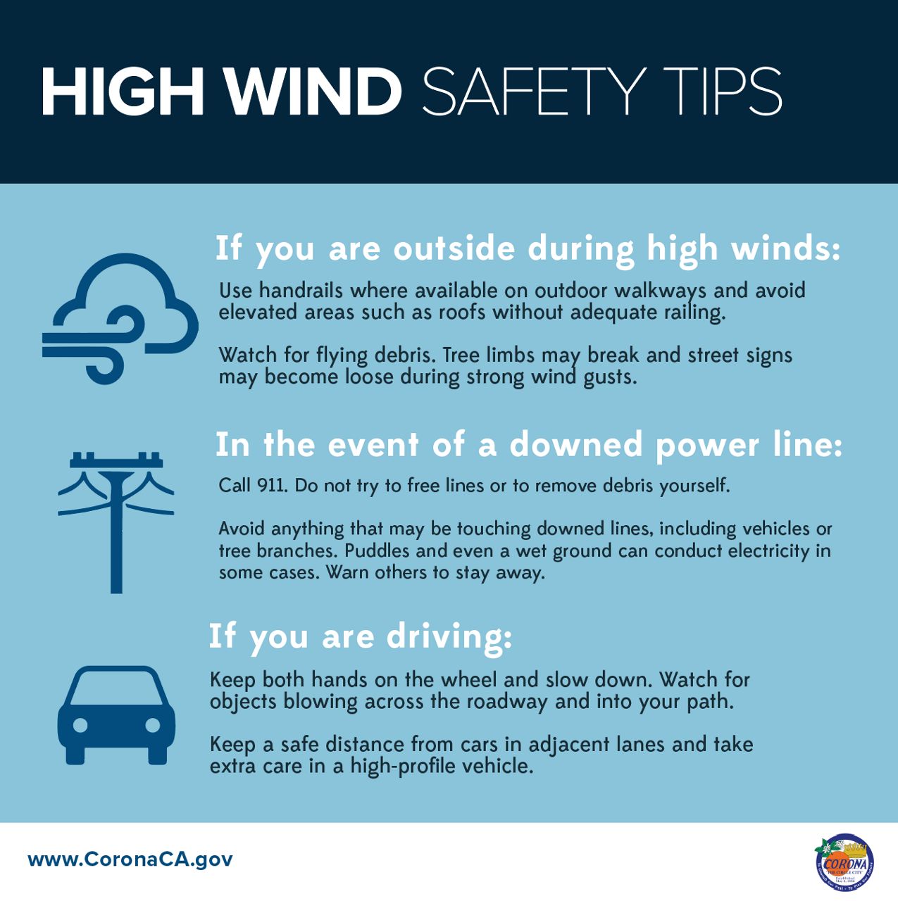
- Stay clear of trees and power lines prior to wind events and do not to park your car under them.
- Make sure the trees on your property are trimmed up and away from your house and any power lines.
- Secure loose shutters and gutters and make sure they are clean of any debris.
- If you live in a mobile home in a strong wind region like the high desert or the base of the Cajon Pass and a High Wind Watch/Warning is issued, have a plan to take shelter in a sturdy building if need be.
- Have your emergency kits ready, with enough food and water for each person in the home. This is in case the power goes out for an extended period of time. Charge batteries for flashlights, cell phones and any other necessary items.
During Santa Ana wind events, it’s important that everyone is aware of the situation, the timing and where the strongest activity will take place. The biggest concern is usually the spread of wildfires, but that’s not the only thing to watch during these events.
Even if you live in a normally wind-sheltered location like the LA coast and basin, you may be doing some traveling and will likely come across the windy conditions on your drive.
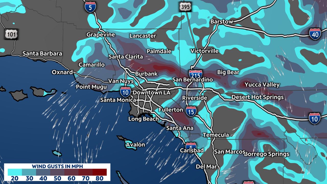
In these offshore wind events, some areas are targeted more than others. The strongest winds are usually through the passes (Banning Pass, Cajon Pass, Tejon Pass known as the Grapevine, and Soledad Pass. We also see strong winds across the LA and Ventura County mountains, valleys, through portions of the Inland Empire out through inland Orange County and the Santa Ana Mountains.
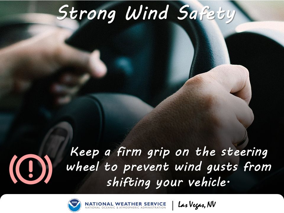
Use caution when driving, especially traveling in a high profile vehicle such as a bus, semi-truck, car-towing trailer or RV. It's these type of vehicles that are more prone to overturn thanks to strong crosswinds. If you are driving near one of these types of vehicles, make sure to reduce speed and keep your distance.
More often than not, we see downed trees and power lines during the strongest wind events, which could lead to widespread power outages across portions of Southern California. This is also why it’s very important to have your emergency kit ready with non-perishable food, in case you are without electricity for an extended period of time.
As we’ve seen previously, these strong wind events can cause a lot of damage!
Scenes from Pomona. Last night’s #SantaAnaWinds toppled massive trees that sliced through fences, roads and this house. Neighbors say no one was hurt. Rainfall in December was the third highest on record for Southern California, which could have contributed to the uprooted trees. pic.twitter.com/zCEYwdaVNA
— Jessica Langlois (@langloislane) January 23, 2022
When Red Flag Warnings are issued and there is extreme fire danger, it’s common for utility companies to disconnect power in wind-prone locations to prevent sparking wildfires.
Usually, these Santa Ana winds actually help mix out a lot of the pollution and poor air by pushing that all out over the coastal waters. Alternatively, they can also cause a lot of blowing sand and dust, which can create health hazards for those who are sensitive. This can also lead to low visibility at times on the roadways, which is usually the case across the deserts.
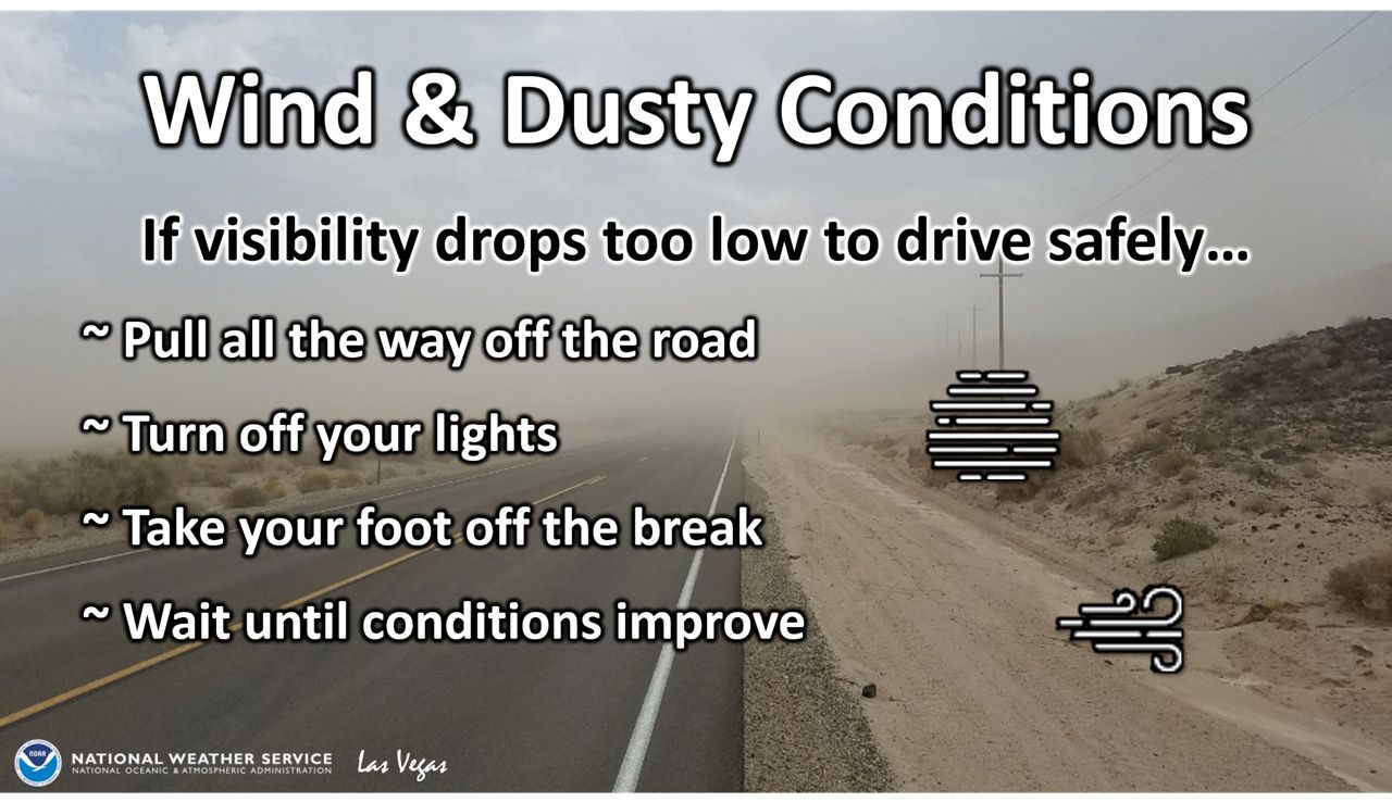
In general, it’s best to remain indoors on these extremely windy days with doors and windows closed. It’s not fun being outdoors on days like this anyway, but if you have to get out and walk a pet, make sure to stay clear of trees and hazards above. Watch for loose items and flying debris that could come at you.
Sometimes these gusty winds can even cause flight delays due to turbulence issues posing aviation hazards. They also tend to make for choppy waters and surf conditions, where boating and swimming are not recommended.
Make sure to keep all of these tips in mind during our next several Santa Ana wind events.