Cut-off lows usually form when an area of cold air sags south along the jet stream and eventually gets pinched off entirely from the jet stream.
The jet stream forms along the boundary, between the cold polar air and warmer mid-latitude air. Think of it as a fast-moving river of air about 30,000 feet above sea level.
Airplanes try to ride the jet stream to move faster and use less fuel when going long distances from west to east.
When the area of low pressure gets pinched off or "cut off" from the jet stream, it no longer has a ride from west to east on the jet stream. Also, it loses its steering mechanism. So, it meanders about without moving very far or fast.
Cut-off lows can bring the same weather to an area for several days. The current cut-off low off the west coast of northern Mexico has been bringing cloudy weather to southern California for several days.
If the low pressure system has a lot of moisture, it can bring several days of rain to an area. When this happens, flooding becomes a big concern. This happens more in the southern or southeastern U.S. compared to the western U.S.
Cut-off lows can happen in the northern hemisphere or southern hemisphere. In the northern hemisphere, they occur south of the jet stream. In the southern hemisphere, they occur on the north side of the jet stream.
First, an area of low pressure forms along the jet stream. Eventually, the low gets pinched off from the jet stream, and finally, it drifts thousands of miles from the jet stream.
See the progression of the images below.
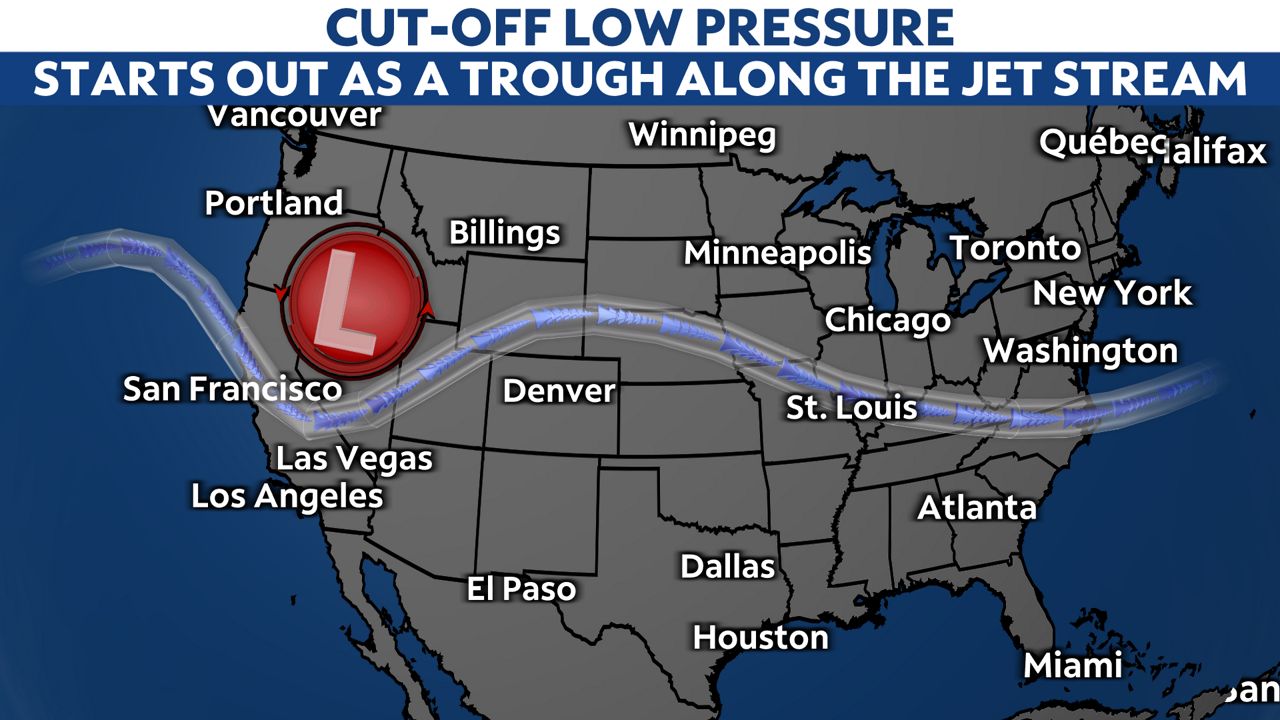
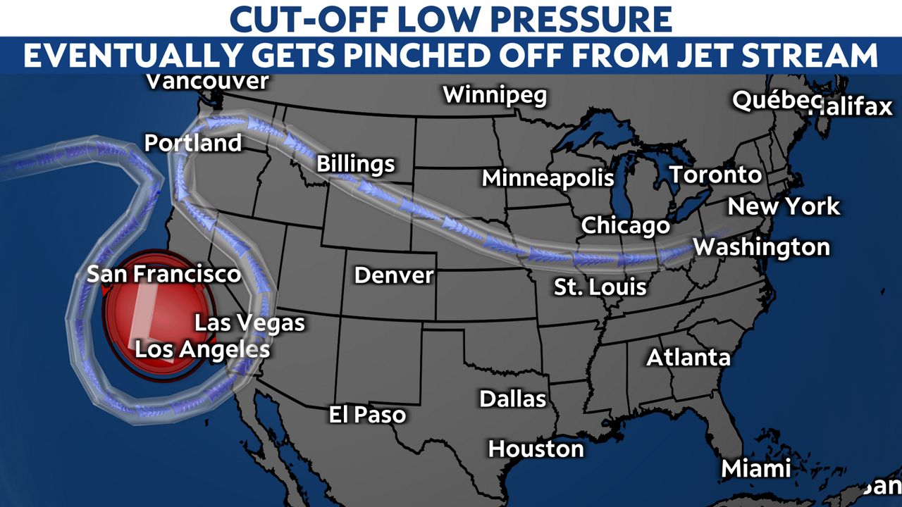
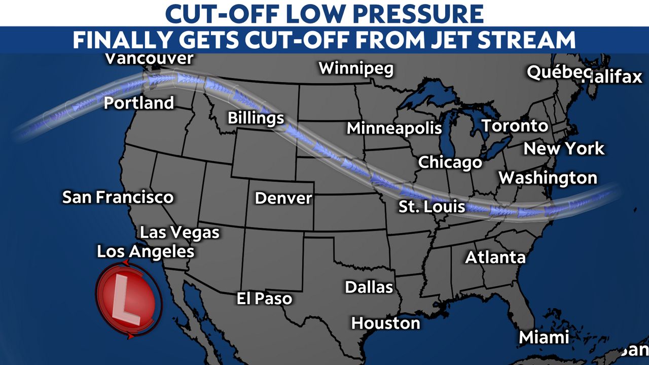
A cut-off low has dominated the weather in Southern California for more than a week now. The center of this low pressure system has meandered around about a thousand miles southwest of Los Angeles.
It first brought rain chances to SoCal last Monday and then on-and-off chances for rain for most of the week. Right now, the forecast has it drifting back north over the weekend and over SoCal around next Monday.
Computer models have a tough time forecasting cut-off lows because there is no steering mechanism or moving mechanism.
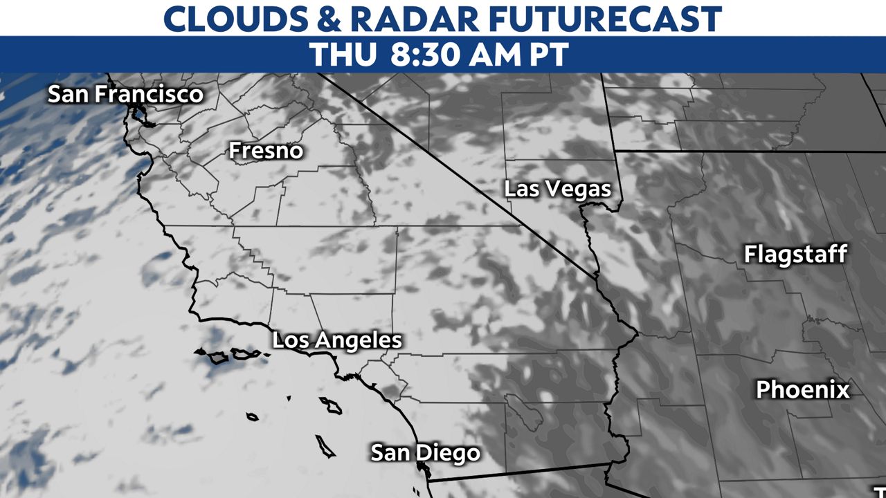
Below is the short-range high-resolution IBM-Graf forecast model predicting clouds and rain around SoCal for Thursday at 8:30 a.m. Notice all the rain moving onshore around Los Angeles.
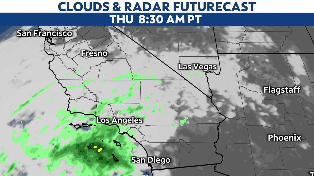
Below is another high-resolution short-range forecast model's rendition, the High Resolution Rapid Refresh model, at the same time...absolutely dry.
The cut-off low ends when it drifts back north and gets carried away by the jet stream, or sometimes, they disintegrate.
Since forecast models have a difficult time forecasting the timing of weather around a cut-off low, the saying "Cut-off lows, weatherman's woes" has become a novelty among weather forecasters.


