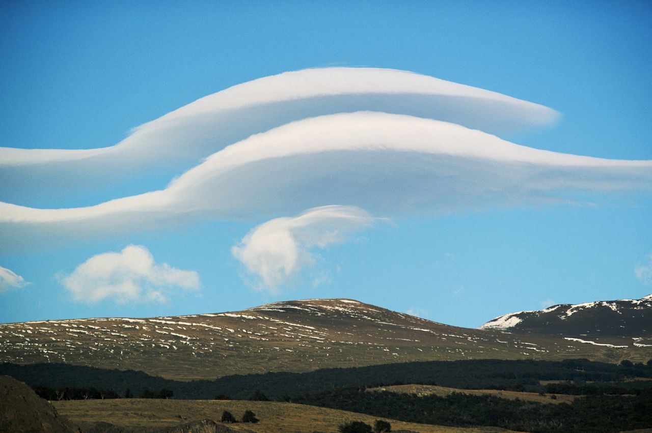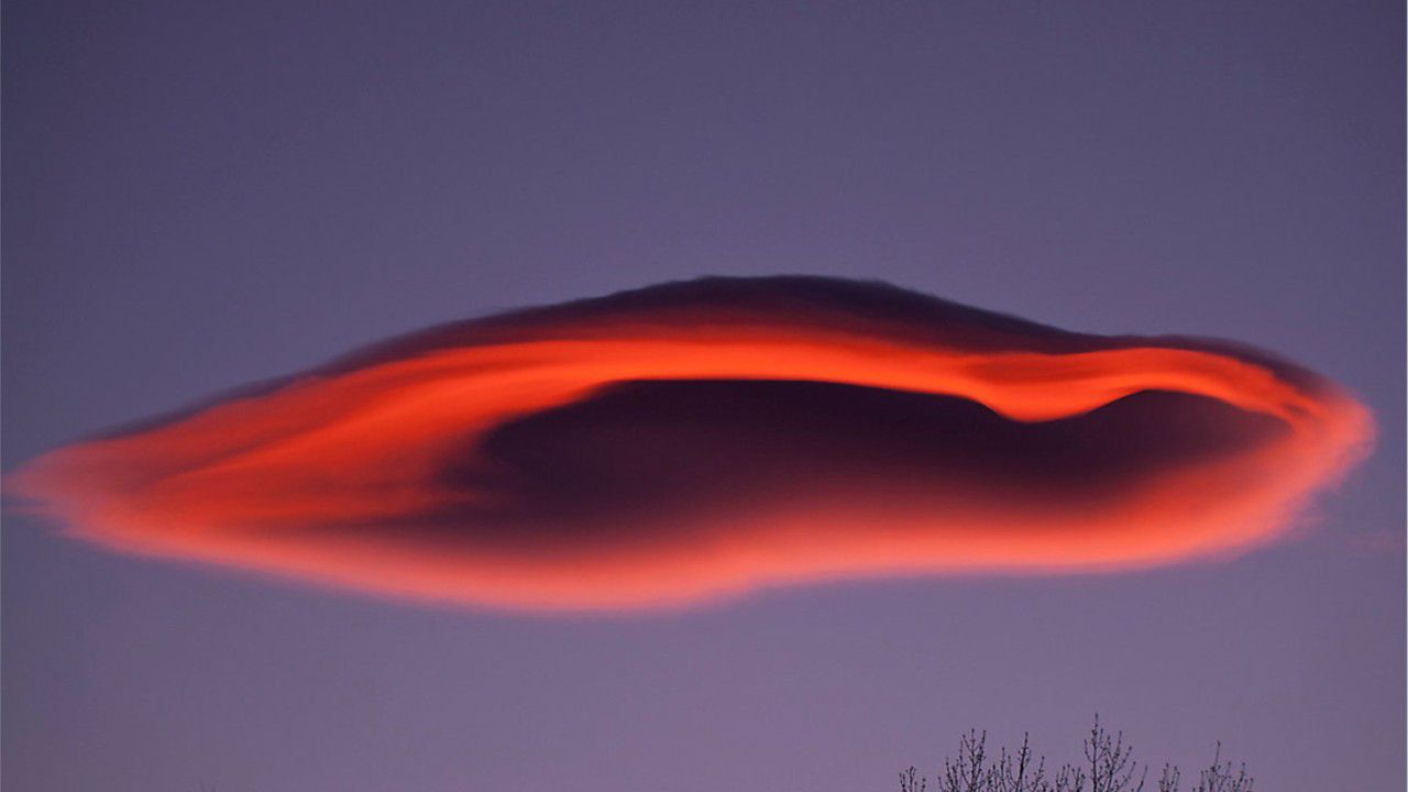
If you looked into the sky last week in SoCal, you may have noticed a fascinating object over the mountains. Was it UFO or just a cool-looking cloud?
Well, in this case, it was definitely a cloud! However, this was a pretty cool-looking cloud that we don't get to see too often in SoCal. It was interesting and rare enough to be plastered all over social media. Below are two of the better images from Twitter.
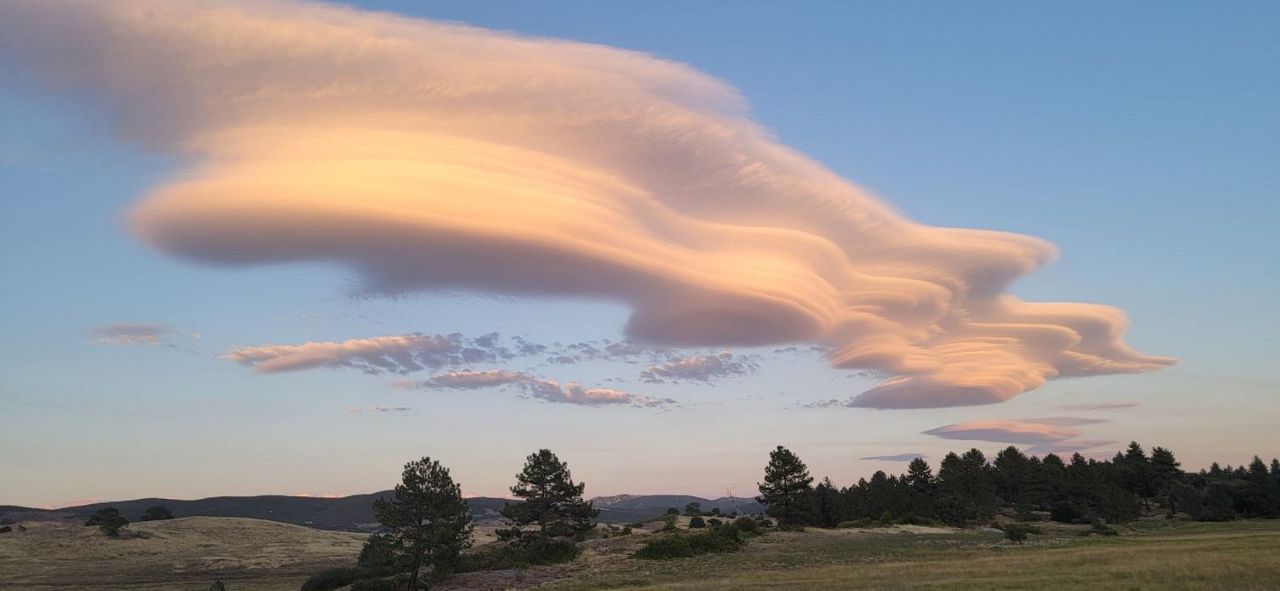
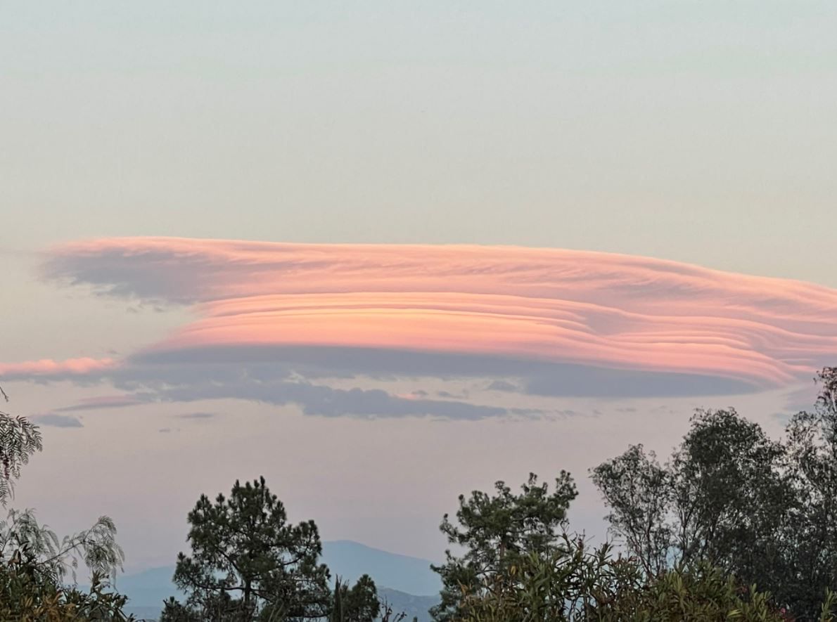
Lenticular clouds form most often in winter, but it is not uncommon to see them at other times of the year. These images were taken in August.
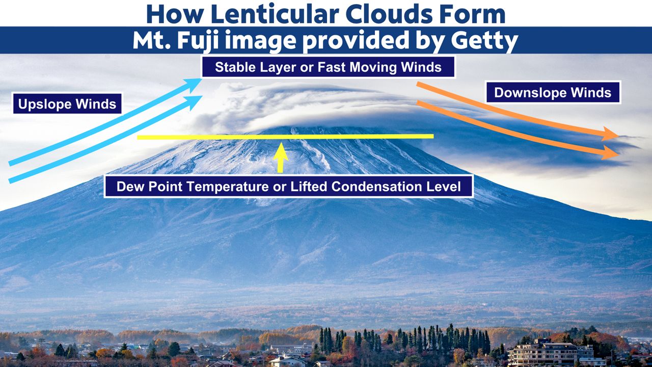
Lenticular clouds may form when wind runs perpendicular to a mountain or mountain chain. It could be a hill or even a tall building, too. In the graphic above, winds are forced up the windward (left, in this photo) side of Mt. Fuji as they run into the mountain.
As the air rises, it cools. This is called expansional cooling. When the air cools down to the dew point temperature, it can no longer hold the water vapor that it once could when it was warmer, and cloud droplets form.
The altitude where this happens is called the lifted condensation level. It is the level where clouds form.
Clouds continue to form as the air rises. At a level above the mountain peak, there is either a stable layer or a level where winds run faster than below and shear off the top of the cloud. The stable layer is warmer than the air below. Either scenerio can occur. Both scenarios give the cloud a sharp edge on top.
After the air passes the mountain ridge, it sinks. This sinking air warms by a process called compressional warming. As the air sinks and warms, it evaporates the cloud droplets. This also gives the cloud a smooth edge on the lee side of the mountain.
This up-and-down motion of the air can continue for up to 100 miles past the first wave of air. Pilots try to avoid these waves because the presence of lenticular clouds means there might be severe turbulence.
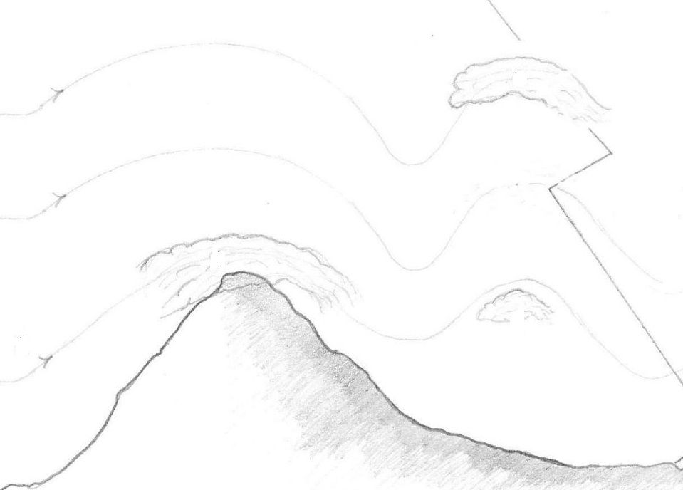
The overall shape of the cloud looks like a lens, and so it is called lenticularis, or a lenticular cloud.