


If you live across the Four Corners region, especially Arizona and New Mexico, you have probably noticed that the monsoon season this year seems pretty active. Even across Southern California, thunderstorms have been very active recently. Or does it just seem that way because last year was unusually dry?
The 2020 monsoon season (from June through September) across the Desert Southwest was a dismal one. In fact, it actually ended up becoming the driest on record across the southwest portion of the country, including Arizona, New Mexico and a portion of West Texas.
It was the driest monsoon season on record (since the records began in 1895) with only 2.97 inches of rainfall averaged across the region. The average amount–including stations from Yuma, Flagstaff, Phoenix, Tucson, Albuquerque and El Paso–is 6.68 inches.
The previous driest year was back in 1956, with 3.40 inches of rainfall.
Here is the breakdown of rainfall last monsoon season for each major city in the Southwest:
Tucson had its second-driest year on record. Yuma and Flagstaff set records for driest and Las Vegas tied its driest on record with just a trace. El Paso had its ninth-driest, while Kingman recorded its third-driest.
An area of high pressure in the mid-levels of the atmosphere usually expands and builds from northern Mexico to the Four Corners. Last year, it really didn’t make it that far north much. With the placement of that monsoon high, it really cut off the tropical moisture flow from the Gulf of California and the Eastern Pacific, and therefore prevented any showers and storms.
Needless to say, it was a parched year, which was a big factor behind the current drought conditions we are facing at the moment.
We’re just over one month into this year’s monsoon season, and as of now, we’re off to a good start–much better than where we were last year at this time.
Something to note: Arizona and New Mexico usually receive up to half of their annual precipitation during the summer months. This is definitely turning into a good year for that.
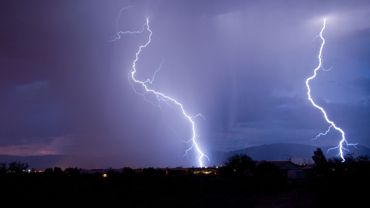
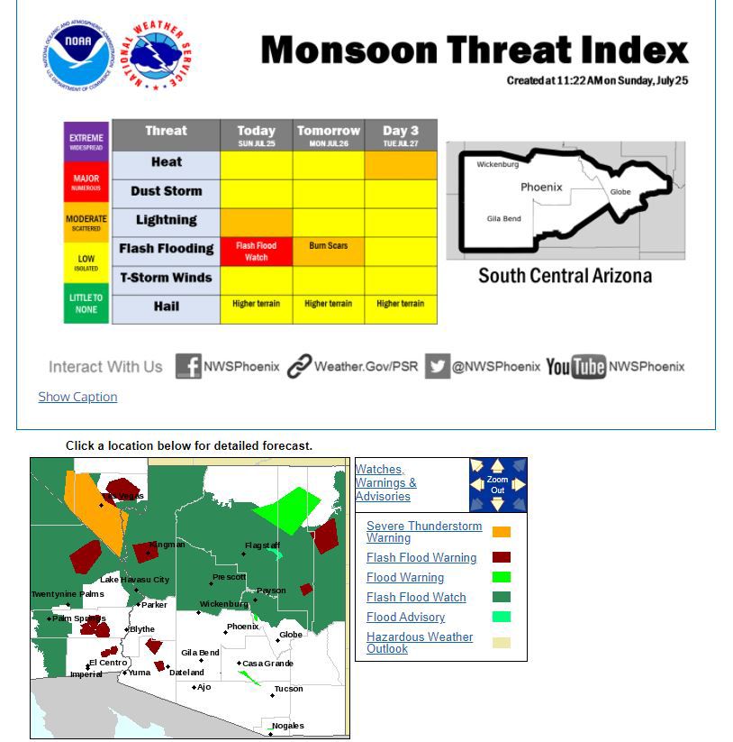
We’ve had rain event after rain event, prompting Flood Watches, Warnings and Advisories much of the time. Heavy rainfall has caused major flooding concerns across Arizona and other portions of the Four Corners and even triggered debris and mudslides at times.
We’ve even seen some of the same flooding concerns across the Riverside and San Diego County mountains and deserts recently, but not nearly as extreme as what we are seeing east of California.
In general, it has been much more active across Southern California with monsoon storm chances these past few weeks. This is a main reason we have not seen a very active summer fire season (otherwise known as terrain-driven fire season) like we had last year.
The good thing is that most storms we’ve had out across SoCal have had rainfall accompanying lightning, which is what we want. We want enough precipitation to wet our dry vegetation and keep lightning strikes from sparking wildfires.
Check out this satellite loop of water vapor, where green shows greater amounts of moisture:
The monsoon season is bringing the rain we have needed across the Southwest, but there are some dangers that also come with this active weather pattern: anything from downbursts and flooding to damaging winds and dust storms.
Below is a list of precipitation totals for each major city across the Southwest since the beginning of the monsoon season on June 15:
- Tucson: 4.46"
- Phoenix: 1.72"
- Yuma: 0.19"
- Flagstaff: 1.86"
- El Paso: 6.93"
- Albuquerque: 1.41"
- Las Vegas: 0.23"
- Kingman: 2.23"
Locally, here’s what we have picked up across the Southland since June 15:
- Downtown LA: 0.12” (average for June/July together is 0.05”)
- Torrance: 0.07” (average for June/July together is 0.05”)
- Lancaster: 0.03” (average for June/July together is 0.08”)
- Escondido: 0.03” (average for June/July together is 0.08”)
- El Cajon: 0.10” (average for June/July together is 0.07”)
- Big Bear Lake: 0.34” (average for June/July together is 0.33”)
- Carlsbad: 0.06” (average for June/July together is 0.06”)
- El Cajon: 0.10” (average for June/July together is 0.07”)
- Fullerton: 0.01” (average for June/July together is 0.05”)
- Hemet: 0.03” (average for June/July together is 0.09”)
- Idyllwild: 0.23” (average for June/July together is 0.22”)
- Oceanside Airport: 0.25” (average for June/July together is 0.08”)
- Oceanside Harbor: 0.19” (average for June/July together is 0.06”)
- Ontario: 0.05” (average for June/July together is 0.03”)
- Palm Springs: 0.11” (average for June/July together is 0.10”)
- Palomar Mountain: 0.03” (average for June/July together is 0.14”)
- Riverside: 0.02” (average for June/July together is 0.07”)
- San Diego Airport: 0.01” (average for June/July together is 0.06”)
- Vista: 0.27” (average for June/July together is 0.08”)
As you can see from these stations, we’ve actually received a decent amount of rainfall for many areas, especially across San Diego County. For many cities, this is more than what we normally see compared to the average of normal rainfall during both June and July.
With the majority of the Southwest under some level of drought conditions, recent rainfall across Arizona and even New Mexico has made a minor dent in the drought recovery process. It’s not much, but if you look closely you can see the changes. Any improvement is better than nothing!
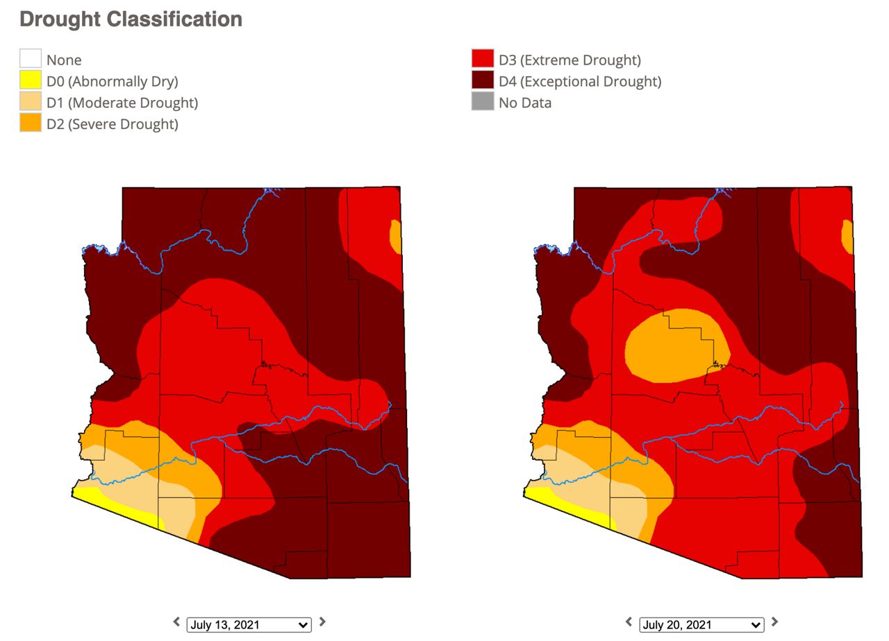
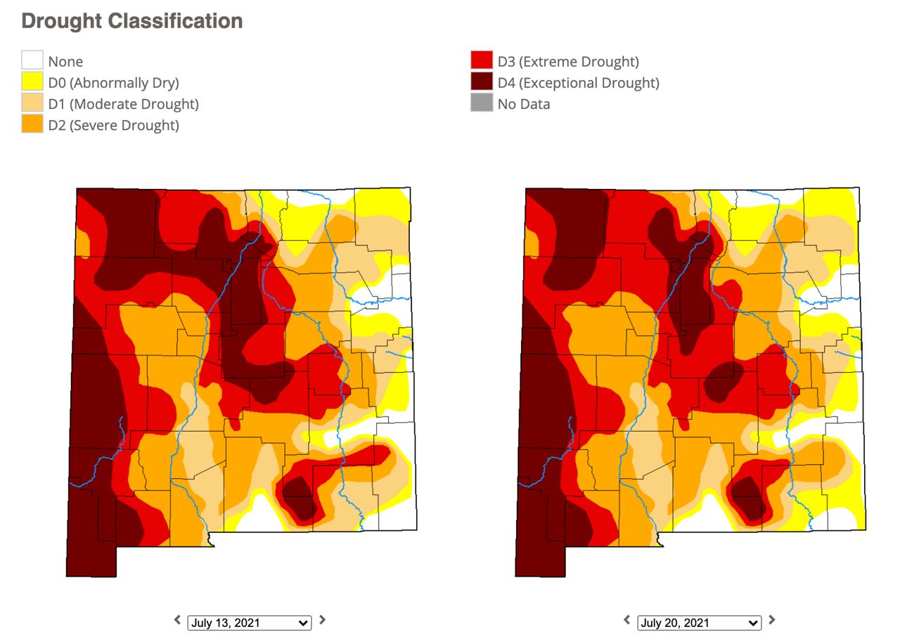
With two months left to go in the monsoon season, the active pattern and continued precipitation could further improve the drought conditions and also help our local landscape once our fall fire season picks up.