An unusually strong area of high pressure over the Four Corners region is driving temperatures into record territory across the Desert Southwest, including here in SoCal.
Several new record highs were set Tuesday.
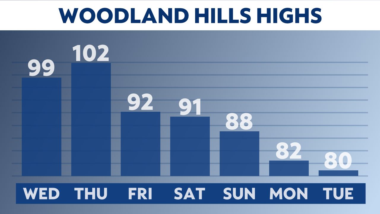
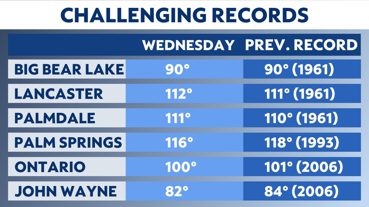
We will once again be within striking distance of records Wednesday, but in fewer locations.
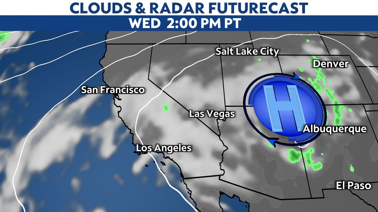
Despite the ridge of high pressure reaching peak strength Wednesday, temperatures will cool as much as ten degrees over Tuesday's highs.
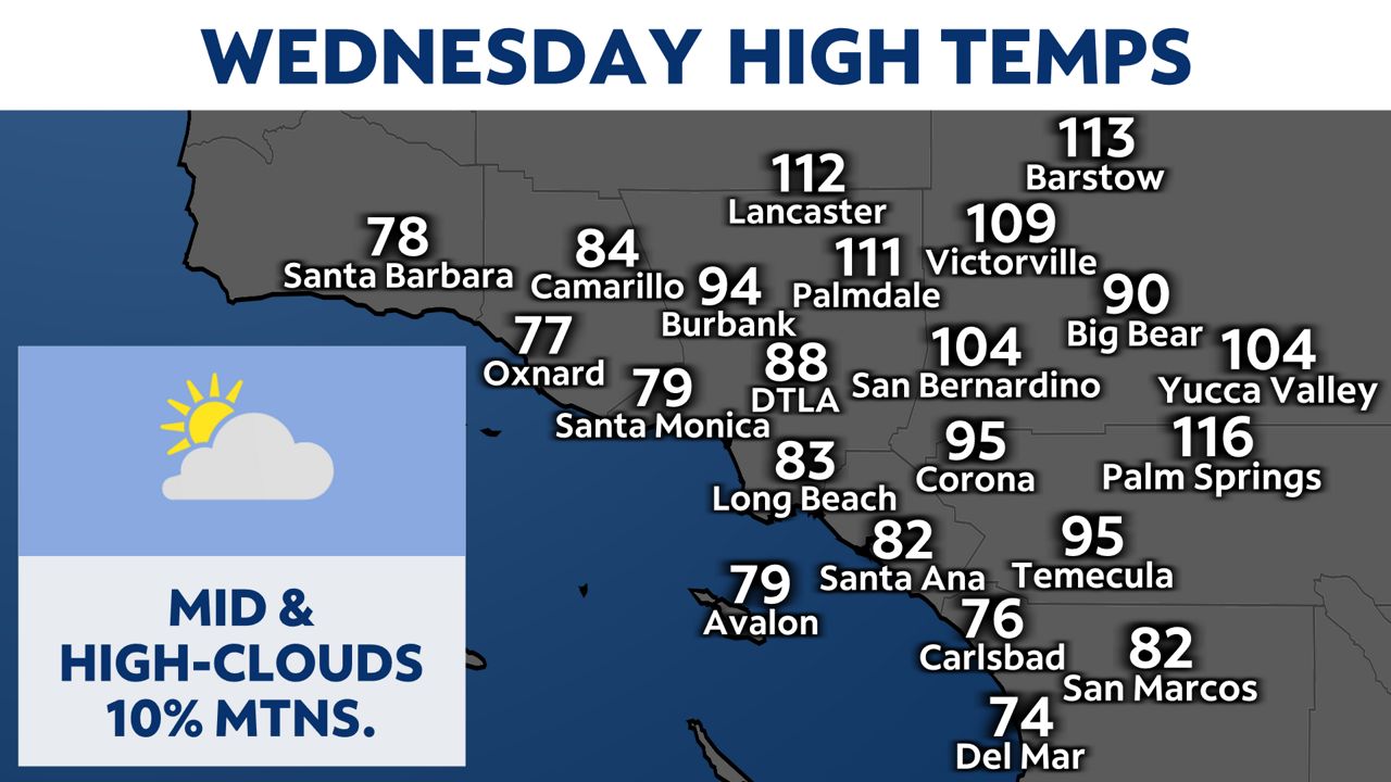
That's because mid and high-level clouds will be wrapping around the core of the high, acting like a shield from the sun's harshest rays. There is a very slight chance of an isolated elevated thunderstorm Wednesday and Thursday across some mountain communities, mainly farther east.
It will still be hot, especially well inland, where an Excessive Heat Warning remains in effect.
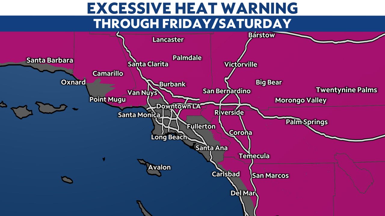
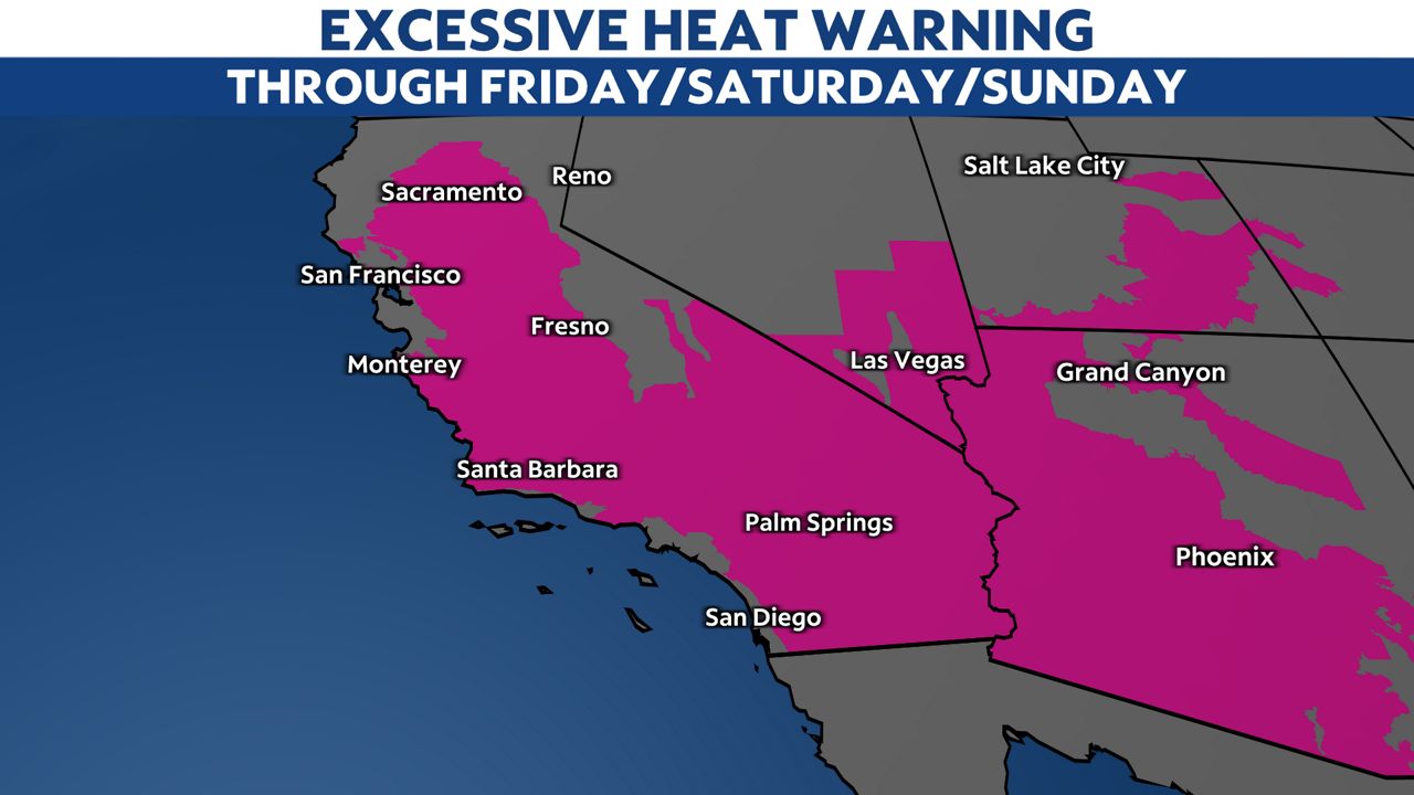
That Excessive Heat Warning actually spans most of the Southwest United States, and will remain in effect through Friday for some, Saturday for others, and Sunday for yet even others.
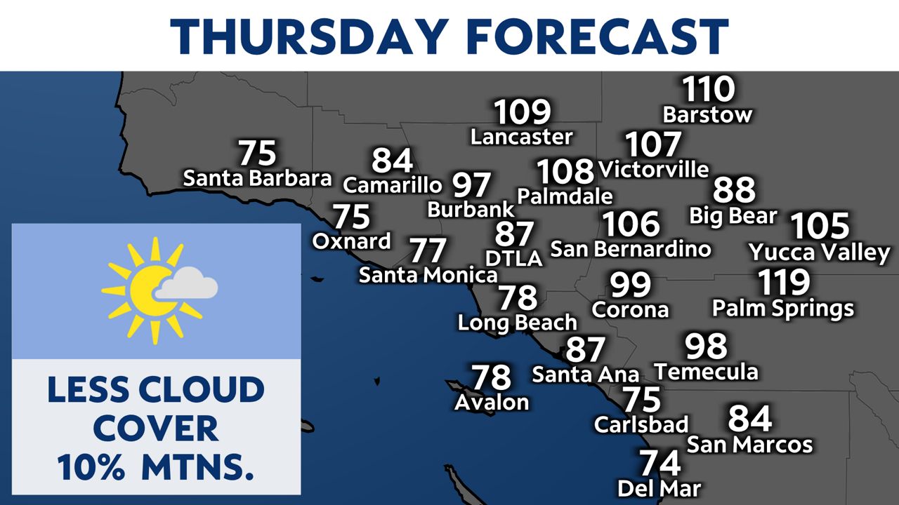
Temperatures actually bump up a little Thursday in SoCal. Despite the fact the ridge will be weakening, we lose some of the cloud cover that will keep us cooler Wednesday.
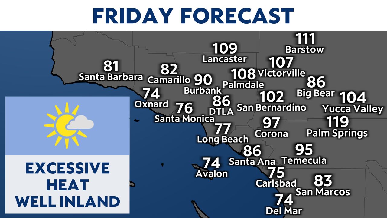
Temperatures stay hot well inland Friday, but will be much more comfortable closer to the coastline.
There will be major cooling into early next week, with temperatures dropping back closer to average as the ridge goes flat.