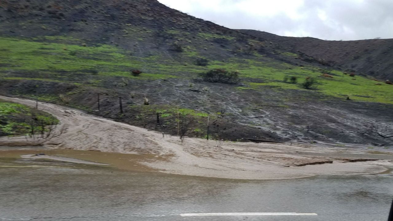
With the upcoming "atmospheric river" rain storm comes the threat for debris flows in and around the recent burn scars left by the recent SoCal wildfires.
A debris flow is a fast-moving mass of water filled with ash, rock, soil, vegetation, boulders, and trees carried downhill by the force of gravity. The threshold rainfall rate that the United States Geological Survey (USGS) uses for potential debris flows is a quarter-inch in 15 minutes, or a half-inch per half-hour.
According to the National Oceanic and Atmospheric Administration, “atmospheric rivers are relatively long, narrow regions in the atmosphere – like rivers in the sky – that transport most of the water vapor outside of the tropics. These columns of vapor move with the weather, carrying an amount of water vapor roughly equivalent to the average flow of water at the mouth of the Mississippi River.”
The current atmospheric river is pointed at the Central California coast and will slowly move down the California coast arriving in Southern California on Thursday.
Spectrum News 1 meteorologists say that the Central Coast mountain ranges and Central Sierra Nevada Mountains that have the fire hose of moisture pointed at them stalled for several hours Wednesday before moving south toward Southern California.
The GFS forecast model (the American long-range model) is forecasting eight to 10 feet of snow in the Sierra Nevada Mountains.
The Santa Cruz Mountains, along with the Santa Lucias (Big Sur Coast) on the Central California Coast, could see eight to 10 inches of rain, according to the National Weather Service based in Monterey. More than five inches has fallen since Tuesday night.
At one point last week, the forecast models were predicting five to eight inches of rain as far south as the Los Angeles basin. Right now, the forecast models are keeping those kinds of numbers north of Santa Barbara.
That is great news for Southern California. Just because the forecast models are keeping the atmospheric river north of Ventura County doesn’t mean we are in the clear.
There is still a chance of thunderstorms, where heavy rainfall is possible. Also, the forecast could change and the atmospheric river could flip back to where it was last week.
So, if you live in or downstream of any one of the recent burn scars, make sure you are paying attention to the weather forecasts the rest of the week.
Debris flows can happen up to five years after a wildfire, but the first one to two years pose the biggest threats, according to the USGS.
Debris flows are more likely to happen in and around burn scars for a few reasons. The USGS has models that forecast the likelihood of debris flows within the perimeter of the major wildfires across the west.
Below is a map of the Bobcat Fire. The red shades are where debris flows are more likely to happen. According to the USGS, the two main input factors that account for 60-70% of the forecast output are steepness of terrain and intensity of the fire.
The more intense a fire burns, the more likely the topsoil changes composition. Before a fire burns through a forest or other wildland area, rain gets absorbed into the soil and there is less runoff.
Also, the canopy of leaves and branches slows the rate at which rain hits the ground, so the soil has more time to absorb the rain.
Lastly, the roots of the trees, bushes and grasses hold the top soil together, and act to anchor the top soil in place.
After a fire, the canopy is gone and rain goes straight to the ground with no delay for absorption to take place. When the plant life and root systems are burned in a fire, the anchor that holds the soil in place no longer exists.
Lastly, and probably most importantly, the composition of the top layer of soil morphs from a sponge-like material to a substance that actually repels the water.
So, the rain beads into pools and carries the ash downhill carried by the force of gravity. Eventually, debris flows can become 30 feet high, destroying or carrying everything in its path.
If you live in or near one of the recent burn scrars, here are some safety tips.
- Be alert, pay attention to the current weather
- Have a "Go Bag" ready if you need to leave quickly
- Sign up for local emergency alerts
- If you have to shelter in place overnight, sleep in an upstairs room


