


There isn’t a one-size-fits-all approach to forecasting climate patterns when there’s an El Niño or a La Niña pattern in place.
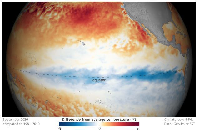
El Niño and La Niña patterns are part of the El Niño Southern Oscillation, which monitors sea-surface temperatures in the equatorial Pacific Ocean.
When sea-surface temperatures in this region are above average, it’s called El Niño; when they are below average, it’s called La Niña.
We aren’t talking about major changes in water temperatures but typically more minor swings — usually on the order of plus or minus a degree Celsius — 1.8 degrees Fahrenheit — or less.
There are instances when water temperatures have been as much as eight degrees Fahrenheit above average — a very strong El Niño — but it’s not common.
This year, the prediction is for a low-end moderate La Niña — 1.1 degrees Celsius above average. This pattern emerged in August 2020 and is forecast to continue through the winter.
Some people — even forecasters — erroneously equate La Niña with drier-than-average conditions here in Southern California. In reality, there are no hard-and-fast rules to climate impacts during either El Niño or La Niña, and anyone who says differently is simply wrong.
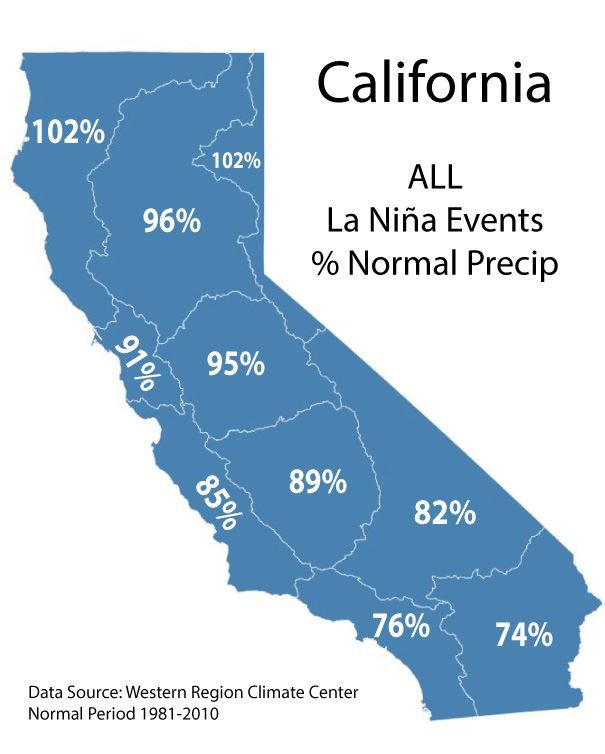
Of all La Niña patterns on record — 22 events in all — Southern California has received, on average, 76% of its normal rainfall.
But there have been some stark contrasts in La Niña years, even over a short period of time.
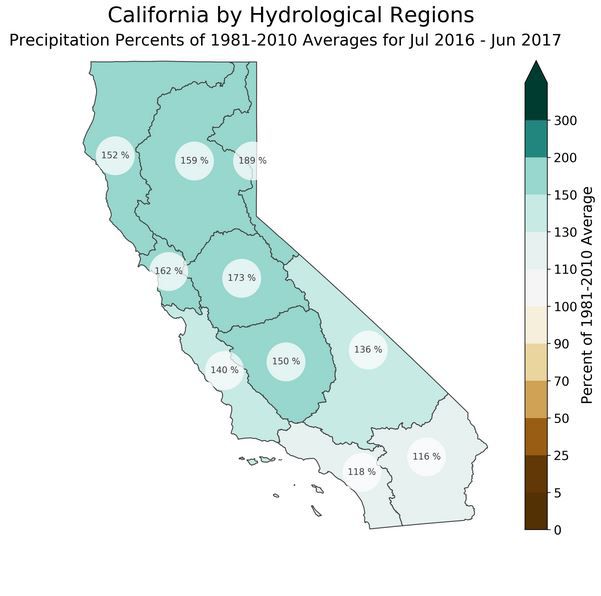
The 2016-2017 weak La Niña brought above-average rainfall to Southern California, 118% of average.
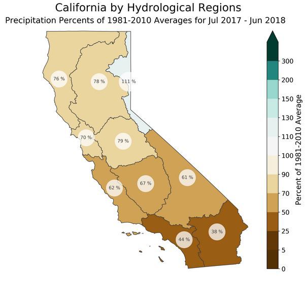
Just one year later during the winter of 2017-2018 in another weak La Niña pattern, Southern California received well below-average rainfall, 44% of average.
Of the 22 La Niña events on record, seven have brought near-average (85%+) or above-average precipitation to Southern California—so 32% of the time. That means 68% of the time when there is a La Niña set-up, we have below-average rainfall—but that’s still not a guarantee.
NOAA's Climate Prediction Center does takes these odds into account when issuing their winter outlook. They are calling for a 40 to 50% of below-average precipitation this winter in Central and Southern California — clearly, not a slam dunk.
So even though the odds may be in favor of a drier winter during a La Niña pattern, it is not a sure thing. We’ll just have to wait and see.