


LOS ANGELES (CNS) — Intense rains poured over most of the Southland Thursday, prompting mudslides, debris flows and flooding that made for a messy morning drive that was light due to the approaching holiday weekend, which forecasters said is still on track to be dry.
Snowfall forced the closure of Interstate 5 through the Grapevine early Thursday morning in northern Los Angeles County but later reopened with CHP escorts. A mudslide blocked traffic and trapped some vehicles on Coldwater Canyon Avenue in Studio City, and flooding blocked the westbound Santa Monica (10) Freeway near the McClure Tunnel in Santa Monica.
In Malibu, more than four dozen people had to be evacuated from Leo Carrillo State Beach campground due to flooding, which also led to closures on Pacific Coast Highway. Decker Road was closed at PCH due to multiple rockslides, according to the city, which also reported multiple instances of downed trees blocking roadways. PCH also was closed at Puerco Canyon due to flowing mud.
A stretch of PCH was closed in Pacific Palisades due to a fallen tree that brought down power lines, according to Caltrans.
Overnight, Mulholland Highway was closed in the Santa Monica Mountains between Las Virgenes and Cornell roads due to mud that inundated the roadway.
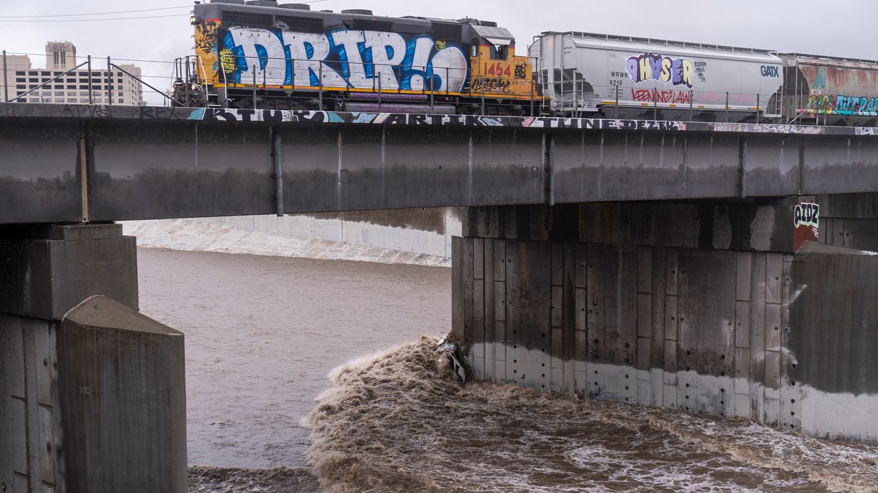
Downpours continued through the morning, but the rain began to taper off during the afternoon, despite continued cool and foggy conditions. Forecasters said light rain would continue to fall into the evening, but the storm system was making its way south. The National Weather Service indicated by mid-afternoon that another one-half to 1 inch could still fall across the area, winding down an unusually wet month.
"Once this is all done tonight the official NWS observation site in downtown Los Angeles will have had its third most wettest month of December on record with records going back to 1877," according to the NWS. "The wettest December was in 1889 with 15.80 inches and the second wettest was in 2010 when 10.23 inches was recorded."
By 10 a.m. Thursday, downtown Los Angeles had received 3.6 inches of rain over the previous 24 hours, according to the weather service. At Leo Carrillo, where campers had to be rescued from flooding, 4.5 inches had fallen, while 4 inches fell in Bel Air, 5.3 inches fell in Woodland Hills and more than 3 inches fell in Alhambra and Pasadena.
A winter storm warning will remain in effect until 8 p.m. Thursday in the Los Angeles County mountains, excluding the Santa Monica range. Many mountain areas had received more than a foot of snow by mid-afternoon, with smaller amounts in lower elevations.
According to the NWS, roughly 18 inches of snow had fallen in the eastern San Gabriel Mountains by mid-morning Thursday, with 3 to 6 inches falling in Frazier Park.
Stretches of Angeles Crest Highway were closed due to the poor weather conditions during the storm, along with state Route 39.
Caltrans reminded motorists that chains were required on the Angeles Crest Highway north of La Canada Flintridge, and the agency urged motorists to be aware of road conditions and anticipate possible closures due to snow.
Gusting winds were also impacting the Antelope Valley, where the NWS issued a wind advisory through 10 p.m. Forecasters said the area should expect winds of 15 to 30 mph, with gusts up to 45 mph, potentially reducing visibility for motorists and blowing dust across roadways.
In Orange County, a mandatory evacuation order that was in effect for the Silverado, Williams and Modjeska canyon areas in the Bond Fire burn area due to fears of possible debris flows was downgraded Thursday morning to voluntary, then lifted altogether by early afternoon.
The NWS issued a flash flood watch for Orange County coastal and inland areas and the Santa Ana Mountains, including the Bond Fire burn area. The watch was expected to be in effect through Thursday afternoon, but it was canceled by midday, with forecasters saying flooding "is no longer expected to pose a threat."
NWS forecasters for Orange County said the area could receive up to 2.5 inches of rain along the coast and as much as 6 inches in the mountains below 5,000 feet, with hourly rainfall amounts of 0.6 to 0.7 inches possible.
Although rain was slowly diminishing, a flash flood watch will continue until 8 p.m. for Los Angeles County burn areas from the Lake, Bobcat, Dam and Ranch 2 fires. Forecasters said "heavy rainfall" remains possible in those areas, and residents should "prepare for potential flooding impacts."
Gov. Gavin Newsom declared a state of emergency in 20 California counties, including Los Angeles and Orange, in response to the storms. The proclamation "supports response and recovery efforts, including expanding access to state resources for counties under the California Disaster Assistance Act."
The intense rains forced the closure of Six Flags Magic Mountain in Valencia. Knott's Berry Farm in Buena Park closed at 1 p.m. due to the downpours.
Temperatures remained "significantly below average" across the region.
While conditions were expected to remain cool, forecasters said things would dry out for the holiday weekend. But winds will be a factor in some areas.
"Dry but continued cool weather is expected Friday through the upcoming holiday weekend and likely beyond," according to the NWS. "Gusty northerly winds are expected Friday in some mountain and foothill areas, with weak to moderate Santa Ana winds over the weekend."