

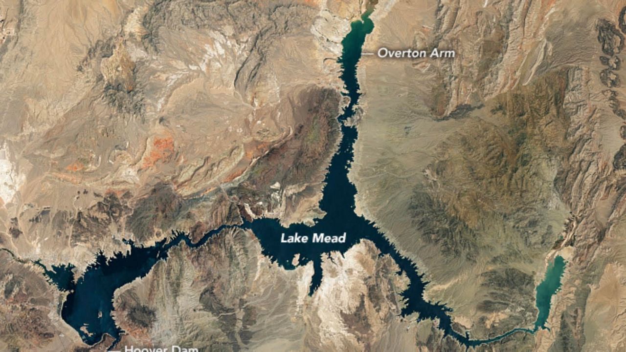
Historically low water levels in Lake Mead have already revealed skeletal remains of human bodies and power boats this summer. Now images from the National Aeronautics and Space Administration are revealing the lake itself is in peril.
Located on the Nevada-Arizona border, the nation’s largest reservoir is at just 27% of capacity, the space agency reported last week. The last time it was so low was April 1937, when the reservoir was first filled after construction of the Hoover Dam.
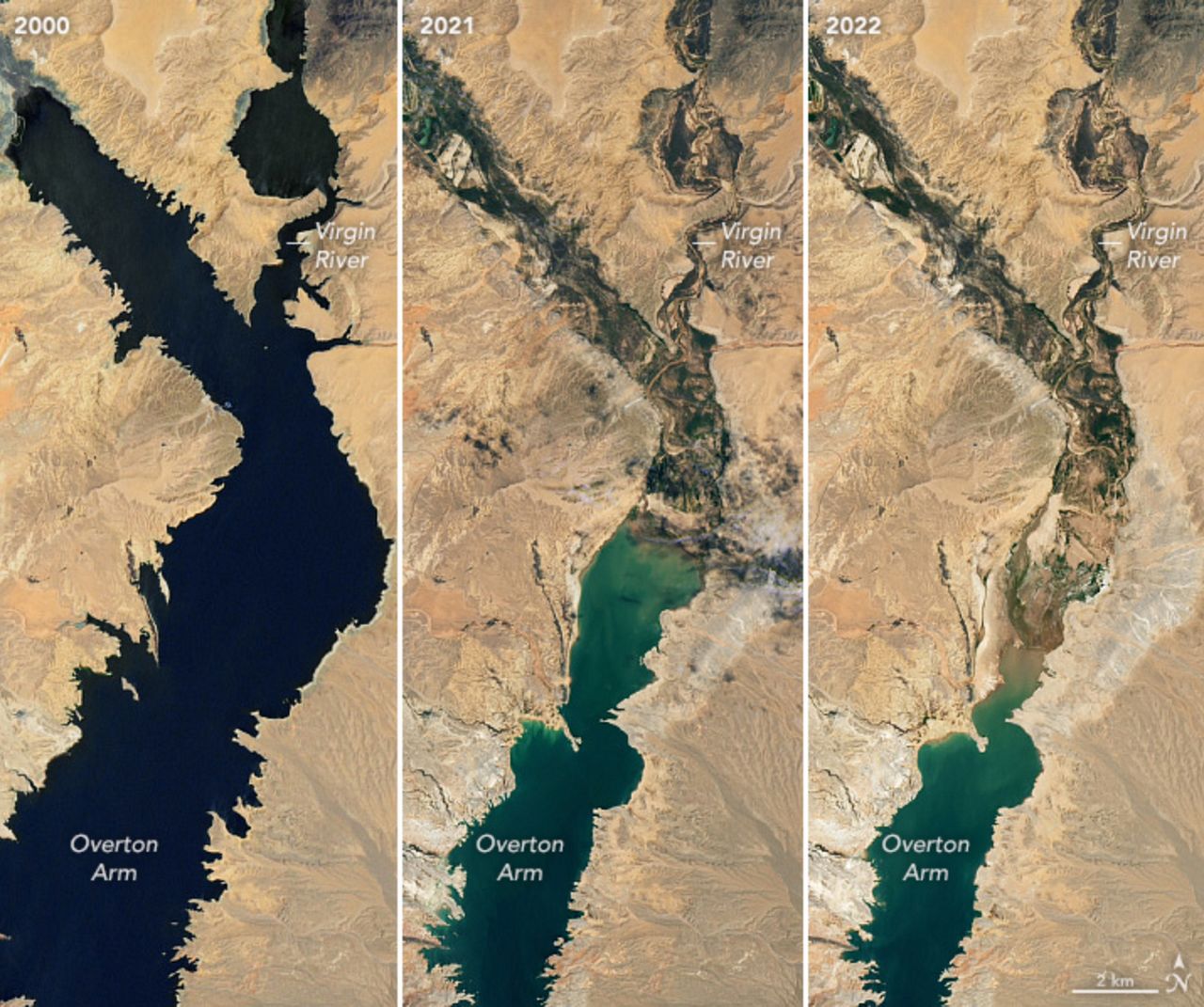
Comparing images from July 3, 2022, and July 6, 2000, pictures taken with NASA satellites showed a bathtub ring of mineralized portions of the lakeshore that were once underwater. While photos from 2000 show a robust and deep lake near capacity, photos from 2021 and 2022 reveal it is shrinking and shallowing out.
Supplied almost entirely by snowmelt from the Rocky Mountains feeding into the Colorado River that in turn fills Lake Mead, NASA officials said the lake holds 9.3 trillion gallons of water at an elevation of 1,220 feet when it is at maximum capacity. The last time it approached that limit was the summer of 1999.
Following several years of drought, the U.S. Department of the Interior declared the first-ever shortage for the Colorado River Basin last August. The river’s aqueduct supplies 25% of Southern California’s water. Millions of people living in California and six other states rely on water from Lake Mead, which has been dropping annually for 22 years.
In June, the U.S. Bureau of Reclamation, which manages the Colorado River basin, sent an emergency request to the many states that rely upon on the river to reduce their water usage by as many as 4 million acre-feet through the end of 2023.
Effective June 1, LADWP imposed mandatory water restrictions for its customers that included reductions in outdoor irrigation. The agency reported earlier this month that Angelenos used 9% less water in June than a year earlier.