OHIO — Here are some things that may not be on the shopping list for Thanksgiving: wet roads, a January chill and our first significant lake-effect snow event of the season.
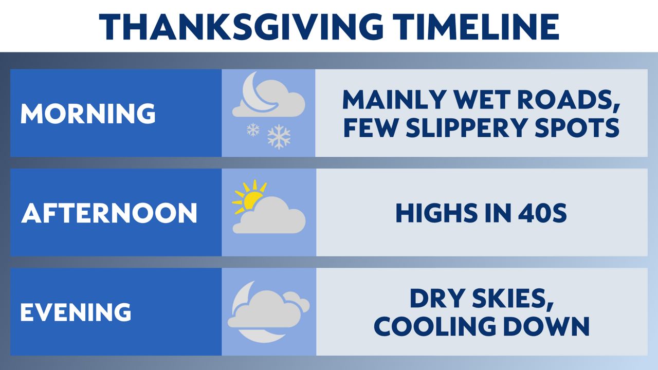
We will start with the busiest travel day of the year which will be dry throughout the morning hours.
Rain will begin to move into western Ohio Wednesday afternoon, but change to snow by the late evening.

Snow showers will be around through the overnight with some travel impacts from lower visibility and isolated slippery spots.
Air and ground temperatures will keep roads mainly wet especially after sunrise on Thanksgiving.

If you want to throw the football around in the afternoon, enjoy the highs in the 40s.
It will feel warm compared to what's ahead.
Our major cooldown begins Thursday night into Friday morning.
Highs on Saturday may not get out of the 20s in some spots so plan for very cold temperatures throughout the entire weekend.
These cold winds out of the northwest will turn on the lake-effect snow machine early Friday, and we won't see a break until the middle of next week.

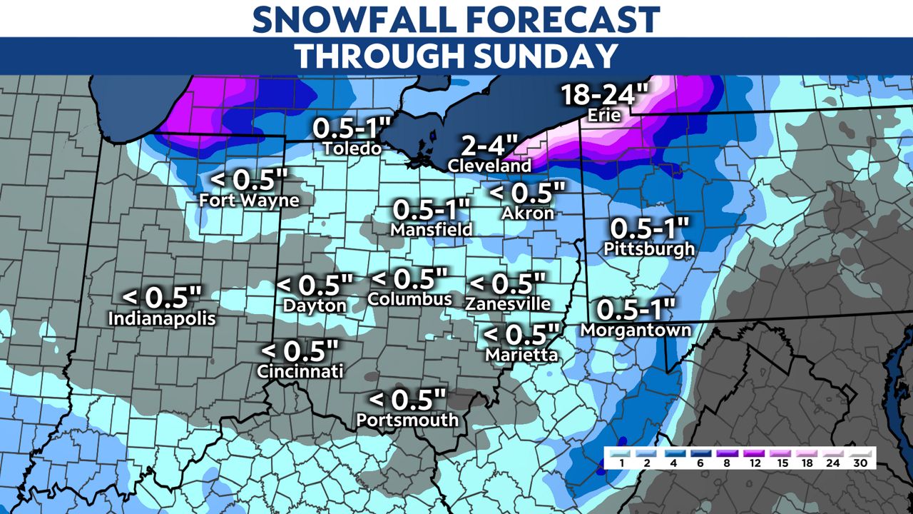
The highest snow amounts will be in the primary snowbelt.
Snow totals in the parts of Lake and Ashtabula counties could get up to 2'.
That is the storm total from Friday to Wednesday of next week.
These bands or squalls could significantly slow down travel on the turnpike throughout the weekend.

Pay attention for quickly changing roads conditions and variable speeds on the turnpike depending on rapid drops in visibility and heavier bands of snow.
Remember, a snow squall can drop visibility to zero and make travel impossible at times.
Travel to your holiday destination may be a little inconvenient from wet roads and a few slippery spots, but heading home Friday through Sunday will likely bring in a more major impact.


