


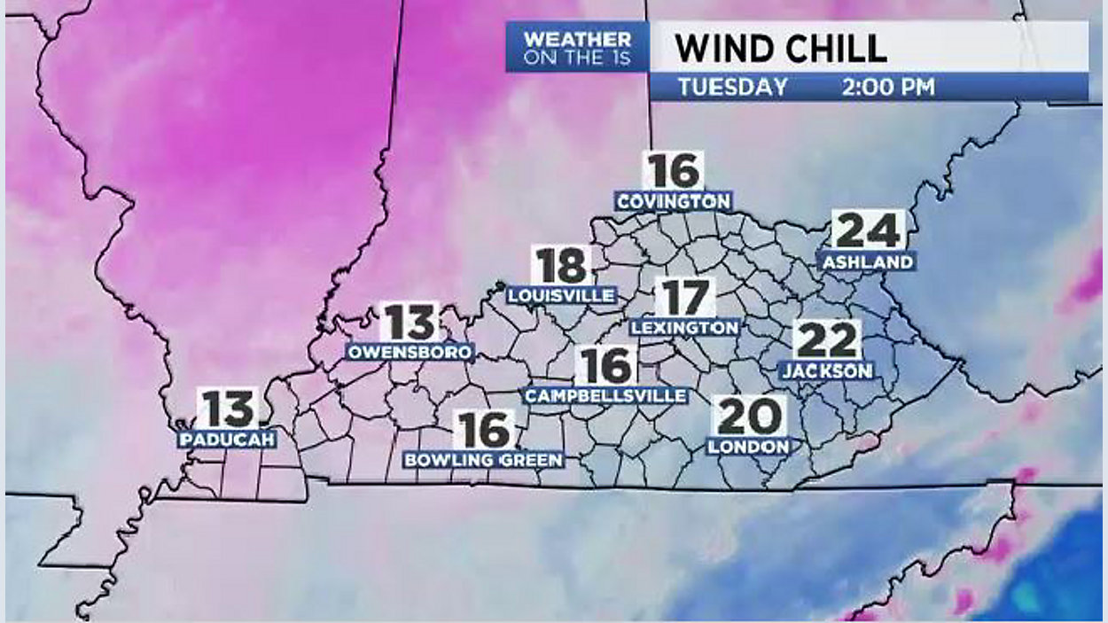
An arctic high rolled across our state yesterday...bringing our 1st snow of the season (ranging from 1"- 2") & the COLDEST air of the season thus far. This morning, temps were in the teens, but a stiff NW wind led to wind chill values in the single digits (the lowest wind chill I noticed was paducah with ZERO). Unfortunately, afternoon "high" temps will NOT get above freezing today (staying below 32° in the upper 20s). Plus, the gusty winds will lead to wind chill values only in the teens this afternoon... so, dress for those numbers! Make sure to dress in layers, and make sure utilize your Cold Weather Safety Tips. Highs today should set new daily records for "Coldest High Temps."
Tonight, the winds will relax, but it'll remain bitterly cold with lows in the teens. Any slick spots will remain. Finally, by Wednesday afternoon...temps will climb above freezing with mid-upper 30s on deck.
The end of the week brings a slow warm up with highs in the Mid-upper 40s through Friday. This weekend, 50s do return by Sunday. Precipitation will be hard to find through the rest of the week.
Stay Warm!